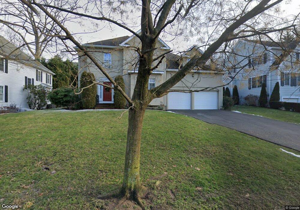
144 Birch Brook Rd Bronxville, NY 10708
Cedar Knolls NeighborhoodEstimated Value: $1,598,093 - $2,006,000
4
Beds
4
Baths
3,312
Sq Ft
$541/Sq Ft
Est. Value
About This Home
This home is located at 144 Birch Brook Rd, Bronxville, NY 10708 and is currently estimated at $1,791,023, approximately $540 per square foot. 144 Birch Brook Rd is a home located in Westchester County with nearby schools including St. Eugene School and Saint Joseph School.
Ownership History
Date
Name
Owned For
Owner Type
Purchase Details
Closed on
Mar 28, 2000
Sold by
Newton Design Associates Inc
Bought by
Lou Whalen and Lou Rose Pang
Current Estimated Value
Purchase Details
Closed on
Aug 18, 1998
Sold by
Lange Eileen C
Bought by
Arnold J Foster & New York Associates In
Purchase Details
Closed on
Feb 27, 1998
Sold by
Sofia John and Sofia Leonard
Bought by
Lange Eileen C
Create a Home Valuation Report for This Property
The Home Valuation Report is an in-depth analysis detailing your home's value as well as a comparison with similar homes in the area
Home Values in the Area
Average Home Value in this Area
Purchase History
| Date | Buyer | Sale Price | Title Company |
|---|---|---|---|
| Lou Whalen | $740,000 | First American Title Ins Co | |
| Arnold J Foster & New York Associates In | $160,000 | Chicago Title Insurance Co | |
| Lange Eileen C | $95,000 | Chicago Title Insurance Co |
Source: Public Records
Tax History Compared to Growth
Tax History
| Year | Tax Paid | Tax Assessment Tax Assessment Total Assessment is a certain percentage of the fair market value that is determined by local assessors to be the total taxable value of land and additions on the property. | Land | Improvement |
|---|---|---|---|---|
| 2024 | $3,920 | $22,000 | $3,400 | $18,600 |
| 2023 | $3,900 | $22,000 | $3,400 | $18,600 |
| 2022 | $3,874 | $22,000 | $3,400 | $18,600 |
| 2021 | $16,539 | $22,000 | $3,400 | $18,600 |
| 2020 | $16,443 | $22,000 | $3,400 | $18,600 |
| 2019 | $20,057 | $22,000 | $3,400 | $18,600 |
| 2018 | $15,413 | $22,000 | $3,400 | $18,600 |
| 2017 | $0 | $22,000 | $3,400 | $18,600 |
| 2016 | $17,552 | $22,000 | $3,400 | $18,600 |
| 2015 | -- | $22,000 | $3,400 | $18,600 |
| 2014 | -- | $22,000 | $3,400 | $18,600 |
| 2013 | -- | $25,700 | $3,400 | $22,300 |
Source: Public Records
Map
Nearby Homes
- 212 Pondfield Rd W
- 209 Pondfield Rd W
- 1523 Central Park Ave Unit 5F
- 1523 Central Park Ave Unit 14C
- 1523 Central Park Ave Unit 17B
- 1531 Central Park Ave Unit C-4
- 10 Wiltshire St
- 1537 Central Park Ave Unit E8
- 1543 Central Park Ave Unit F-04
- 1543 Central Park Ave Unit F8
- 46 Dellwood Rd
- 1561 Central Park Ave Unit I-5
- 1561 Central Park Ave Unit I2
- 1549 Central Park Ave Unit G-11
- 682 Tuckahoe Rd Unit 4A
- 682 Tuckahoe Rd Unit 1A
- 1 Arlington St Unit 2B
- 20 Witherell St
- 133 Pondfield Rd W Unit 2B
- 17 Winchester Ave Unit 1B
- 138 Birch Brook Rd
- 150 Birch Brook Rd
- 175 Dellwood Rd
- 154 Birch Brook Rd
- 145 Birch Brook Rd
- 151 Dellwood Rd
- 153 Birch Brook Rd
- 251 Pondfield Rd W
- 259 Pondfield Rd W
- 137 Birch Brook Rd
- 161 Birch Brook Rd
- 120 Birch Brook Rd
- 160 Birch Brook Rd
- 120 Birchbrook Rd
- 143 Dellwood Rd
- 129 Birch Brook Rd
- 160 Dellwood Rd
- 169 Birch Brook Rd
- 258 Pondfield Rd W
- 250 Pondfield Rd W