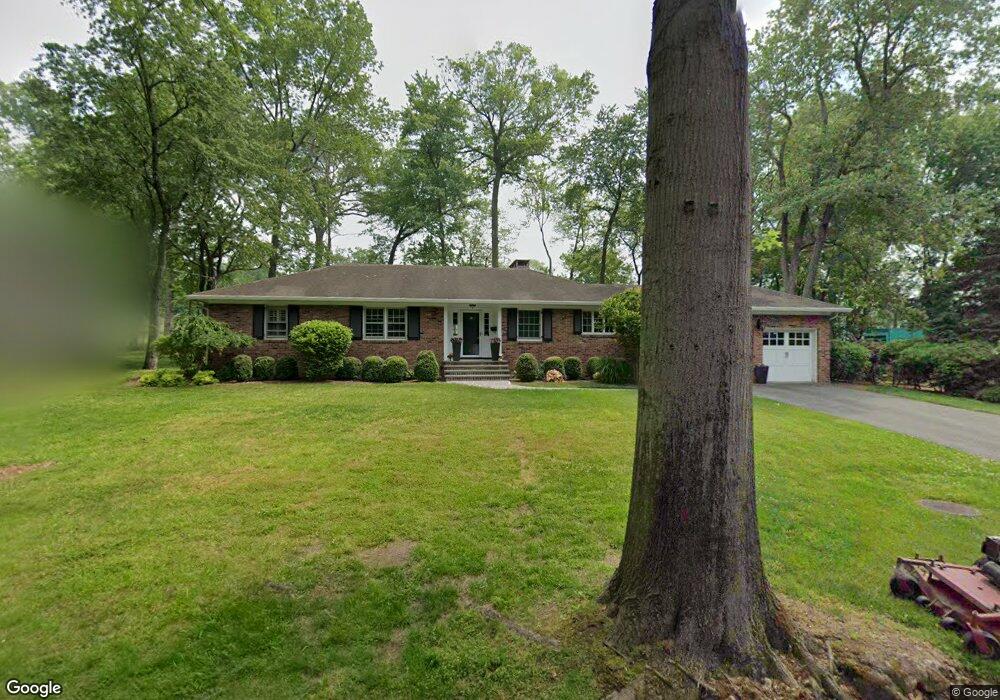
144 Canoe Brook Rd Short Hills, NJ 07078
Estimated Value: $1,715,000 - $2,461,000
--
Bed
--
Bath
1,957
Sq Ft
$988/Sq Ft
Est. Value
About This Home
This home is located at 144 Canoe Brook Rd, Short Hills, NJ 07078 and is currently estimated at $1,932,777, approximately $987 per square foot. 144 Canoe Brook Rd is a home located in Essex County with nearby schools including Hartshorn Elementary School, Millburn Middle School, and Millburn High School.
Ownership History
Date
Name
Owned For
Owner Type
Purchase Details
Closed on
Jan 14, 1999
Sold by
Cantor Bruce
Bought by
Tobia Joseph
Current Estimated Value
Home Financials for this Owner
Home Financials are based on the most recent Mortgage that was taken out on this home.
Original Mortgage
$158,000
Outstanding Balance
$36,615
Interest Rate
6.75%
Estimated Equity
$1,896,162
Purchase Details
Closed on
Sep 22, 1993
Sold by
Loftness Stella
Bought by
Cantor Bruce and Cantor Susan
Home Financials for this Owner
Home Financials are based on the most recent Mortgage that was taken out on this home.
Original Mortgage
$195,000
Interest Rate
6.9%
Create a Home Valuation Report for This Property
The Home Valuation Report is an in-depth analysis detailing your home's value as well as a comparison with similar homes in the area
Home Values in the Area
Average Home Value in this Area
Purchase History
| Date | Buyer | Sale Price | Title Company |
|---|---|---|---|
| Tobia Joseph | $198,000 | -- | |
| Cantor Bruce | $290,000 | -- |
Source: Public Records
Mortgage History
| Date | Status | Borrower | Loan Amount |
|---|---|---|---|
| Open | Tobia Joseph | $158,000 | |
| Previous Owner | Cantor Bruce | $195,000 |
Source: Public Records
Tax History Compared to Growth
Tax History
| Year | Tax Paid | Tax Assessment Tax Assessment Total Assessment is a certain percentage of the fair market value that is determined by local assessors to be the total taxable value of land and additions on the property. | Land | Improvement |
|---|---|---|---|---|
| 2025 | $19,607 | $1,002,400 | $696,600 | $305,800 |
| 2024 | $19,607 | $1,002,400 | $696,600 | $305,800 |
| 2022 | $19,477 | $1,002,400 | $696,600 | $305,800 |
| 2021 | $19,427 | $1,002,400 | $696,600 | $305,800 |
| 2020 | $19,306 | $1,002,400 | $696,600 | $305,800 |
| 2019 | $19,346 | $1,002,400 | $696,600 | $305,800 |
| 2018 | $19,066 | $1,002,400 | $696,600 | $305,800 |
| 2017 | $18,605 | $1,002,400 | $696,600 | $305,800 |
| 2016 | $17,592 | $816,700 | $429,000 | $387,700 |
| 2015 | $17,192 | $816,700 | $429,000 | $387,700 |
| 2014 | $16,465 | $816,700 | $429,000 | $387,700 |
Source: Public Records
Map
Nearby Homes
- 82 Browning Rd
- 80 Canoe Brook Rd
- 29 Wordsworth Rd
- 19 Shelley Rd
- 14 Dorset Ln
- 26 Dorset Ln
- 303 White Oak Ridge Rd
- 368 Hartshorn Dr
- 149 Hillcrest Ave
- 2 Rose Ln
- 330 Hartshorn Dr
- 55 Oxbow Ln
- 290 Long Hill Dr
- 30 Wildwood Ln
- 40 Lee Terrace
- 60 Fernwood Rd
- 6 Cambridge Dr
- 59 West Rd
- 50 Bellevue Ave
- 57 Parrott Mill Rd
- 142 Canoe Brook Rd
- 136 Canoe Brook Rd
- 134 Canoe Brook Rd
- 130 Canoe Brook Rd
- 128 Canoe Brook Rd
- 103 Browning Rd
- 105 Browning Rd
- 99 Browning Rd
- 95 Browning Rd
- 104 Browning Rd
- 93 Browning Rd
- 100 Browning Rd
- 89 Browning Rd
- 112 Canoe Brook Rd
- 6 Fielding Rd
- 87 Browning Rd
- 108 Canoe Brook Rd
- 1 Fielding Rd
- 10 Fielding Rd
- 83 Browning Rd