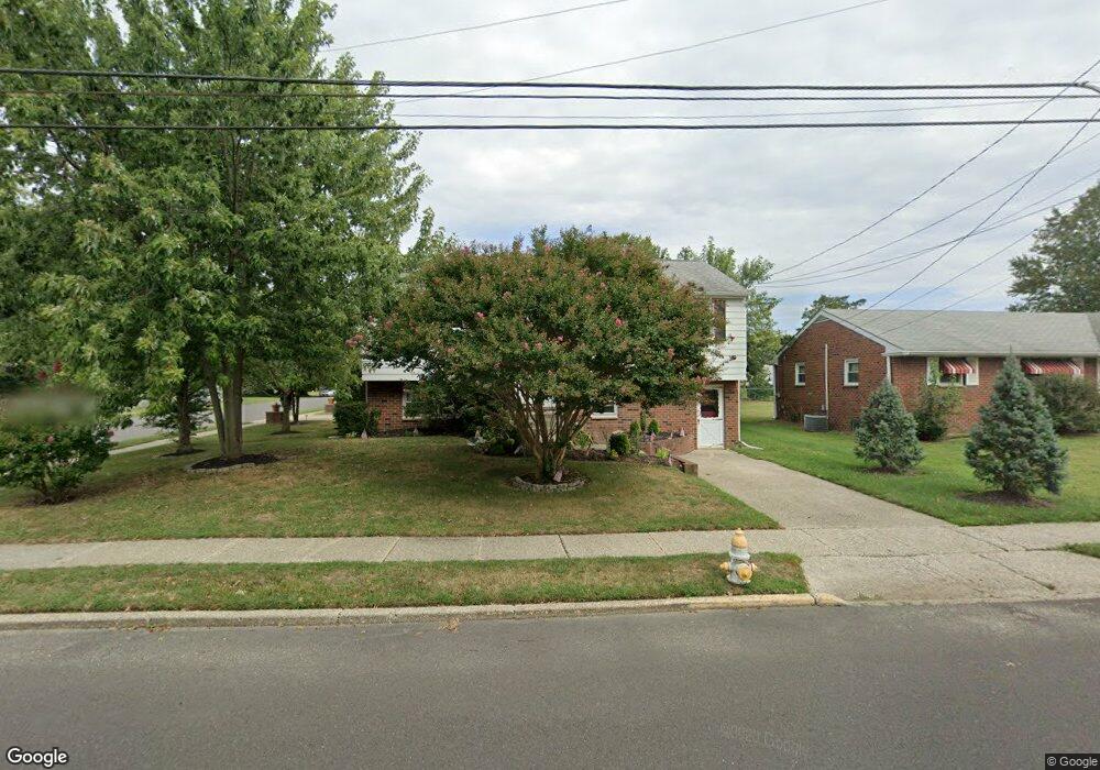
144 Carson Ave Gibbstown, NJ 08027
Greenwich Township NeighborhoodEstimated Value: $325,000 - $400,000
4
Beds
2
Baths
2,228
Sq Ft
$165/Sq Ft
Est. Value
About This Home
This home is located at 144 Carson Ave, Gibbstown, NJ 08027 and is currently estimated at $368,008, approximately $165 per square foot. 144 Carson Ave is a home located in Gloucester County with nearby schools including Nehaunsey Middle School and Guardian Angels Regional School.
Ownership History
Date
Name
Owned For
Owner Type
Purchase Details
Closed on
Feb 26, 2009
Sold by
Pigliacelli Michael V and Pigliacelli Elizabeth
Bought by
Hood Roger Charles and Hood Rebecca Lee
Current Estimated Value
Home Financials for this Owner
Home Financials are based on the most recent Mortgage that was taken out on this home.
Original Mortgage
$212,087
Outstanding Balance
$134,930
Interest Rate
5.14%
Mortgage Type
FHA
Estimated Equity
$233,078
Purchase Details
Closed on
Aug 15, 2003
Sold by
Chila Diego and Chila Guiseppe
Bought by
Pigliacelli Michael V and Pigliacelli Elizabeth J
Home Financials for this Owner
Home Financials are based on the most recent Mortgage that was taken out on this home.
Original Mortgage
$144,000
Interest Rate
5.69%
Mortgage Type
Purchase Money Mortgage
Create a Home Valuation Report for This Property
The Home Valuation Report is an in-depth analysis detailing your home's value as well as a comparison with similar homes in the area
Home Values in the Area
Average Home Value in this Area
Purchase History
| Date | Buyer | Sale Price | Title Company |
|---|---|---|---|
| Hood Roger Charles | $216,000 | Intercoastal Title Agency In | |
| Pigliacelli Michael V | $180,000 | Group 21 |
Source: Public Records
Mortgage History
| Date | Status | Borrower | Loan Amount |
|---|---|---|---|
| Open | Hood Roger Charles | $212,087 | |
| Previous Owner | Pigliacelli Michael V | $144,000 |
Source: Public Records
Tax History Compared to Growth
Tax History
| Year | Tax Paid | Tax Assessment Tax Assessment Total Assessment is a certain percentage of the fair market value that is determined by local assessors to be the total taxable value of land and additions on the property. | Land | Improvement |
|---|---|---|---|---|
| 2025 | $6,879 | $199,800 | $36,500 | $163,300 |
| 2024 | $6,517 | $199,800 | $36,500 | $163,300 |
| 2023 | $6,517 | $199,800 | $36,500 | $163,300 |
| 2022 | $6,521 | $199,800 | $36,500 | $163,300 |
| 2021 | $6,454 | $199,800 | $36,500 | $163,300 |
| 2020 | $6,543 | $199,800 | $36,500 | $163,300 |
| 2019 | $6,547 | $199,800 | $36,500 | $163,300 |
| 2018 | $6,362 | $199,800 | $36,500 | $163,300 |
| 2017 | $6,208 | $199,800 | $36,500 | $163,300 |
| 2016 | $6,140 | $199,800 | $36,500 | $163,300 |
| 2015 | $5,942 | $199,800 | $36,500 | $163,300 |
| 2014 | $5,686 | $199,800 | $36,500 | $163,300 |
Source: Public Records
Map
Nearby Homes
- 330 Croce Ave
- W Broad St
- 0 Swedesboro Ave Unit NJGL2061592
- 219 Vanneman Blvd
- 0 S Democrat Rd Unit NJGL2065008
- 255 Elizabeth Ave
- 335 W Buck St
- 344 W Washington St
- L18 20 W Broad St
- 1224 Heddon Ave
- 1214 Walter Ave
- 269 W Broad St
- 1043 Penn Line Rd
- 227 W Buck St
- 1534 Pine St
- 1519 Pine St
- 122 W Washington St
- 140 142 W Jefferson St
- 342 Democrat Rd
- 100 Giammarino Ave
- 136 Carson Ave
- 204 Carson Ave
- 219 Harmony Rd
- 128 Carson Ave
- 207 Harmony Rd
- 500 Myrtle Ave
- 235 Harmony Rd
- 135 Carson Ave
- 212 Carson Ave
- 127 Carson Ave
- 199 Harmony Rd
- 243 Harmony Rd
- 218 Carson Ave
- 504 Myrtle Ave
- 112 Carson Ave
- 600 Betty Rose Ave
- 251 Harmony Rd
- 224 Carson Ave
- 214 Harmony Rd
- 604 Betty Rose Ave