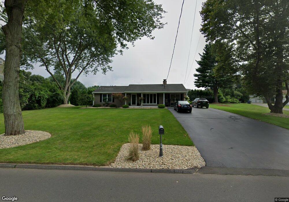
144 Coles Rd Cromwell, CT 06416
Estimated Value: $331,038 - $394,000
2
Beds
2
Baths
1,260
Sq Ft
$297/Sq Ft
Est. Value
About This Home
This home is located at 144 Coles Rd, Cromwell, CT 06416 and is currently estimated at $374,760, approximately $297 per square foot. 144 Coles Rd is a home located in Middlesex County with nearby schools including Edna C. Stevens School, Woodside Intermediate School, and Cromwell Middle School.
Ownership History
Date
Name
Owned For
Owner Type
Purchase Details
Closed on
Oct 9, 2007
Sold by
Webster Larry
Bought by
Cornelio Randal S
Current Estimated Value
Home Financials for this Owner
Home Financials are based on the most recent Mortgage that was taken out on this home.
Original Mortgage
$196,000
Outstanding Balance
$124,786
Interest Rate
6.59%
Estimated Equity
$249,974
Purchase Details
Closed on
Mar 21, 2007
Sold by
Gilman Mary Rose D Est
Bought by
Webster Larry
Create a Home Valuation Report for This Property
The Home Valuation Report is an in-depth analysis detailing your home's value as well as a comparison with similar homes in the area
Home Values in the Area
Average Home Value in this Area
Purchase History
| Date | Buyer | Sale Price | Title Company |
|---|---|---|---|
| Cornelio Randal S | $245,000 | -- | |
| Webster Larry | $175,000 | -- |
Source: Public Records
Mortgage History
| Date | Status | Borrower | Loan Amount |
|---|---|---|---|
| Open | Webster Larry | $35,000 | |
| Open | Webster Larry | $196,000 | |
| Previous Owner | Webster Larry | $124,000 |
Source: Public Records
Tax History
| Year | Tax Paid | Tax Assessment Tax Assessment Total Assessment is a certain percentage of the fair market value that is determined by local assessors to be the total taxable value of land and additions on the property. | Land | Improvement |
|---|---|---|---|---|
| 2025 | $5,548 | $180,180 | $77,700 | $102,480 |
| 2024 | $5,418 | $180,180 | $77,700 | $102,480 |
| 2023 | $5,299 | $180,180 | $77,700 | $102,480 |
| 2022 | $4,967 | $149,030 | $71,120 | $77,910 |
| 2021 | $4,967 | $149,030 | $71,120 | $77,910 |
| 2020 | $4,893 | $149,030 | $71,120 | $77,910 |
| 2019 | $4,893 | $149,030 | $71,120 | $77,910 |
| 2018 | $4,893 | $149,030 | $71,120 | $77,910 |
| 2017 | $5,222 | $153,910 | $74,600 | $79,310 |
| 2016 | $5,176 | $153,910 | $74,600 | $79,310 |
| 2015 | $4,830 | $153,910 | $74,600 | $79,310 |
| 2014 | $5,122 | $153,910 | $74,600 | $79,310 |
Source: Public Records
Map
Nearby Homes
- 159 Evergreen Rd
- 34 Woodsboro Cir Unit 34
- 180 Skyview Dr Unit 180
- 43 Sunridge Ln
- 58 Blackhaw Dr
- 3 Avon Dale Rd Unit 3
- 21 Hawthorn Ct Unit 21
- 104 North Rd
- 3 Sunridge Ln Unit 3
- 11 Valley Run Dr Unit 11
- 234 Skyview Dr Unit 234
- 7 Willow Ct Unit 7
- 9 Willow Ct
- 1 Great Oak Ct
- 55 North Rd
- 22 Linda Ct Unit 22
- 9 Bayberry Ct
- 10 Dogwood Ct Unit 10
- 37 Coles Rd
- 30 Larkspur Dr
Your Personal Tour Guide
Ask me questions while you tour the home.