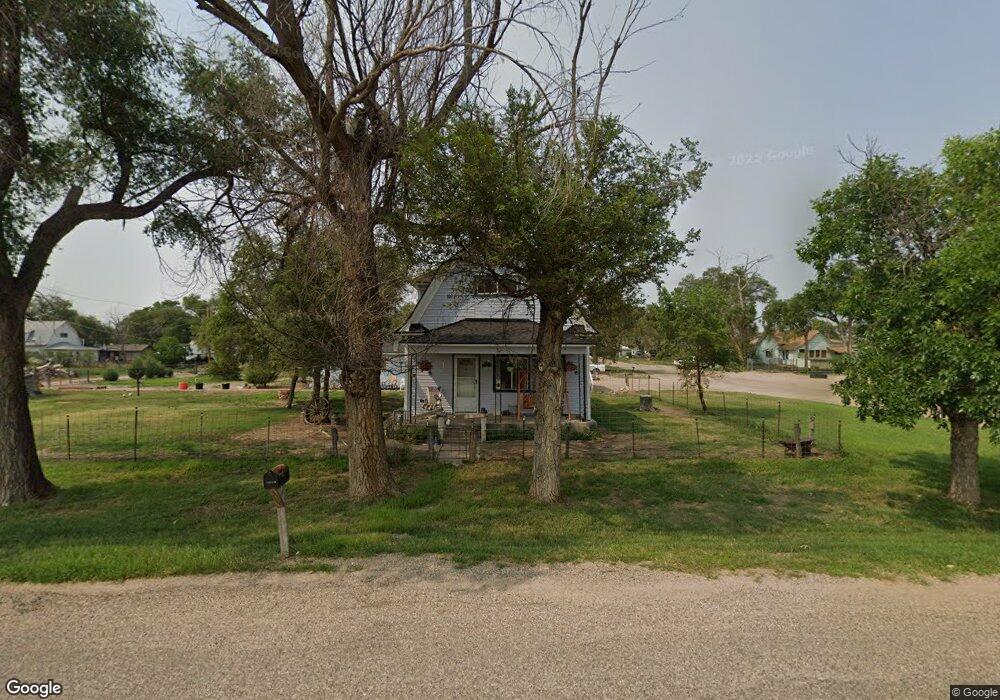
144 E 6th St Las Animas, CO 81054
Estimated Value: $82,106 - $148,000
3
Beds
1
Bath
1,766
Sq Ft
$65/Sq Ft
Est. Value
About This Home
This home is located at 144 E 6th St, Las Animas, CO 81054 and is currently estimated at $115,027, approximately $65 per square foot. 144 E 6th St is a home located in Bent County with nearby schools including Las Animas Elementary School, Las Animas Junior High School, and Las Animas High School.
Ownership History
Date
Name
Owned For
Owner Type
Purchase Details
Closed on
Nov 14, 2019
Sold by
Hughes Schlichenmayer C Joanna
Bought by
Banister Russell
Current Estimated Value
Home Financials for this Owner
Home Financials are based on the most recent Mortgage that was taken out on this home.
Original Mortgage
$22,000
Outstanding Balance
$20,689
Interest Rate
8%
Mortgage Type
Purchase Money Mortgage
Estimated Equity
$94,338
Purchase Details
Closed on
Apr 24, 2003
Bought by
Hughes-Schlichenmayer C Joanna
Create a Home Valuation Report for This Property
The Home Valuation Report is an in-depth analysis detailing your home's value as well as a comparison with similar homes in the area
Purchase History
| Date | Buyer | Sale Price | Title Company |
|---|---|---|---|
| Banister Russell | $20,000 | None Available | |
| Hughes-Schlichenmayer C Joanna | -- | -- |
Source: Public Records
Mortgage History
| Date | Status | Borrower | Loan Amount |
|---|---|---|---|
| Open | Banister Russell | $22,000 |
Source: Public Records
Tax History
| Year | Tax Paid | Tax Assessment Tax Assessment Total Assessment is a certain percentage of the fair market value that is determined by local assessors to be the total taxable value of land and additions on the property. | Land | Improvement |
|---|---|---|---|---|
| 2024 | $119 | $1,000 | $103 | $897 |
| 2023 | $118 | $1,000 | $103 | $897 |
| 2022 | $324 | $3,850 | $400 | $3,450 |
| 2021 | $326 | $3,023 | $375 | $2,648 |
| 2020 | $294 | $2,732 | $375 | $2,357 |
| 2019 | $299 | $2,732 | $375 | $2,357 |
| 2018 | $299 | $2,751 | $378 | $2,373 |
| 2017 | $302 | $2,751 | $378 | $2,373 |
| 2016 | $315 | $2,879 | $418 | $2,461 |
| 2015 | -- | $2,879 | $418 | $2,461 |
| 2014 | -- | $2,879 | $418 | $2,461 |
| 2013 | -- | $2,879 | $418 | $2,461 |
Source: Public Records
Map
Nearby Homes
- 535 Moore Ave
- 626 St Vrain Ave
- 626 St Vrain St
- 629 St Vrain Ave
- 940 Carson Ave
- 621 Carson Ave
- 312 Carson Ave
- 509 5th St
- 415 9th St
- 1032 Locust Ave
- 1046 Locust Ave
- 705 Locust Ave
- 24 Bent Ave
- 433 Grove Ave
- 1103 Ambassador Thompson Blvd
- 651 Ash Ave
- 426 Poplar Ave
- 0 Cr Ff 5
- 10928 Us Highway 50
- 606 Hurd Ave
- 525 Oakland Ave
- 525 Oakland Ave Unit 9-10
- 0 E 6th St Unit 79485
- 0 E 6th St Unit Leng 88689
- 558 Oakland Ave
- 118 E 6th St
- 143 E 6th St
- 515 Oakland Ave
- 540 Garfield Ave
- 536 Oakland Ave
- 520 Oakland Ave
- 107 E 6th St
- 209 E 6th St
- 520 Garfield Ave
- 546 Garfield Ave
- 503 Oakland Ave
- 533 Lincoln Ave
- 537 Lincoln Ave
- 537 Lincoln Ave Unit 1
- 248 E 6th St
Your Personal Tour Guide
Ask me questions while you tour the home.