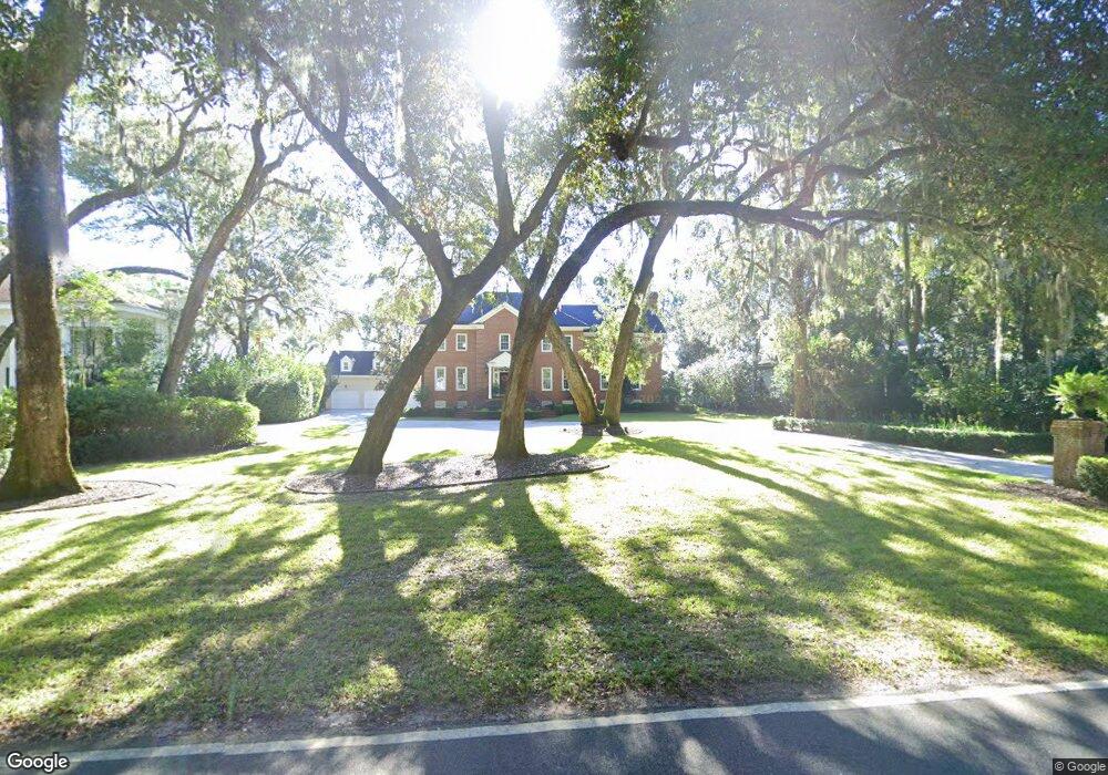
144 Hampton Point Dr Saint Simons Island, GA 31522
Hampton Point NeighborhoodEstimated Value: $1,362,179 - $2,154,000
4
Beds
5
Baths
4,298
Sq Ft
$402/Sq Ft
Est. Value
About This Home
This home is located at 144 Hampton Point Dr, Saint Simons Island, GA 31522 and is currently estimated at $1,727,045, approximately $401 per square foot. 144 Hampton Point Dr is a home located in Glynn County with nearby schools including Oglethorpe Point Elementary School, Glynn Middle School, and Glynn Academy.
Ownership History
Date
Name
Owned For
Owner Type
Purchase Details
Closed on
Sep 17, 2010
Sold by
Yelverton Charles
Bought by
Yelverton Rebecca C
Current Estimated Value
Purchase Details
Closed on
Sep 10, 2009
Sold by
Yelverton Rebecca C
Bought by
Yelverton Rebecca C
Purchase Details
Closed on
Aug 20, 2008
Sold by
Yelverton Peter F
Bought by
Yelverton Peter F and Yelverton Rebecca C
Create a Home Valuation Report for This Property
The Home Valuation Report is an in-depth analysis detailing your home's value as well as a comparison with similar homes in the area
Home Values in the Area
Average Home Value in this Area
Purchase History
| Date | Buyer | Sale Price | Title Company |
|---|---|---|---|
| Yelverton Rebecca C | -- | -- | |
| Yelverton Rebecca C | -- | -- | |
| Yelverton Rebecca C | $289,125 | -- | |
| Yelverton Rebecca C | -- | -- | |
| Yelverton Rebecca C | -- | -- | |
| Yelverton Peter F | -- | -- |
Source: Public Records
Tax History Compared to Growth
Tax History
| Year | Tax Paid | Tax Assessment Tax Assessment Total Assessment is a certain percentage of the fair market value that is determined by local assessors to be the total taxable value of land and additions on the property. | Land | Improvement |
|---|---|---|---|---|
| 2025 | $10,827 | $431,720 | $110,040 | $321,680 |
| 2024 | $10,895 | $434,440 | $110,040 | $324,400 |
| 2023 | $10,222 | $434,440 | $110,040 | $324,400 |
| 2022 | $9,923 | $398,720 | $166,120 | $232,600 |
| 2021 | $10,229 | $398,720 | $166,120 | $232,600 |
| 2020 | $9,130 | $443,480 | $166,120 | $277,360 |
| 2019 | $9,130 | $353,000 | $166,120 | $186,880 |
| 2018 | $9,130 | $353,000 | $166,120 | $186,880 |
| 2017 | $9,130 | $353,000 | $166,120 | $186,880 |
| 2016 | $8,424 | $353,000 | $166,120 | $186,880 |
| 2015 | $8,459 | $353,000 | $166,120 | $186,880 |
| 2014 | $8,459 | $353,000 | $166,120 | $186,880 |
Source: Public Records
Map
Nearby Homes
- 141 Hampton Point Dr
- 144 Butler Lake Dr
- 133 Hampton Point Dr
- 147 Butler Lake Dr
- 145 Butler Lake Dr
- 160 Hampton Point Dr
- 160 Butler Lake Dr
- 166 Hampton Point Dr
- 170 Hampton Point Dr
- 814 Kings Grant
- 150 Rice Mill
- 819 Kings Grant
- 403 Indigo
- 178 Hampton Point Dr
- 904 Champney
- 121 Rice Mill
- 104 Montrose
- 182 Hampton Point Dr
- 180 Rice Mill
- 119 Kiln Trail
- 146 Hampton Point Dr
- 142 Hampton Point Dr
- 8 Charles Town Landing
- 4 Charles Town Landing
- 12 Charles Town Landing
- 16 Charles Town Landing
- 18 Charles Town Landing
- 2 Charles Town Landing
- 22 Charles Town Landing
- 6 Charles Town Landing
- 24 Charles Town Landing
- 14 Charles Town Landing
- 20 Charles Town Landing
- 10 Charles Town Landing
- 5 Charles Town Landing
- 1 Charles Town Landing
- 11 Charles Town Landing
- 21 Charles Town Landing
- 15 Charles Town Landing
- 9 Charles Town Landing