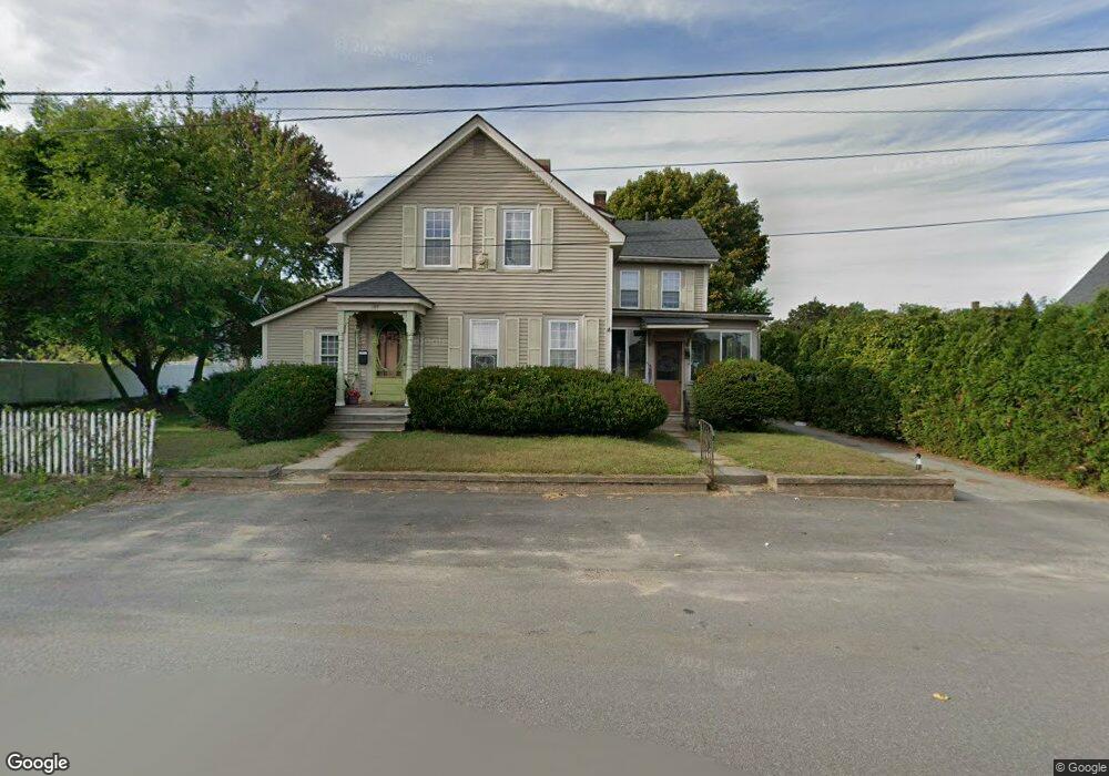
144 Lawrence St Clinton, MA 01510
Estimated Value: $453,268 - $549,000
4
Beds
2
Baths
2,510
Sq Ft
$207/Sq Ft
Est. Value
About This Home
This home is located at 144 Lawrence St, Clinton, MA 01510 and is currently estimated at $519,567, approximately $206 per square foot. 144 Lawrence St is a home located in Worcester County with nearby schools including Clinton Elementary School, Clinton Senior High School, and Clinton Middle School.
Ownership History
Date
Name
Owned For
Owner Type
Purchase Details
Closed on
Jul 22, 2003
Sold by
Dion Lisa M and Dion Richard P
Bought by
Dion Lisa M
Current Estimated Value
Purchase Details
Closed on
Aug 22, 1997
Sold by
Dion Lisa M and Heinold Moira A
Bought by
Dion Richard P and Dion Lisa M
Home Financials for this Owner
Home Financials are based on the most recent Mortgage that was taken out on this home.
Original Mortgage
$40,000
Interest Rate
7.42%
Mortgage Type
Purchase Money Mortgage
Create a Home Valuation Report for This Property
The Home Valuation Report is an in-depth analysis detailing your home's value as well as a comparison with similar homes in the area
Home Values in the Area
Average Home Value in this Area
Purchase History
We collect this data history from publicly available records. To have your information removed, we recommend requesting removal directly through your county’s website.
| Date | Buyer | Sale Price | Title Company |
|---|---|---|---|
| Dion Lisa M | -- | -- | |
| Dion Richard P | $62,000 | -- |
Source: Public Records
Mortgage History
We collect this data history from publicly available records. To have your information removed, we recommend requesting removal directly through your county’s website.
| Date | Status | Borrower | Loan Amount |
|---|---|---|---|
| Previous Owner | Dion Richard P | $136,000 | |
| Previous Owner | Dion Richard P | $96,000 | |
| Previous Owner | Dion Richard P | $40,000 |
Source: Public Records
Tax History
| Year | Tax Paid | Tax Assessment Tax Assessment Total Assessment is a certain percentage of the fair market value that is determined by local assessors to be the total taxable value of land and additions on the property. | Land | Improvement |
|---|---|---|---|---|
| 2025 | $5,456 | $410,200 | $94,000 | $316,200 |
| 2024 | $5,021 | $382,100 | $94,000 | $288,100 |
| 2023 | $4,729 | $353,700 | $85,400 | $268,300 |
| 2022 | $4,716 | $316,300 | $77,700 | $238,600 |
| 2021 | $4,264 | $267,500 | $74,100 | $193,400 |
| 2020 | $4,055 | $261,800 | $74,100 | $187,700 |
| 2019 | $3,809 | $239,100 | $71,900 | $167,200 |
| 2018 | $3,737 | $220,100 | $80,800 | $139,300 |
| 2017 | $3,426 | $193,900 | $67,500 | $126,400 |
| 2016 | $3,349 | $193,900 | $67,500 | $126,400 |
| 2015 | $3,084 | $185,100 | $67,100 | $118,000 |
| 2014 | $2,989 | $185,100 | $67,100 | $118,000 |
Source: Public Records
Map
Nearby Homes
- 861 Main St
- 719 Main St
- 57 Clark St
- 55 Sterling St Unit 306
- 55 Sterling St Unit 314
- 55 Sterling St Unit 208
- 55 Sterling St Unit 305
- 508 High St
- 51 Rigby St
- 65 Pearl St
- 216 Walnut St
- 6 Nelson St
- 129 High St
- 0 Parker Rd
- 112 School St
- 97 Sterling St
- 1185 Main St Unit 4
- 386 Main St
- 19 Brendan Rd
- 115117 Mechanic St Unit 4
- 152 Lawrence St
- 136 Lawrence St
- 128 Lawrence St
- 128 Lawrence St Unit 1
- 139 Lawrence St
- 15 Forest Ave
- 16 Lewis St
- 135 Lawrence St
- 18 Lewis St
- 122 Lawrence St
- 122 Lawrence St Unit 1
- 123 Lawrence St
- 123 Lawrence St Unit 2
- 105 Flagg St
- 99 Flagg St
- 99 Flagg St Unit 2
- 24 Lewis St
- 24 Lewis St Unit 1
- 107 Flagg St
- 107 Flagg St Unit 2
Your Personal Tour Guide
Ask me questions while you tour the home.