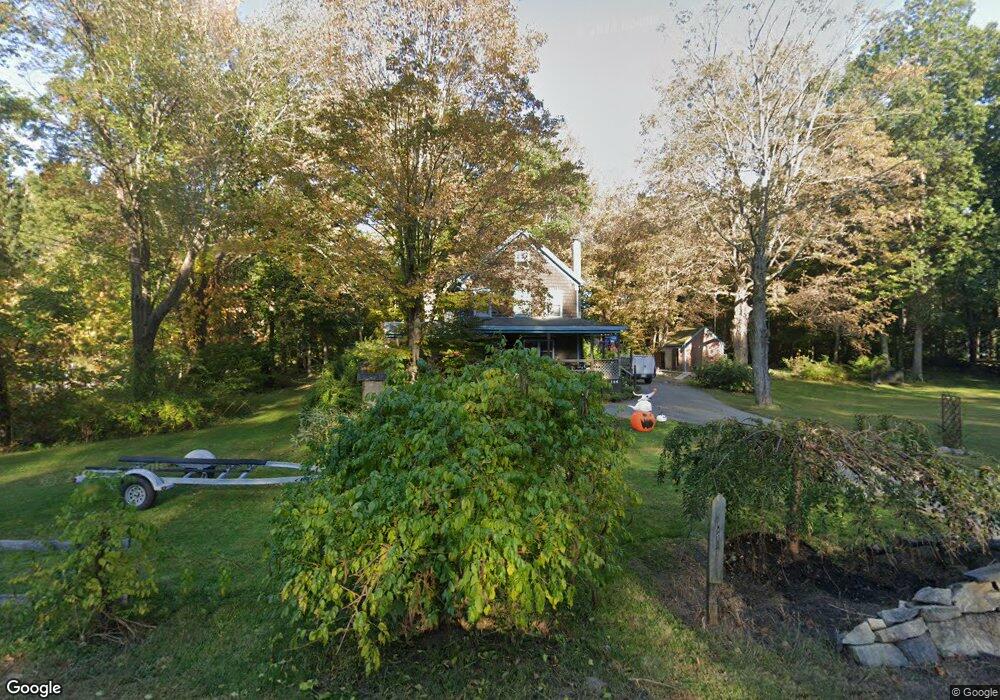
144 Main St Byfield, MA 01922
Estimated Value: $673,000 - $695,000
4
Beds
2
Baths
1,646
Sq Ft
$415/Sq Ft
Est. Value
About This Home
This home is located at 144 Main St, Byfield, MA 01922 and is currently estimated at $682,716, approximately $414 per square foot. 144 Main St is a home located in Essex County with nearby schools including Triton Regional High School, River Valley Charter School, and The Governors Academy.
Ownership History
Date
Name
Owned For
Owner Type
Purchase Details
Closed on
Jul 8, 2011
Sold by
Luca David B
Bought by
Tsoulas Nicole A and Murphy Jonathan A
Current Estimated Value
Home Financials for this Owner
Home Financials are based on the most recent Mortgage that was taken out on this home.
Original Mortgage
$258,000
Outstanding Balance
$173,165
Interest Rate
4%
Mortgage Type
Purchase Money Mortgage
Estimated Equity
$509,551
Create a Home Valuation Report for This Property
The Home Valuation Report is an in-depth analysis detailing your home's value as well as a comparison with similar homes in the area
Home Values in the Area
Average Home Value in this Area
Purchase History
| Date | Buyer | Sale Price | Title Company |
|---|---|---|---|
| Tsoulas Nicole A | $304,500 | -- | |
| Tsoulas Nicole A | $304,500 | -- |
Source: Public Records
Mortgage History
| Date | Status | Borrower | Loan Amount |
|---|---|---|---|
| Open | Tsoulas Nicole A | $258,000 | |
| Closed | Tsoulas Nicole A | $258,000 |
Source: Public Records
Tax History Compared to Growth
Tax History
| Year | Tax Paid | Tax Assessment Tax Assessment Total Assessment is a certain percentage of the fair market value that is determined by local assessors to be the total taxable value of land and additions on the property. | Land | Improvement |
|---|---|---|---|---|
| 2025 | $4,974 | $667,600 | $387,900 | $279,700 |
| 2024 | $4,706 | $612,700 | $347,000 | $265,700 |
| 2023 | $4,676 | $539,300 | $296,000 | $243,300 |
| 2022 | $4,659 | $478,800 | $265,400 | $213,400 |
| 2021 | $4,324 | $405,600 | $204,100 | $201,500 |
| 2020 | $4,392 | $399,600 | $204,100 | $195,500 |
| 2019 | $4,099 | $379,200 | $183,700 | $195,500 |
| 2018 | $3,971 | $364,300 | $183,700 | $180,600 |
| 2017 | $3,817 | $359,800 | $183,700 | $176,100 |
| 2016 | $3,381 | $296,600 | $142,900 | $153,700 |
| 2015 | $3,265 | $283,400 | $132,700 | $150,700 |
| 2014 | $3,208 | $283,400 | $132,700 | $150,700 |
Source: Public Records
Map
Nearby Homes
- 111 Moulton St
- 137 Indian Hill St
- 15 Central St
- 55 Pearson Dr Unit 9 - ALDER
- 55 Pearson Dr Unit 6-Dogwood
- 55 Pearson Dr Unit 3 - ALDER
- 55 Pearson Dr Unit 8-Dogwood
- 13 Turkey Hill Rd
- 30 Forest St
- 18 Forest St
- 34 Central St
- 6 Parker River Dr
- 21 Main St
- 15 Knobb Hill
- 4 Swanton Way
- 66 Parish Rd Unit 4
- 167 Middle St
- 10 Noyes Rd
- 5 Charles St
- 86 Middle St