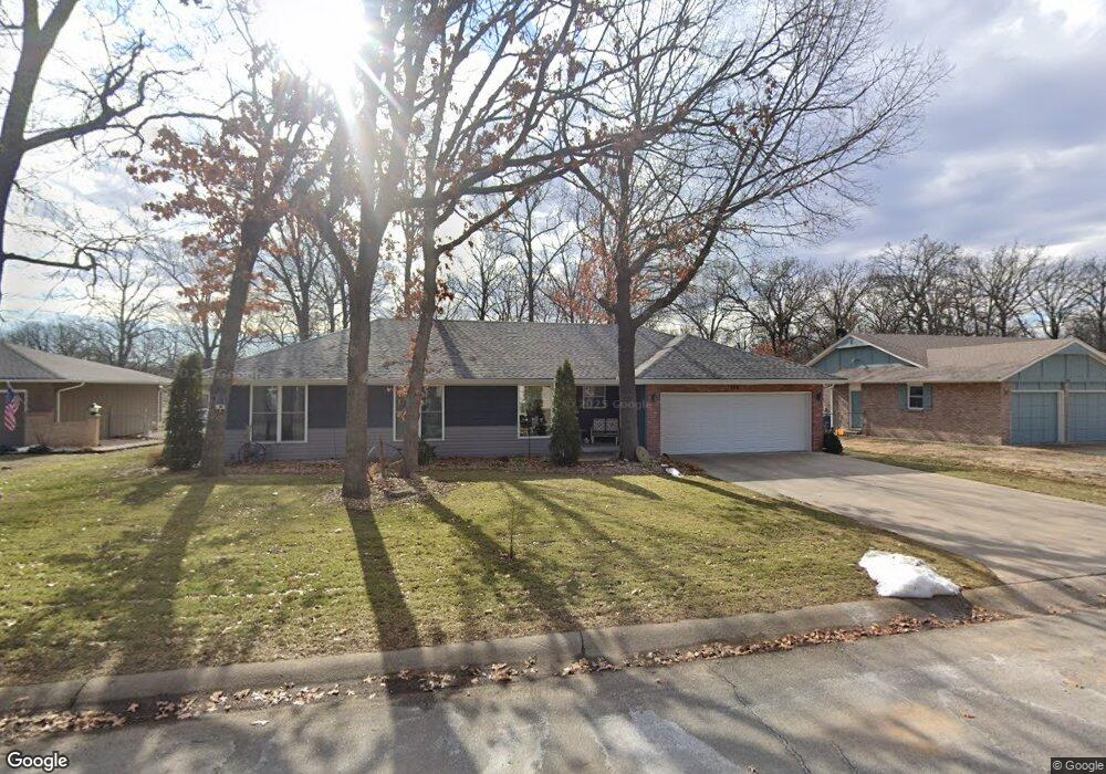
144 Par Ln Carl Junction, MO 64834
Briarbrook NeighborhoodEstimated Value: $235,876 - $263,000
3
Beds
2
Baths
1,620
Sq Ft
$153/Sq Ft
Est. Value
About This Home
This home is located at 144 Par Ln, Carl Junction, MO 64834 and is currently estimated at $247,469, approximately $152 per square foot. 144 Par Ln is a home located in Jasper County with nearby schools including Carl Junction Primary School (K-1), Carl Junction Intermediate School, and Carl Junction Primary School (2-3).
Ownership History
Date
Name
Owned For
Owner Type
Purchase Details
Closed on
Apr 6, 2017
Sold by
Wiseman Rhonda Kay and Wiseman David
Bought by
Larson Lorence W and Larson Hendra B
Current Estimated Value
Home Financials for this Owner
Home Financials are based on the most recent Mortgage that was taken out on this home.
Original Mortgage
$110,000
Outstanding Balance
$91,319
Interest Rate
4.21%
Mortgage Type
New Conventional
Estimated Equity
$156,150
Purchase Details
Closed on
Dec 16, 2011
Sold by
Hill Michael L and Hill Lana J
Bought by
Hartley Rhonda
Home Financials for this Owner
Home Financials are based on the most recent Mortgage that was taken out on this home.
Original Mortgage
$96,000
Interest Rate
4.03%
Mortgage Type
New Conventional
Purchase Details
Closed on
May 18, 2007
Sold by
Reitemeier Clarence G and Reitemeier Norene G
Bought by
Reid Paul D and Reid Kathleen M
Create a Home Valuation Report for This Property
The Home Valuation Report is an in-depth analysis detailing your home's value as well as a comparison with similar homes in the area
Home Values in the Area
Average Home Value in this Area
Purchase History
| Date | Buyer | Sale Price | Title Company |
|---|---|---|---|
| Larson Lorence W | -- | None Available | |
| Hartley Rhonda | -- | Fatco | |
| Reid Paul D | -- | Abbey |
Source: Public Records
Mortgage History
| Date | Status | Borrower | Loan Amount |
|---|---|---|---|
| Open | Larson Lorence W | $110,000 | |
| Previous Owner | Hartley Rhonda | $96,000 |
Source: Public Records
Tax History
| Year | Tax Paid | Tax Assessment Tax Assessment Total Assessment is a certain percentage of the fair market value that is determined by local assessors to be the total taxable value of land and additions on the property. | Land | Improvement |
|---|---|---|---|---|
| 2025 | $1,619 | $28,290 | $4,430 | $23,860 |
| 2024 | $1,624 | $25,260 | $4,430 | $20,830 |
| 2023 | $1,624 | $25,260 | $4,430 | $20,830 |
| 2022 | $1,596 | $24,810 | $4,430 | $20,380 |
| 2021 | $1,384 | $24,810 | $4,430 | $20,380 |
| 2020 | $1,303 | $23,020 | $4,430 | $18,590 |
| 2019 | $1,240 | $23,020 | $4,430 | $18,590 |
| 2018 | $909 | $16,970 | $0 | $0 |
| 2017 | $911 | $16,970 | $0 | $0 |
| 2016 | $952 | $17,880 | $0 | $0 |
Source: Public Records
Map
Nearby Homes
- 107 Foursome Ln
- 128 Par Ln
- 328 Briarbrook Dr
- 306 Lakeview Ln
- 710 Briarbrook Dr
- 126 N Windwood
- 201 Tee Ln
- 9130 Missouri 171
- 112 Red Oak Dr
- 126 Briarbrook Dr
- 111 Briarbrook Dr
- 106 Victoria Ln
- 807 Copper Oaks Dr
- 121 Forest Dr
- 708 Danica Jo Ln
- 909 Silver Oaks Dr
- 232 Hickory Place
- XXX Lone Elm
- 6548 Mo-171
- 908 Silver Oaks Dr
Your Personal Tour Guide
Ask me questions while you tour the home.