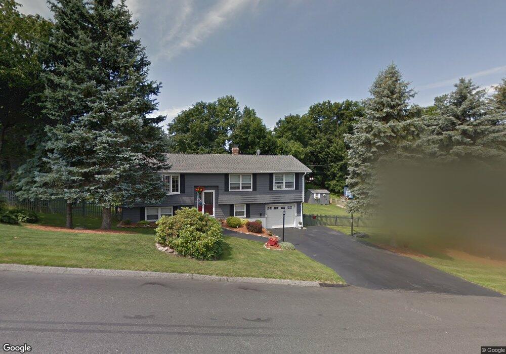
144 Saint Nicholas Ave Worcester, MA 01606
Burncoat NeighborhoodEstimated Value: $442,000 - $489,825
3
Beds
2
Baths
1,196
Sq Ft
$386/Sq Ft
Est. Value
About This Home
This home is located at 144 Saint Nicholas Ave, Worcester, MA 01606 and is currently estimated at $462,206, approximately $386 per square foot. 144 Saint Nicholas Ave is a home located in Worcester County with nearby schools including Worcester Arts Magnet School, Jacob Hiatt Magnet School, and Chandler Magnet.
Ownership History
Date
Name
Owned For
Owner Type
Purchase Details
Closed on
Aug 28, 1992
Sold by
Zielinski Jadwiga
Bought by
Kusz Gary P and Kusz Maribeth
Current Estimated Value
Create a Home Valuation Report for This Property
The Home Valuation Report is an in-depth analysis detailing your home's value as well as a comparison with similar homes in the area
Home Values in the Area
Average Home Value in this Area
Purchase History
| Date | Buyer | Sale Price | Title Company |
|---|---|---|---|
| Kusz Gary P | $122,000 | -- |
Source: Public Records
Mortgage History
| Date | Status | Borrower | Loan Amount |
|---|---|---|---|
| Open | Kusz Gary P | $140,000 | |
| Closed | Kusz Gary P | $21,222 | |
| Closed | Kusz Gary P | $21,000 |
Source: Public Records
Tax History Compared to Growth
Tax History
| Year | Tax Paid | Tax Assessment Tax Assessment Total Assessment is a certain percentage of the fair market value that is determined by local assessors to be the total taxable value of land and additions on the property. | Land | Improvement |
|---|---|---|---|---|
| 2025 | $5,822 | $441,400 | $119,000 | $322,400 |
| 2024 | $5,760 | $418,900 | $119,000 | $299,900 |
| 2023 | $5,626 | $392,300 | $103,500 | $288,800 |
| 2022 | $4,875 | $320,500 | $82,800 | $237,700 |
| 2021 | $4,837 | $297,100 | $66,200 | $230,900 |
| 2020 | $4,610 | $271,200 | $66,200 | $205,000 |
| 2019 | $4,500 | $250,000 | $59,700 | $190,300 |
| 2018 | $4,527 | $239,400 | $59,700 | $179,700 |
| 2017 | $4,332 | $225,400 | $59,700 | $165,700 |
| 2016 | $4,303 | $208,800 | $44,500 | $164,300 |
| 2015 | $4,191 | $208,800 | $44,500 | $164,300 |
| 2014 | $4,080 | $208,800 | $44,500 | $164,300 |
Source: Public Records
Map
Nearby Homes
- 14 Housatonic St
- 95 Saint Nicholas Ave
- 13 Fatima Ln
- 80 Clark St
- 68 Housatonic St
- 2 Maria Ln Unit 2
- 15 Inwood Rd
- 276 Saint Nicholas Ave
- 31 Enaya Cir Unit 31
- 314 Burncoat St
- 12 Prudential Rd
- 304 Saint Nicholas Ave
- 49 Prudential Rd
- 113 Bay State Rd
- 43 Fales St
- 2206 Halcyon Dr Unit 2206
- 80 Prudential Rd
- 120 Bay State Rd
- 3 Granville Ave
- 18 Claffey Ave
- 175 Clark St
- 136 Saint Nicholas Ave
- 77 Uncatena Ave
- 79 Uncatena Ave
- 75 Uncatena Ave
- 132 Saint Nicholas Ave
- 160 Saint Nicholas Ave
- 176 Clark St
- 167 Clark St
- 191 Clark St
- 184 Clark St
- 172 Clark St
- 126 Saint Nicholas Ave
- 131 Saint Nicholas Ave
- 168 Saint Nicholas Ave
- 89 Uncatena Ave
- 120 Saint Nicholas Ave
- 73 Uncatena Ave
- 194 Clark St
- 194 Clark St Unit 1