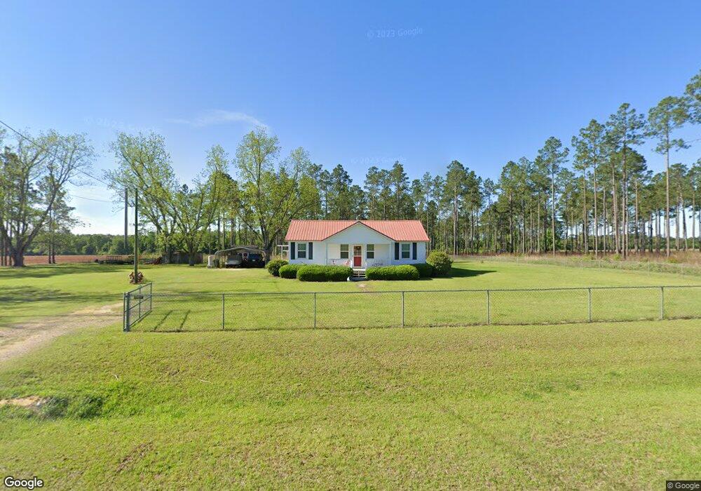
144 Sauls Rd Moultrie, GA 31768
Estimated Value: $136,377 - $166,000
--
Bed
1
Bath
1,197
Sq Ft
$126/Sq Ft
Est. Value
About This Home
This home is located at 144 Sauls Rd, Moultrie, GA 31768 and is currently estimated at $151,094, approximately $126 per square foot. 144 Sauls Rd is a home located in Colquitt County with nearby schools including Sunset Elementary School, C.A. Gray Junior High School, and Willie J. Williams Middle School.
Ownership History
Date
Name
Owned For
Owner Type
Purchase Details
Closed on
May 3, 2006
Sold by
Parrish Gordon E
Bought by
Walden Matthew
Current Estimated Value
Home Financials for this Owner
Home Financials are based on the most recent Mortgage that was taken out on this home.
Original Mortgage
$64,900
Outstanding Balance
$37,566
Interest Rate
6.39%
Mortgage Type
New Conventional
Estimated Equity
$113,528
Purchase Details
Closed on
Jul 31, 2001
Sold by
Harper Opal Kearce Life
Bought by
Parrish Margaret O
Purchase Details
Closed on
Nov 16, 1994
Bought by
Harper Opal Kearce
Purchase Details
Closed on
Mar 1, 1993
Bought by
Harper Vernon W
Purchase Details
Closed on
Jan 16, 1991
Bought by
Harper Opal Kerce
Create a Home Valuation Report for This Property
The Home Valuation Report is an in-depth analysis detailing your home's value as well as a comparison with similar homes in the area
Home Values in the Area
Average Home Value in this Area
Purchase History
| Date | Buyer | Sale Price | Title Company |
|---|---|---|---|
| Walden Matthew | $64,900 | -- | |
| Parrish Margaret O | $36,000 | -- | |
| Harper Opal Kearce | -- | -- | |
| Harper Vernon W | -- | -- | |
| Harper Opal Kerce | -- | -- |
Source: Public Records
Mortgage History
| Date | Status | Borrower | Loan Amount |
|---|---|---|---|
| Open | Walden Matthew | $64,900 |
Source: Public Records
Tax History Compared to Growth
Tax History
| Year | Tax Paid | Tax Assessment Tax Assessment Total Assessment is a certain percentage of the fair market value that is determined by local assessors to be the total taxable value of land and additions on the property. | Land | Improvement |
|---|---|---|---|---|
| 2024 | $1,023 | $44,031 | $5,285 | $38,746 |
| 2023 | $929 | $35,665 | $5,285 | $30,380 |
| 2022 | $766 | $32,153 | $4,699 | $27,454 |
| 2021 | $684 | $28,152 | $4,699 | $23,453 |
| 2020 | $653 | $26,403 | $4,699 | $21,704 |
| 2019 | $694 | $25,237 | $4,699 | $20,538 |
| 2018 | $646 | $25,237 | $4,699 | $20,538 |
| 2017 | $688 | $25,271 | $4,733 | $20,538 |
| 2016 | $697 | $25,271 | $4,733 | $20,538 |
| 2015 | $703 | $25,271 | $4,733 | $20,538 |
| 2014 | $690 | $25,271 | $4,733 | $20,538 |
| 2013 | -- | $25,270 | $4,733 | $20,537 |
Source: Public Records
Map
Nearby Homes
- 219 Cox Dairy Rd
- 0 Gatewood Cir Unit 1652303
- 1215 12th St SW
- 2010 West Blvd
- 904 Barbara Cir
- 905 Barbara Cir
- 216 Circle Rd
- 1159 6th St SW
- 1712 Villa Dr SW
- 1160 4th St SW
- 1546 Ivy Ln
- 1175 4th St SW
- 515 8th St SW
- 1310 S Main St
- 1321 Hallmark Dr
- 39 Hummingbird Rd
- 1777 S Main St
- 610 4th Ave SW
- 410 West Bypass NW
- Lot 3 Hummingbird Ln
- 182 Sauls Rd
- 961 Tree Farm Rd
- 850 Tree Farm Rd
- 874 Tree Farm Rd
- 910 Tree Farm Rd
- 260 Sauls Rd
- 950 Tree Farm Rd
- 0 Tree Farm Rd
- 1027 Tree Farm Rd
- 823 Tree Farm Rd
- 750 Tree Farm Rd
- 111 Lakeshore Rd
- 180 Cw Cooper Rd
- 344 Sauls Rd
- 131 Lakeshore Rd
- 1061 Tree Farm Rd
- 1067 Tree Farm Rd
- 1066 Tree Farm Rd
- 439 Sauls Rd
- 357 Sauls Rd