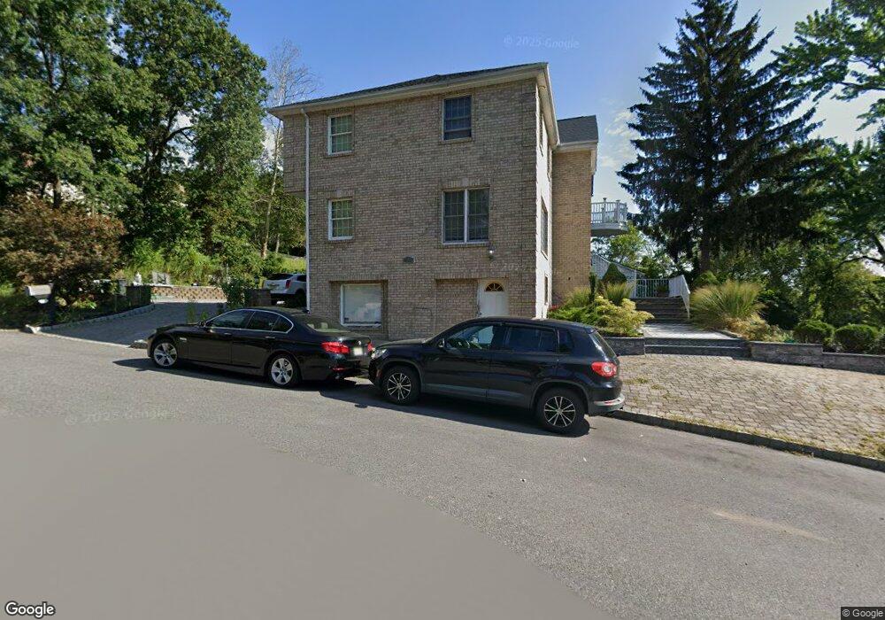
144 Shepherds Ln Totowa, NJ 07512
Estimated Value: $773,000 - $960,000
--
Bed
--
Bath
2,468
Sq Ft
$349/Sq Ft
Est. Value
About This Home
This home is located at 144 Shepherds Ln, Totowa, NJ 07512 and is currently estimated at $861,706, approximately $349 per square foot. 144 Shepherds Ln is a home located in Passaic County with nearby schools including Washington Park Elementary School, Passaic Valley High School, and John P Holland Charter School.
Ownership History
Date
Name
Owned For
Owner Type
Purchase Details
Closed on
Jul 9, 2004
Sold by
Totowa Djc
Bought by
Selman Medi and Selman Newsrin
Current Estimated Value
Purchase Details
Closed on
Aug 8, 1994
Sold by
Bonifacio Maximo
Bought by
Maniaci Elizabeth and Dean Lynda
Home Financials for this Owner
Home Financials are based on the most recent Mortgage that was taken out on this home.
Original Mortgage
$145,000
Interest Rate
8.38%
Create a Home Valuation Report for This Property
The Home Valuation Report is an in-depth analysis detailing your home's value as well as a comparison with similar homes in the area
Home Values in the Area
Average Home Value in this Area
Purchase History
| Date | Buyer | Sale Price | Title Company |
|---|---|---|---|
| Selman Medi | $350,000 | -- | |
| Maniaci Elizabeth | $160,000 | -- |
Source: Public Records
Mortgage History
| Date | Status | Borrower | Loan Amount |
|---|---|---|---|
| Previous Owner | Maniaci Elizabeth | $145,000 |
Source: Public Records
Tax History Compared to Growth
Tax History
| Year | Tax Paid | Tax Assessment Tax Assessment Total Assessment is a certain percentage of the fair market value that is determined by local assessors to be the total taxable value of land and additions on the property. | Land | Improvement |
|---|---|---|---|---|
| 2025 | $16,396 | $604,800 | $221,500 | $383,300 |
| 2024 | $15,682 | $604,800 | $221,500 | $383,300 |
| 2022 | $14,745 | $604,800 | $221,500 | $383,300 |
| 2021 | $14,388 | $604,800 | $221,500 | $383,300 |
| 2020 | $14,648 | $604,800 | $221,500 | $383,300 |
| 2019 | $14,443 | $604,800 | $221,500 | $383,300 |
| 2018 | $14,412 | $604,800 | $221,500 | $383,300 |
| 2017 | $14,267 | $604,800 | $221,500 | $383,300 |
| 2016 | $14,207 | $604,800 | $221,500 | $383,300 |
| 2015 | $13,814 | $604,800 | $221,500 | $383,300 |
| 2014 | $12,834 | $604,800 | $221,500 | $383,300 |
Source: Public Records
Map
Nearby Homes
- 125 Hamilton Trail
- 107 Hamilton Trail
- 256 Elberon Ave Unit 258
- 256-258 Elberon Ave
- 302 Lincoln Ave
- 253 Emerson Ave Unit 255
- 8 Flintlock Ct
- 41 Stirling Terrace
- 207 Burlington Ave
- 91 Chatham Ave
- 203-207 Burlington Ave
- 89-91 Chatham Ave
- 81 Columbus Ave
- 26 Crosby Ave
- 28 Battle Ridge Trail
- 239 Lexington Ave Unit 241
- 153 155arlington Ave
- 135 Elberon Ave Unit 137
- 153 Arlington Ave Unit 155
- 231-233 Lenox Ave
- 9 Fellner Place
- 152 Hamilton Trail
- 100 Shepherds Ln
- 100 Shepherds Ln
- 143 Shepherds Ln
- 143 Shepherds Ln Unit 2
- 159 Hamilton Trail
- 142 Hamilton Trail
- 151 Hamilton Trail
- 2 Stanford Ct
- 349 Barnert Ave
- 140 Shepherds Ln
- 12 Stanford Ct
- 147 Hamilton Trail
- 128 Hamilton Trail
- 20 Stanford Ct
- 116 Hamilton Trail
- 343 Barnert Ave
- 344 Barnert Ave
- 17 Stanford Ct