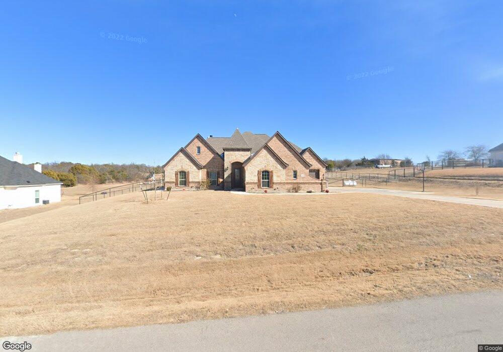
144 Stanford Ln Springtown, TX 76082
Estimated Value: $554,415 - $611,000
--
Bed
--
Bath
2,583
Sq Ft
$224/Sq Ft
Est. Value
About This Home
This home is located at 144 Stanford Ln, Springtown, TX 76082 and is currently estimated at $579,354, approximately $224 per square foot. 144 Stanford Ln is a home with nearby schools including Goshen Creek Elementary School, Springtown Middle School, and Springtown Intermediate School.
Ownership History
Date
Name
Owned For
Owner Type
Purchase Details
Closed on
Aug 17, 2018
Sold by
Ashlyn Homes Inc
Bought by
Jeffery Jim Harold and Jeffery Jeffrey Krysslin
Current Estimated Value
Home Financials for this Owner
Home Financials are based on the most recent Mortgage that was taken out on this home.
Original Mortgage
$322,059
Outstanding Balance
$281,923
Interest Rate
4.87%
Mortgage Type
FHA
Estimated Equity
$297,431
Purchase Details
Closed on
Apr 9, 2018
Sold by
D4 Stanford Investments Llc
Bought by
Ashlyn Homes Inc
Home Financials for this Owner
Home Financials are based on the most recent Mortgage that was taken out on this home.
Original Mortgage
$268,000
Interest Rate
4.43%
Mortgage Type
Purchase Money Mortgage
Create a Home Valuation Report for This Property
The Home Valuation Report is an in-depth analysis detailing your home's value as well as a comparison with similar homes in the area
Home Values in the Area
Average Home Value in this Area
Purchase History
| Date | Buyer | Sale Price | Title Company |
|---|---|---|---|
| Jeffery Jim Harold | -- | Republic Title Company | |
| Ashlyn Homes Inc | -- | None Available |
Source: Public Records
Mortgage History
| Date | Status | Borrower | Loan Amount |
|---|---|---|---|
| Open | Jeffery Jim Harold | $322,059 | |
| Previous Owner | Ashlyn Homes Inc | $268,000 |
Source: Public Records
Tax History Compared to Growth
Tax History
| Year | Tax Paid | Tax Assessment Tax Assessment Total Assessment is a certain percentage of the fair market value that is determined by local assessors to be the total taxable value of land and additions on the property. | Land | Improvement |
|---|---|---|---|---|
| 2025 | $6,788 | $549,534 | -- | -- |
| 2024 | $6,788 | $499,576 | -- | -- |
| 2023 | $6,788 | $454,160 | $0 | $0 |
| 2022 | $7,362 | $412,880 | $50,000 | $362,880 |
| 2021 | $7,604 | $392,880 | $50,000 | $342,880 |
| 2020 | $6,925 | $358,960 | $40,000 | $318,960 |
| 2019 | $7,444 | $358,960 | $40,000 | $318,960 |
| 2018 | $416 | $20,000 | $20,000 | $0 |
| 2017 | $436 | $20,000 | $20,000 | $0 |
Source: Public Records
Map
Nearby Homes
- 124 Stanford Ln
- 317 Palo Alto Dr
- 235 Columbia Ct
- 223 Columbia Ct
- 252 Harvard Ln
- 391 Red Bird Dr
- 447 Red Bird Dr
- 363 Red Bird Dr
- 2801 Agnes Cir
- 105 Kathy Stephens Ave
- TBD Candis Ct
- 104 Candis Ct
- 340 Sanger Dr
- 408 Herb Stephens Jr Way
- 144 Brady Coleman Ln
- 137 Brady Coleman Ln
- 650 Sanger Dr
- 1038 Colt Rd
- 1097 Colt Rd
- 1094 Colt Rd
- 140 Stanford Ln
- 148 Stanford Ln
- 143 Stanford Ln
- 147 Stanford Ln
- 136 Stanford Ln
- 152 Stanford Ln
- 139 Stanford Ln
- 153 Stanford Ln
- 135 Stanford Ln
- 132 Stanford Ln
- 2606 Agnes Cir
- 131 Stanford Ln
- 128 Stanford Ln
- 268 Columbia Ct
- 127 Stanford Ln
- 264 Columbia Ct
- 272 Columbia Ct
- 328 Palo Alto Dr
- 320 Palo Alto Dr
- 123 Stanford Ln