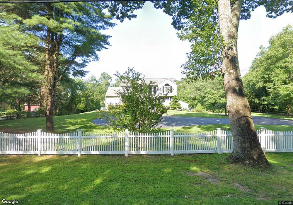
144 Westbrook Rd Deep River, CT 06417
Estimated Value: $601,109 - $725,000
4
Beds
3
Baths
2,656
Sq Ft
$256/Sq Ft
Est. Value
About This Home
This home is located at 144 Westbrook Rd, Deep River, CT 06417 and is currently estimated at $679,277, approximately $255 per square foot. 144 Westbrook Rd is a home located in Middlesex County with nearby schools including Valley Regional High School.
Ownership History
Date
Name
Owned For
Owner Type
Purchase Details
Closed on
Jun 12, 2025
Sold by
Delorenze Richard A
Bought by
Richard A Delorenze Ret and Delorenze
Current Estimated Value
Purchase Details
Closed on
Apr 21, 2023
Sold by
Delorenze Paula A
Bought by
Delorenze Richard A
Purchase Details
Closed on
Nov 18, 1997
Sold by
Strobel Paula R
Bought by
Delorenze Paula A and Delorenze Richard A
Purchase Details
Closed on
May 31, 1991
Sold by
Reeves Lawrence F and Reeves Thetis
Bought by
Strobel Reaves E and Strobel Paula R
Purchase Details
Closed on
Jun 6, 1989
Sold by
White Larry A
Bought by
Reeves Thetis
Create a Home Valuation Report for This Property
The Home Valuation Report is an in-depth analysis detailing your home's value as well as a comparison with similar homes in the area
Home Values in the Area
Average Home Value in this Area
Purchase History
| Date | Buyer | Sale Price | Title Company |
|---|---|---|---|
| Richard A Delorenze Ret | -- | None Available | |
| Richard A Delorenze Ret | -- | None Available | |
| Delorenze Richard A | -- | None Available | |
| Delorenze Richard A | -- | None Available | |
| Delorenze Paula A | $183,000 | -- | |
| Delorenze Paula A | $183,000 | -- | |
| Strobel Reaves E | $225,000 | -- | |
| Reeves Thetis | $225,000 | -- |
Source: Public Records
Mortgage History
| Date | Status | Borrower | Loan Amount |
|---|---|---|---|
| Previous Owner | Reeves Thetis | $50,000 | |
| Previous Owner | Reeves Thetis | $230,000 |
Source: Public Records
Tax History
| Year | Tax Paid | Tax Assessment Tax Assessment Total Assessment is a certain percentage of the fair market value that is determined by local assessors to be the total taxable value of land and additions on the property. | Land | Improvement |
|---|---|---|---|---|
| 2025 | $9,310 | $291,130 | $57,680 | $233,450 |
| 2024 | $9,136 | $291,130 | $57,680 | $233,450 |
| 2023 | $8,699 | $291,130 | $57,680 | $233,450 |
| 2022 | $8,437 | $291,130 | $57,680 | $233,450 |
| 2021 | $8,612 | $291,130 | $57,680 | $233,450 |
| 2020 | $8,286 | $276,290 | $60,200 | $216,090 |
| 2019 | $8,128 | $276,290 | $60,200 | $216,090 |
| 2018 | $8,128 | $276,290 | $60,200 | $216,090 |
| 2017 | $7,990 | $276,290 | $60,200 | $216,090 |
| 2016 | $7,606 | $276,290 | $60,200 | $216,090 |
| 2015 | $7,557 | $287,560 | $60,130 | $227,430 |
| 2014 | $7,442 | $287,560 | $60,130 | $227,430 |
Source: Public Records
Map
Nearby Homes
- 0 Glen Grove Rd
- 97 Bushy Hill Rd
- 272 Westbrook Rd
- 151 Bushy Hill Rd
- 538 Winthrop Rd
- 112 Cedar Swamp Rd
- 41 Bushy Hill Rd
- 113 Winthrop Rd
- 22 Ebony Ln
- 120 Warsaw St
- 29 Mitchel Terrace
- 214 Kelsey Hill Rd
- 46 Hemlock Dr
- 50 Kelseytown Rd
- 8 Butter Jones Rd
- 43 Bokum Rd
- 48A Ironworks Rd
- 209 Main St
- 4 Laurel Ln
- 33 Deep River Rd
- 152 Westbrook Rd
- 138 Westbrook Rd
- 0 Bushy Hill Rd
- 134 Westbrook Rd
- 162 Westbrook Rd
- 151 Westbrook Rd
- 6 Bushy Hill Rd
- 10 Ellen Ln
- 16 Ellen Ln
- 166 Westbrook Rd
- 161 Westbrook Rd
- 22 Ellen Ln
- 27 Beechwood Dr
- 173 Westbrook Rd
- 116 Westbrook Rd
- 115 Westbrook Rd
- 180 Westbrook Rd
- 22 Nature Trail
- 28 Bushy Hill Rd
- 112 Westbrook Rd
Your Personal Tour Guide
Ask me questions while you tour the home.