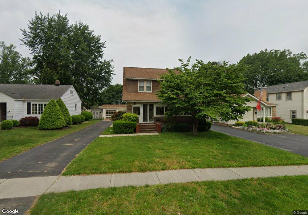
144 Woodhill Dr Amherst, OH 44001
Estimated Value: $133,000 - $228,000
3
Beds
2
Baths
1,310
Sq Ft
$142/Sq Ft
Est. Value
About This Home
This home is located at 144 Woodhill Dr, Amherst, OH 44001 and is currently estimated at $185,814, approximately $141 per square foot. 144 Woodhill Dr is a home located in Lorain County with nearby schools including Powers Elementary School, Walter G. Nord Middle School, and Amherst Junior High School.
Ownership History
Date
Name
Owned For
Owner Type
Purchase Details
Closed on
Apr 29, 2025
Sold by
Cotton Paul Edward and Cotton David A
Bought by
Dotson Troy and Dotson Sue
Current Estimated Value
Purchase Details
Closed on
Nov 10, 2000
Sold by
Last Will Of Gloria M Cotton and Cotton David A
Bought by
Cotton Paul E
Home Financials for this Owner
Home Financials are based on the most recent Mortgage that was taken out on this home.
Original Mortgage
$60,000
Interest Rate
7.87%
Create a Home Valuation Report for This Property
The Home Valuation Report is an in-depth analysis detailing your home's value as well as a comparison with similar homes in the area
Home Values in the Area
Average Home Value in this Area
Purchase History
| Date | Buyer | Sale Price | Title Company |
|---|---|---|---|
| Dotson Troy | $122,000 | None Listed On Document | |
| Cotton Paul E | $95,000 | Real Estate Title Service Co |
Source: Public Records
Mortgage History
| Date | Status | Borrower | Loan Amount |
|---|---|---|---|
| Previous Owner | Cotton Paul E | $60,000 |
Source: Public Records
Tax History Compared to Growth
Tax History
| Year | Tax Paid | Tax Assessment Tax Assessment Total Assessment is a certain percentage of the fair market value that is determined by local assessors to be the total taxable value of land and additions on the property. | Land | Improvement |
|---|---|---|---|---|
| 2024 | $2,155 | $53,361 | $10,283 | $43,078 |
| 2023 | $2,126 | $44,380 | $9,076 | $35,305 |
| 2022 | $2,038 | $44,380 | $9,076 | $35,305 |
| 2021 | $2,044 | $44,380 | $9,076 | $35,305 |
| 2020 | $1,958 | $37,740 | $7,720 | $30,020 |
| 2019 | $1,919 | $37,740 | $7,720 | $30,020 |
| 2018 | $1,882 | $37,740 | $7,720 | $30,020 |
| 2017 | $1,836 | $33,730 | $5,160 | $28,570 |
| 2016 | $1,851 | $33,730 | $5,160 | $28,570 |
| 2015 | $1,841 | $33,730 | $5,160 | $28,570 |
| 2014 | $1,659 | $30,260 | $4,630 | $25,630 |
| 2013 | $1,665 | $30,260 | $4,630 | $25,630 |
Source: Public Records
Map
Nearby Homes
- 825 Cleveland Ave
- 168 Orchard Hill Dr
- 891 Park Ave
- 105 N Woodhill Dr
- 1140 Woodside Dr
- 2176 Myla Way
- 2180 Myla Way
- 726 Sunrise Dr
- 135 Ridgeland Dr
- 707 Greenlawn Dr
- 483 N Main St
- 653 Brennan Dr
- 394 Long St
- 117 Fall Lake Ln
- 8 Riviera Ave
- 60 Flamingo Ave
- 0 Middle Ridge Rd Unit 5102632
- 0 Middle Ridge Rd Unit 5160578
- 41 Flamingo Ave
- 6394 Balsam Dr
- 146 Woodhill Dr
- 142 Woodhill Dr
- 148 Woodhill Dr
- 140 Woodhill Dr
- 138 Woodhill Dr
- 150 Woodhill Dr
- 133 Jackson St
- 135 Jackson St
- 145 Woodhill Dr
- 147 Woodhill Dr
- 127 Jackson St
- 152 Woodhill Dr
- 136 Woodhill Dr
- 137 Jackson St
- 141 Woodhill Dr
- 151 Woodhill Dr
- 125 Jackson St
- 154 Woodhill Dr
- 139 Woodhill Dr
- 132 Woodhill Dr