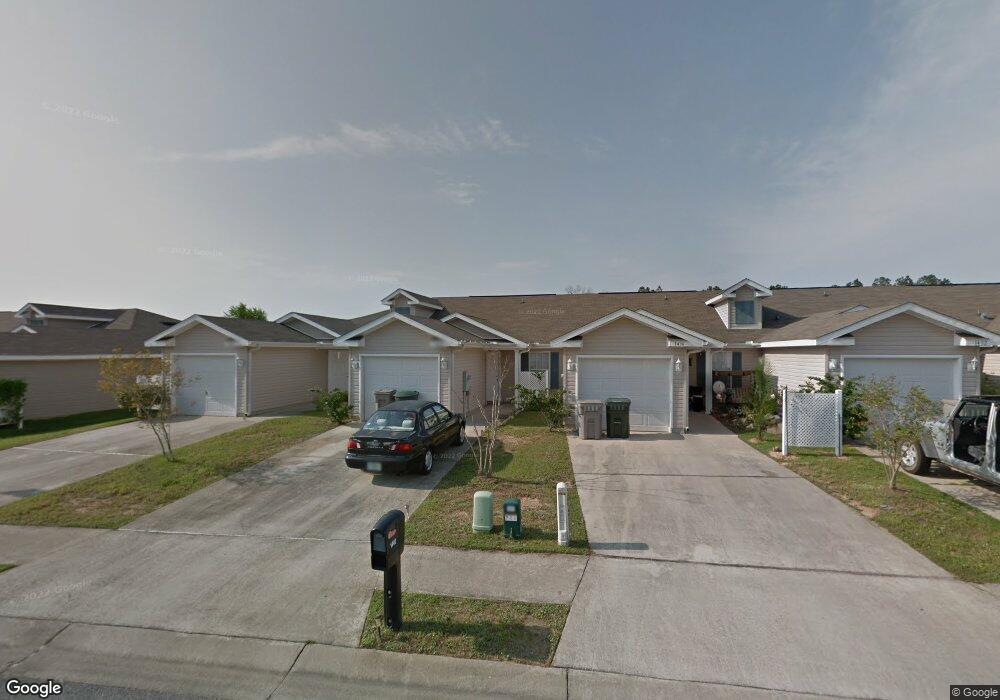
1440 Dunhurst Dr Pensacola, FL 32534
Estimated Value: $175,951 - $210,000
--
Bed
2
Baths
936
Sq Ft
$205/Sq Ft
Est. Value
About This Home
This home is located at 1440 Dunhurst Dr, Pensacola, FL 32534 and is currently estimated at $191,988, approximately $205 per square foot. 1440 Dunhurst Dr is a home located in Escambia County with nearby schools including Lincoln Park Elementary School, Beulah Middle School, and J.M. Tate Senior High School.
Ownership History
Date
Name
Owned For
Owner Type
Purchase Details
Closed on
May 12, 2023
Sold by
Hinnant Michelle
Bought by
Hinnant Michael C and Hinnant Carolyn
Current Estimated Value
Purchase Details
Closed on
Jul 28, 2006
Sold by
Mitchell Homes Inc
Bought by
Hinnant Paul M and Hinnant Jennie
Home Financials for this Owner
Home Financials are based on the most recent Mortgage that was taken out on this home.
Original Mortgage
$65,000
Interest Rate
6.6%
Mortgage Type
Purchase Money Mortgage
Create a Home Valuation Report for This Property
The Home Valuation Report is an in-depth analysis detailing your home's value as well as a comparison with similar homes in the area
Home Values in the Area
Average Home Value in this Area
Purchase History
| Date | Buyer | Sale Price | Title Company |
|---|---|---|---|
| Hinnant Michael C | $100 | None Listed On Document | |
| Hinnant Michael C | $100 | None Listed On Document | |
| Hinnant Paul M | $117,900 | None Available |
Source: Public Records
Mortgage History
| Date | Status | Borrower | Loan Amount |
|---|---|---|---|
| Previous Owner | Hinnant Paul M | $65,000 |
Source: Public Records
Tax History Compared to Growth
Tax History
| Year | Tax Paid | Tax Assessment Tax Assessment Total Assessment is a certain percentage of the fair market value that is determined by local assessors to be the total taxable value of land and additions on the property. | Land | Improvement |
|---|---|---|---|---|
| 2024 | $1,994 | $147,883 | $15,000 | $132,883 |
| 2023 | $1,994 | $140,897 | $15,000 | $125,897 |
| 2022 | $1,580 | $119,418 | $10,000 | $109,418 |
| 2021 | $1,308 | $85,435 | $0 | $0 |
| 2020 | $1,300 | $86,236 | $0 | $0 |
| 2019 | $1,256 | $82,334 | $0 | $0 |
| 2018 | $1,337 | $99,240 | $0 | $0 |
| 2017 | $1,114 | $69,000 | $0 | $0 |
| 2016 | $1,082 | $65,640 | $0 | $0 |
| 2015 | $1,072 | $65,640 | $0 | $0 |
| 2014 | $1,079 | $66,147 | $0 | $0 |
Source: Public Records
Map
Nearby Homes
- 8964 Abbington Dr
- 1518 Farragut Way
- 8920 Brigade Trail
- 8916 Brigade Trail
- 8913 Brigade Trail
- 1433 Claridge Place
- 8907 Abbington Dr
- 1463 Keylan Cove
- 1412 Croquet Dr
- 9200 Bowman Ave
- 1830 Mary Jo Way
- 1904 Mary Jo Way
- 1422 Starlight Dr
- 1921 Larkspur Cir
- 1403 Twilight Dr
- 1755 Mary Jo Way
- 1783 Mary Jo Way
- 1760 Paisleigh Dr
- 1772 Paisleigh Dr
- 116 Mt Pilot St
- 1436 Dunhurst Dr
- 1450 Dunhurst Dr
- 1428 Dunhurst Dr
- 1454 Dunhurst Dr
- 1424 Dunhurst Dr
- 0 Dunhurst Dr
- 1458 Dunhurst Dr
- 1420 Dunhurst Dr
- 1462 Dunhurst Dr
- 1466 Dunhurst Dr
- 1435 Dunhurst Dr
- 1445 Dunhurst Dr
- 1449 Dunhurst Dr
- 1429 Dunhurst Dr
- 1453 Dunhurst Dr
- 1470 Dunhurst Dr
- 1425 Dunhurst Dr
- 1412 Dunhurst Dr
- 1457 Dunhurst Dr
- 1421 Dunhurst Dr