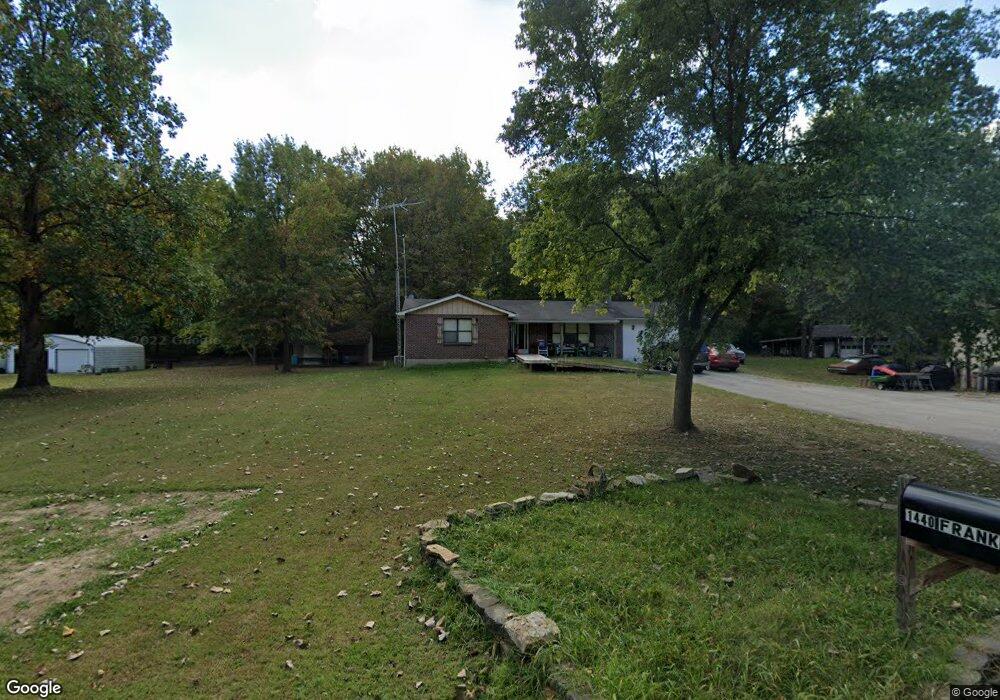
1440 Frank Dr Barnhart, MO 63012
Estimated Value: $248,000 - $334,000
--
Bed
--
Bath
1,330
Sq Ft
$211/Sq Ft
Est. Value
About This Home
This home is located at 1440 Frank Dr, Barnhart, MO 63012 and is currently estimated at $281,200, approximately $211 per square foot. 1440 Frank Dr is a home located in Jefferson County with nearby schools including Pevely Elementary School, Senn-Thomas Middle School, and Herculaneum High School.
Ownership History
Date
Name
Owned For
Owner Type
Purchase Details
Closed on
Aug 20, 2021
Sold by
Lee Boxdorfer Roy
Bought by
Boxdorfer Virginia
Current Estimated Value
Purchase Details
Closed on
Jul 21, 2021
Sold by
Boxdorfer Frank Lee and Boxdorfer Virginia
Bought by
Boxdorfer Frank Lee and Boxdorfer Deborah
Purchase Details
Closed on
Mar 28, 1998
Sold by
Lee Boxdorfer Frank L and Lee Roy
Bought by
Boxdorfer Frank Lee and Boxdorfer Roy Lee
Create a Home Valuation Report for This Property
The Home Valuation Report is an in-depth analysis detailing your home's value as well as a comparison with similar homes in the area
Home Values in the Area
Average Home Value in this Area
Purchase History
| Date | Buyer | Sale Price | Title Company |
|---|---|---|---|
| Boxdorfer Virginia | -- | -- | |
| Boxdorfer Frank Lee | -- | None Available | |
| Boxdorfer Virginia | -- | -- | |
| Boxdorfer Frank Lee | -- | None Available | |
| Boxdorfer Frank Lee | -- | -- | |
| Boxdorfer Frank Lee | -- | -- | |
| Boxdorfer Roy Lee | -- | -- |
Source: Public Records
Tax History Compared to Growth
Tax History
| Year | Tax Paid | Tax Assessment Tax Assessment Total Assessment is a certain percentage of the fair market value that is determined by local assessors to be the total taxable value of land and additions on the property. | Land | Improvement |
|---|---|---|---|---|
| 2025 | $1,944 | $27,500 | $3,300 | $24,200 |
| 2024 | $1,944 | $25,600 | $3,300 | $22,300 |
| 2023 | $1,944 | $25,600 | $3,300 | $22,300 |
| 2022 | $1,925 | $25,600 | $3,300 | $22,300 |
| 2021 | $1,928 | $25,600 | $3,300 | $22,300 |
| 2020 | $1,767 | $23,000 | $3,000 | $20,000 |
| 2019 | $1,770 | $23,000 | $3,000 | $20,000 |
| 2018 | $1,768 | $23,000 | $3,000 | $20,000 |
| 2017 | $1,686 | $23,000 | $3,000 | $20,000 |
| 2016 | $1,460 | $21,400 | $3,000 | $18,400 |
| 2015 | $1,459 | $21,400 | $3,000 | $18,400 |
| 2013 | -- | $20,800 | $2,800 | $18,000 |
Source: Public Records
Map
Nearby Homes
- 1670 Clover Ct
- 1022 Graystone Park
- 7255 Meriwether Ct
- 1728 Fairfax Dr
- 2030 Engle Ridge Rd
- 7098 Ridge Dr
- 900 Bluff Rd
- 7062 Tuckahoe Ct
- 1299 Riesling Ln
- 8286 Commercial Blvd
- 7056 Albermarle Ct
- 1298 Riesling Ln
- 2000 Lot 10 Crossroads Rd
- 2000 Lot 9 Crossroads Rd
- 2000 Lot 8 Crossroads Rd
- 2000 Lot 7 Crossroads Rd
- 2000 Lot 6 Crossroads Rd
- 2000 Lot 5 Crossroads Rd
- 2000 Lot 4 Crossroads Rd
- 2000 Lot 3 Crossroads Rd
- 1422 Frank Dr
- 7676 Schmidt Rd
- 1406 Frank Dr
- 7860 Us Highway 61/67
- 1390 Frank Dr
- 0 Engle Creek Rd
- 7854 Us Highway 61/67
- 1299 Rocky Meadows Dr
- 1299 Rocky Meadows Dr
- 7678 Oak Ln
- 7707 Us Highway 61/67
- 1298 Rocky Meadows Dr
- 7685 Us Highway 61/67
- 7685 Us Highway 61/67
- 1470 Stoneridge Ct
- 1269 Rocky Meadows Dr
- 1471 Stoneridge Ct
- 0 1 62 Acres On Eagles Nest Rd
- 1458 Stoneridge Ct
- 7600 Us Highway 61 67