Estimated Value: $190,000 - $288,000
3
Beds
2
Baths
1,770
Sq Ft
$144/Sq Ft
Est. Value
About This Home
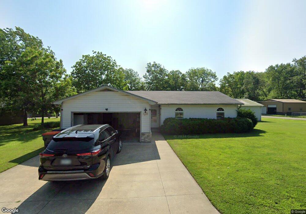
This home is located at 1440 Katie Dr, Grove, OK 74344 and is currently estimated at $255,541, approximately $144 per square foot. 1440 Katie Dr is a home located in Delaware County with nearby schools including Grove Lower Elementary School, Grove Upper Elementary School, and Grove Middle School.
Ownership History
Date
Name
Owned For
Owner Type
Purchase Details
Closed on
Oct 27, 2021
Sold by
Mccrary Kathryn L
Bought by
Equity Trust Company
Current Estimated Value
Purchase Details
Closed on
Aug 20, 1998
Sold by
Kirkpatrick Dwight L
Bought by
Kirkpatrick Revoc Trust
Purchase Details
Closed on
Apr 30, 1998
Sold by
Adair Jack and Adair Irene
Purchase Details
Closed on
Oct 16, 1989
Sold by
Smith Harry L and Smith Lillian
Create a Home Valuation Report for This Property
The Home Valuation Report is an in-depth analysis detailing your home's value as well as a comparison with similar homes in the area
Home Values in the Area
Average Home Value in this Area
Purchase History
| Date | Buyer | Sale Price | Title Company |
|---|---|---|---|
| Equity Trust Company | $122,500 | None Listed On Document | |
| Kirkpatrick Revoc Trust | -- | -- | |
| -- | $95,000 | -- | |
| -- | $37,000 | -- |
Source: Public Records
Tax History
| Year | Tax Paid | Tax Assessment Tax Assessment Total Assessment is a certain percentage of the fair market value that is determined by local assessors to be the total taxable value of land and additions on the property. | Land | Improvement |
|---|---|---|---|---|
| 2025 | $1,089 | $13,460 | $1,595 | $11,865 |
| 2024 | $1,038 | $12,819 | $1,519 | $11,300 |
| 2023 | $1,038 | $12,209 | $1,463 | $10,746 |
| 2022 | $971 | $12,210 | $1,454 | $10,756 |
| 2021 | $923 | $11,628 | $1,452 | $10,176 |
| 2020 | $894 | $11,074 | $1,462 | $9,612 |
| 2019 | $854 | $10,045 | $1,420 | $8,625 |
| 2018 | $727 | $9,854 | $1,414 | $8,440 |
| 2017 | $706 | $9,567 | $1,396 | $8,171 |
| 2016 | $682 | $9,017 | $1,350 | $7,667 |
| 2015 | $692 | $9,017 | $1,350 | $7,667 |
| 2014 | $695 | $9,017 | $1,350 | $7,667 |
Source: Public Records
Map
Nearby Homes
- 827 Apple Dr
- 1426 Kings Place
- 5161 63rd St
- 1413 Orchard Dr
- 000 Highway 59 911 Address Tbd
- 0 Tbd Hwy 59 - 911 Address Tbd
- 1517 80th St
- 1518 80th St NW
- 8411 U S 59
- 0 N Hwy 59 Unit 2605676
- TBD N N
- 703 N 36th St
- TBD Sunset Cir
- TBD Red Bud Dr
- 27505 S 614 Rd
- 1014 Red Bud Dr
- 27400 S 614 Rd
- 59396 E 288 Ct
- 59386 E 288 Ct
- 59399 E 288 Ct
- 1442 Terry Ln
- 1454 Lakeside Dr
- 1438 Terry Ln
- 1438 Terry Ln
- 1450 Terry Ln
- 1438 Lakeside Dr
- 1456 Lakeside Dr
- 1437 Lakeside Dr
- 1425 Lakeside Dr
- 1433 Lakeside Dr
- Lots 7,8&9 Lakeside Dr
- 1449 Lakeside Dr
- 1445 Lakeside Dr
- 1453 Lakeside Dr
- 1469 Terry Ln
- 1468 Terry Ln
- 6331 W 68th St
- 6800 Us Highway 59
- 6800 Us Highway 59
- 6800 Us Hwy 59
Your Personal Tour Guide
Ask me questions while you tour the home.