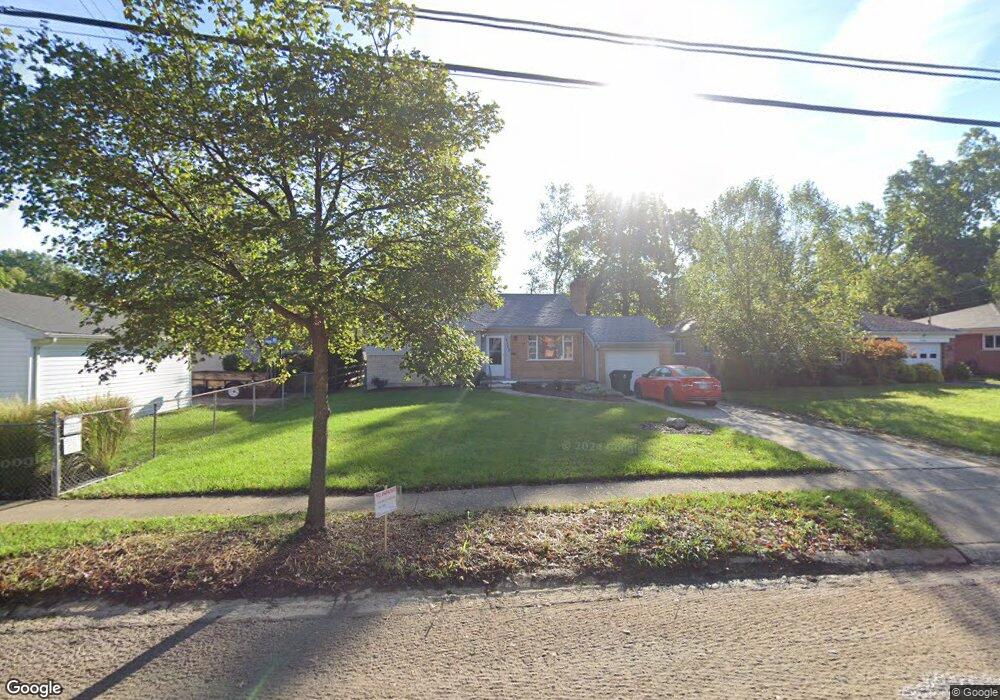
1440 Mayland Dr Cincinnati, OH 45230
Mount Washington NeighborhoodEstimated Value: $263,441 - $290,000
3
Beds
2
Baths
1,260
Sq Ft
$220/Sq Ft
Est. Value
About This Home
This home is located at 1440 Mayland Dr, Cincinnati, OH 45230 and is currently estimated at $277,360, approximately $220 per square foot. 1440 Mayland Dr is a home located in Hamilton County with nearby schools including Mt. Washington Elementary School, Clark Montessori High School, and Shroder High School.
Ownership History
Date
Name
Owned For
Owner Type
Purchase Details
Closed on
Apr 3, 2014
Sold by
Souder Linda E
Bought by
Souder Linda E and Souder Robert
Current Estimated Value
Purchase Details
Closed on
Apr 18, 2011
Sold by
Stierli Christine F and Souder Linda E
Bought by
Souder Linda E and The Stierli Keystone Inheritance Trust
Purchase Details
Closed on
Apr 9, 2009
Sold by
Stierli Harry and Stierli Christene F
Bought by
Stierli Christine F
Create a Home Valuation Report for This Property
The Home Valuation Report is an in-depth analysis detailing your home's value as well as a comparison with similar homes in the area
Home Values in the Area
Average Home Value in this Area
Purchase History
| Date | Buyer | Sale Price | Title Company |
|---|---|---|---|
| Souder Linda E | -- | Attorney | |
| Souder Linda E | -- | Attorney | |
| Stierli Christine F | -- | Attorney |
Source: Public Records
Tax History Compared to Growth
Tax History
| Year | Tax Paid | Tax Assessment Tax Assessment Total Assessment is a certain percentage of the fair market value that is determined by local assessors to be the total taxable value of land and additions on the property. | Land | Improvement |
|---|---|---|---|---|
| 2024 | $3,978 | $66,462 | $9,499 | $56,963 |
| 2023 | $4,068 | $66,462 | $9,499 | $56,963 |
| 2022 | $3,172 | $46,414 | $7,987 | $38,427 |
| 2021 | $3,049 | $46,414 | $7,987 | $38,427 |
| 2020 | $3,138 | $46,414 | $7,987 | $38,427 |
| 2019 | $3,010 | $40,716 | $7,007 | $33,709 |
| 2018 | $3,014 | $40,716 | $7,007 | $33,709 |
| 2017 | $2,863 | $40,716 | $7,007 | $33,709 |
| 2016 | $3,088 | $43,320 | $8,008 | $35,312 |
| 2015 | $2,785 | $43,320 | $8,008 | $35,312 |
| 2014 | $2,805 | $43,320 | $8,008 | $35,312 |
| 2013 | $2,853 | $43,320 | $8,008 | $35,312 |
Source: Public Records
Map
Nearby Homes
- 1405 Dyer Ave
- 6146 Mariwood Ln
- 1605 Marlou Ln
- 6114 Glade Ave
- 4 Cottage Ct
- 1323 Thornbird Dr
- 6952 Shadow Ridge Rd
- 1634 Brandon Ave
- 1549 Sutton Ave
- 6390 Cambridge Ave
- 1508 Beth Ln
- 1739 Marquette Ave
- 6537 Craigland Ct
- a Salem Rd
- 6137 Benneville St
- 6510 Waldorf Place
- 6258 Benneville St
- 1 Salem Rd
- 6065 Salem Rd
- 1150 Brooke Ave
- 1436 Mayland Dr
- 6299 Glade Ave
- 6303 Glade Ave
- 6295 Glade Ave
- 1432 Mayland Dr
- 1449 Dyer Ave
- 1459 Dyer Ave
- 6305 Glade Ave
- 1447 Dyer Ave
- 1428 Mayland Dr
- 6291 Glade Ave
- 1443 Dyer Ave
- 1441 Mayland Dr
- 6307 Glade Ave
- 1437 Mayland Dr
- 6287 Glade Ave
- 1439 Dyer Ave
- 1433 Mayland Dr
- 1424 Mayland Dr
- 1437 Dyer Ave