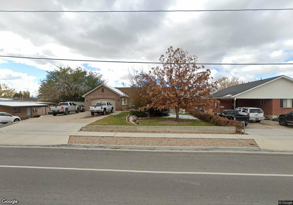
1440 S 1100 W Woods Cross, UT 84087
Estimated Value: $628,000 - $697,000
6
Beds
3
Baths
3,540
Sq Ft
$186/Sq Ft
Est. Value
About This Home
This home is located at 1440 S 1100 W, Woods Cross, UT 84087 and is currently estimated at $659,294, approximately $186 per square foot. 1440 S 1100 W is a home located in Davis County with nearby schools including Woods Cross Elementary School, Millcreek Junior High School, and Woods Cross High School.
Ownership History
Date
Name
Owned For
Owner Type
Purchase Details
Closed on
Nov 8, 2019
Sold by
Stroud Kim R and Stroud Jill E
Bought by
Shepherd Cynthia and Shepherd Robert S
Current Estimated Value
Home Financials for this Owner
Home Financials are based on the most recent Mortgage that was taken out on this home.
Original Mortgage
$397,842
Outstanding Balance
$347,596
Interest Rate
3.37%
Mortgage Type
FHA
Estimated Equity
$311,698
Purchase Details
Closed on
Jul 8, 2014
Sold by
Morby Samuel A
Bought by
Stroud Kim R and Stroud Jill E
Home Financials for this Owner
Home Financials are based on the most recent Mortgage that was taken out on this home.
Original Mortgage
$242,400
Interest Rate
4.07%
Mortgage Type
New Conventional
Purchase Details
Closed on
Jun 28, 2012
Sold by
Nelson Kody Lloyd and Nelson Michelle
Bought by
Morby Samuel A
Home Financials for this Owner
Home Financials are based on the most recent Mortgage that was taken out on this home.
Original Mortgage
$130,000
Interest Rate
3.74%
Mortgage Type
New Conventional
Purchase Details
Closed on
Jun 7, 2004
Sold by
Hale D Ronald and Hale Alyson G
Bought by
Nelson Kody Lloyd and Nelson Michelle
Home Financials for this Owner
Home Financials are based on the most recent Mortgage that was taken out on this home.
Original Mortgage
$208,000
Interest Rate
5.92%
Mortgage Type
Purchase Money Mortgage
Purchase Details
Closed on
Sep 13, 2002
Sold by
Hale D Ronald
Bought by
Hale D Ronald and Hale Alyson G
Purchase Details
Closed on
Mar 18, 2000
Sold by
Hale D Ronald
Bought by
Hale D Ronald and Hale Alyson G
Home Financials for this Owner
Home Financials are based on the most recent Mortgage that was taken out on this home.
Original Mortgage
$126,000
Interest Rate
7.37%
Purchase Details
Closed on
Mar 3, 2000
Sold by
Hale Ronald D
Bought by
Hale D Ronald
Home Financials for this Owner
Home Financials are based on the most recent Mortgage that was taken out on this home.
Original Mortgage
$126,000
Interest Rate
7.37%
Purchase Details
Closed on
Feb 3, 2000
Sold by
Lowe Jay R and Lowe Pauline Ray
Bought by
Hale Ronald D
Home Financials for this Owner
Home Financials are based on the most recent Mortgage that was taken out on this home.
Original Mortgage
$126,000
Interest Rate
7.37%
Create a Home Valuation Report for This Property
The Home Valuation Report is an in-depth analysis detailing your home's value as well as a comparison with similar homes in the area
Home Values in the Area
Average Home Value in this Area
Purchase History
| Date | Buyer | Sale Price | Title Company |
|---|---|---|---|
| Shepherd Cynthia | -- | Stewart Title Ins Agency | |
| Stroud Kim R | -- | North American Title | |
| Morby Samuel A | -- | Cornerstone Title In | |
| Nelson Kody Lloyd | -- | Security Title Company | |
| Hale D Ronald | -- | Western States Title Company | |
| Hale D Ronald | -- | Western States Title Company | |
| Hale D Ronald | -- | Aspen Title Insurance Agency | |
| Hale D Ronald | -- | Aspen Title Insurance Agency | |
| Hale Ronald D | -- | Aspen Title Insurance Agency |
Source: Public Records
Mortgage History
| Date | Status | Borrower | Loan Amount |
|---|---|---|---|
| Open | Shepherd Cynthia | $397,842 | |
| Previous Owner | Stroud Kim R | $242,400 | |
| Previous Owner | Morby Samuel A | $130,000 | |
| Previous Owner | Nelson Kody Lloyd | $208,000 | |
| Previous Owner | Hale D Ronald | $126,000 |
Source: Public Records
Tax History Compared to Growth
Tax History
| Year | Tax Paid | Tax Assessment Tax Assessment Total Assessment is a certain percentage of the fair market value that is determined by local assessors to be the total taxable value of land and additions on the property. | Land | Improvement |
|---|---|---|---|---|
| 2025 | $4,117 | $330,000 | $139,999 | $190,001 |
| 2024 | $4,141 | $331,100 | $155,797 | $175,303 |
| 2023 | $3,945 | $605,000 | $212,262 | $392,738 |
| 2022 | $4,149 | $346,500 | $91,893 | $254,607 |
| 2021 | $3,385 | $459,000 | $137,490 | $321,510 |
| 2020 | $3,132 | $418,000 | $131,681 | $286,319 |
| 2019 | $2,856 | $383,000 | $119,835 | $263,165 |
| 2018 | $2,694 | $357,000 | $117,223 | $239,777 |
| 2016 | $2,084 | $167,475 | $58,662 | $108,813 |
| 2015 | $1,729 | $133,485 | $58,662 | $74,823 |
| 2014 | $1,408 | $111,233 | $58,662 | $52,571 |
| 2013 | -- | $128,486 | $37,395 | $91,091 |
Source: Public Records
Map
Nearby Homes
- 1288 S 1050 W
- 1137 S 1050 W
- 1309 W 1200 S
- 1334 W 1300 S
- 1069 W Linden Ln Unit 31
- 1072 W Audrey Ln Unit 17
- 1422 W 1300 S
- 1064 W Audrey Ln Unit 15
- Swiss 2 - Urban Plan at The Audrey - theAUDREY
- Swiss 3 - Urban Plan at The Audrey - theAUDREY
- Swiss 1 - Cottage Plan at The Audrey - theAUDREY
- Swiss 4 - Cottage Plan at The Audrey - theAUDREY
- Swiss 2 - Cottage Plan at The Audrey - theAUDREY
- Swiss 3 - Cottage Plan at The Audrey - theAUDREY
- Swiss 4 - Urban Plan at The Audrey - theAUDREY
- Swiss 1 - Urban Plan at The Audrey - theAUDREY
- 1623 S 925 W
- 1056 W Audrey Ln Unit 14
- 1075 W Audrey Ln Unit 6
- 1067 W Audrey Ln Unit 8