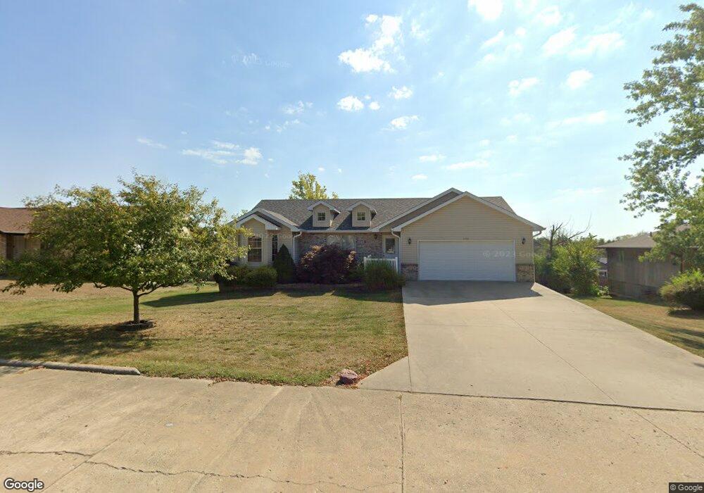
1440 S Daniel Boone Blvd Columbia, MO 65201
Estimated Value: $311,000 - $361,000
3
Beds
2
Baths
1,562
Sq Ft
$210/Sq Ft
Est. Value
About This Home
This home is located at 1440 S Daniel Boone Blvd, Columbia, MO 65201 and is currently estimated at $328,477, approximately $210 per square foot. 1440 S Daniel Boone Blvd is a home located in Boone County with nearby schools including Cedar Ridge Elementary School, Oakland Middle School, and Muriel W. Battle High School.
Ownership History
Date
Name
Owned For
Owner Type
Purchase Details
Closed on
Mar 20, 2009
Sold by
Baker Larry and Baker Wilma J
Bought by
Groseclose Matthew D
Current Estimated Value
Home Financials for this Owner
Home Financials are based on the most recent Mortgage that was taken out on this home.
Original Mortgage
$125,600
Outstanding Balance
$80,833
Interest Rate
5.36%
Mortgage Type
Purchase Money Mortgage
Estimated Equity
$247,644
Purchase Details
Closed on
Aug 22, 2008
Sold by
Premier Development Properties Llc
Bought by
Baker Larry and Baker Wilma J
Home Financials for this Owner
Home Financials are based on the most recent Mortgage that was taken out on this home.
Original Mortgage
$125,000
Interest Rate
6.42%
Mortgage Type
Construction
Create a Home Valuation Report for This Property
The Home Valuation Report is an in-depth analysis detailing your home's value as well as a comparison with similar homes in the area
Purchase History
| Date | Buyer | Sale Price | Title Company |
|---|---|---|---|
| Groseclose Matthew D | -- | Boone Central Title Company | |
| Baker Larry | -- | None Available |
Source: Public Records
Mortgage History
| Date | Status | Borrower | Loan Amount |
|---|---|---|---|
| Open | Groseclose Matthew D | $125,600 | |
| Previous Owner | Baker Larry | $125,000 |
Source: Public Records
Tax History
| Year | Tax Paid | Tax Assessment Tax Assessment Total Assessment is a certain percentage of the fair market value that is determined by local assessors to be the total taxable value of land and additions on the property. | Land | Improvement |
|---|---|---|---|---|
| 2025 | $2,603 | $37,012 | $2,736 | $34,276 |
| 2024 | $2,433 | $33,649 | $2,736 | $30,913 |
| 2023 | $2,413 | $33,649 | $2,736 | $30,913 |
| 2022 | $2,318 | $32,357 | $2,736 | $29,621 |
| 2021 | $2,322 | $32,357 | $2,736 | $29,621 |
| 2020 | $2,278 | $29,959 | $2,736 | $27,223 |
| 2019 | $2,278 | $29,959 | $2,736 | $27,223 |
| 2018 | $2,122 | $0 | $0 | $0 |
| 2017 | $2,098 | $27,740 | $2,736 | $25,004 |
| 2016 | $2,095 | $27,740 | $2,736 | $25,004 |
| 2015 | $1,934 | $27,740 | $2,736 | $25,004 |
| 2014 | $1,939 | $27,740 | $2,736 | $25,004 |
Source: Public Records
Map
Nearby Homes
- 1581 S Berkley Dr
- 4720 Kenora Dr
- 1108 Shadow Hawk Ct
- 1104 Shadow Hawk Ct
- 4519 Estacada Dr
- 1301 Haxby Ct
- LOT 586 Brockton Dr
- 913 Spyglass Ct
- 909 Spyglass Ct
- 4516 Royal County Rd
- 4805 Hoylake Cir
- 1801 Fair Oaks Ct
- 4813 Hoylake Cir
- 2033 Stone Mountain Ct
- 2025 Random Ridge
- 4725 Stayton Ferry Cir
- 5004 Stone Mountain Pkwy
- 1491 S Pecos Ave
- 4741 Stayton Ferry Loop
- 4409 Royal County Rd
- 1460 S Daniel Boone Blvd
- 1420 S Daniel Boone Blvd
- 1441 S Berkley Dr
- 1461 S Berkley Dr
- 1421 S Berkley Dr
- 1421 S Daniel Boone Blvd
- 1480 S Daniel Boone Blvd
- 1441 S Daniel Boone Blvd
- 1461 S Daniel Boone Blvd
- 1481 S Berkley Dr
- 1500 S Daniel Boone Blvd
- 1481 S Daniel Boone Blvd
- 1440 S Berkley Dr
- 1501 S Berkley Dr
- 1460 S Berkley Dr
- 1420 S Berkley Dr
- 1480 S Berkley Dr
- 1520 S Daniel Boone Blvd
- LOT 37 S Berkley Dr
- LOT 36 S Berkley Dr
Your Personal Tour Guide
Ask me questions while you tour the home.