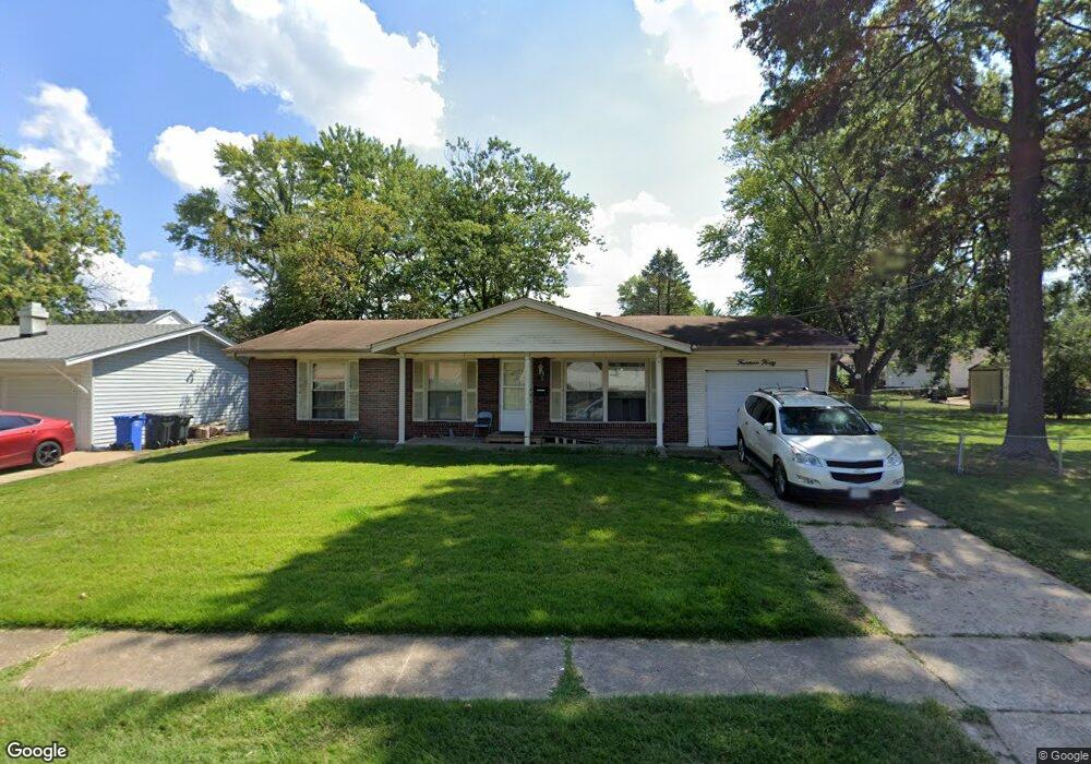
1440 Saint Anthony Ln Florissant, MO 63033
Estimated Value: $183,000 - $207,000
3
Beds
2
Baths
1,066
Sq Ft
$183/Sq Ft
Est. Value
About This Home
This home is located at 1440 Saint Anthony Ln, Florissant, MO 63033 and is currently estimated at $194,668, approximately $182 per square foot. 1440 Saint Anthony Ln is a home located in St. Louis County with nearby schools including Parker Road Elementary School, Cross Keys Middle School, and McCluer North High School.
Ownership History
Date
Name
Owned For
Owner Type
Purchase Details
Closed on
Mar 1, 2013
Sold by
Davis Emma
Bought by
Davis Emma and Long Debbie A
Current Estimated Value
Purchase Details
Closed on
Feb 5, 2004
Sold by
Latham Charles E and Latham Janet A
Bought by
Davis Emma
Home Financials for this Owner
Home Financials are based on the most recent Mortgage that was taken out on this home.
Original Mortgage
$30,000
Outstanding Balance
$14,099
Interest Rate
5.86%
Mortgage Type
Purchase Money Mortgage
Estimated Equity
$180,569
Create a Home Valuation Report for This Property
The Home Valuation Report is an in-depth analysis detailing your home's value as well as a comparison with similar homes in the area
Home Values in the Area
Average Home Value in this Area
Purchase History
| Date | Buyer | Sale Price | Title Company |
|---|---|---|---|
| Davis Emma | -- | None Available | |
| Davis Emma | $111,950 | -- |
Source: Public Records
Mortgage History
| Date | Status | Borrower | Loan Amount |
|---|---|---|---|
| Open | Davis Emma | $30,000 |
Source: Public Records
Tax History Compared to Growth
Tax History
| Year | Tax Paid | Tax Assessment Tax Assessment Total Assessment is a certain percentage of the fair market value that is determined by local assessors to be the total taxable value of land and additions on the property. | Land | Improvement |
|---|---|---|---|---|
| 2025 | $2,271 | $33,950 | $6,480 | $27,470 |
| 2024 | $2,271 | $29,330 | $4,860 | $24,470 |
| 2023 | $2,263 | $29,330 | $4,860 | $24,470 |
| 2022 | $2,182 | $24,870 | $4,860 | $20,010 |
| 2021 | $2,145 | $24,870 | $4,860 | $20,010 |
| 2020 | $1,838 | $19,990 | $3,740 | $16,250 |
| 2019 | $1,802 | $19,990 | $3,740 | $16,250 |
| 2018 | $1,821 | $18,050 | $2,090 | $15,960 |
| 2017 | $1,811 | $18,050 | $2,090 | $15,960 |
| 2016 | $1,659 | $16,090 | $2,090 | $14,000 |
| 2015 | $1,668 | $16,090 | $2,090 | $14,000 |
| 2014 | $1,716 | $17,100 | $3,800 | $13,300 |
Source: Public Records
Map
Nearby Homes
- 265 Waterford Dr
- 375 Waterford Dr
- 3140 Saint Catherine St
- 100 Broadmere Dr
- 415 Waterford Dr
- 3435 Saint Catherine St
- 670 Hargrove Ln
- 190 Coteau Ln
- 3515 Saint Catherine St
- 1945 Pohlman Rd
- 2 Carson Ct
- 2320 Greenberry Dr
- 3475 Stonehaven Dr
- 2520 Greenberry Dr
- 130 Dauphin Ln
- 12 Country Ln
- 1606 Willow Wren Ct Unit 109
- 990 Saddle Dr
- 2505 Saint Catherine St
- 2255 Wheatfield Dr
- 1460 Saint Anthony Ln
- 290 Pueblo Dr
- 260 Pueblo Dr
- 1568 Saddlegate Ct
- 1480 Saint Anthony Ln
- 1574 Saddlegate Ct
- 230 Pueblo Dr
- 1445 Saint Anthony Ln
- 1425 Saint Anthony Ln
- 1465 Saint Anthony Ln
- 1520 Saint Anthony Ln
- 210 Pueblo Dr
- 1562 Saddlegate Ct
- 1580 Saddlegate Ct
- 1415 Saint Anthony Ln
- 1485 Saint Anthony Ln
- 1540 Saint Anthony Ln
- 1405 Saint Anthony Ln
- 1525 Saint Anthony Ln
- 190 Pueblo Dr