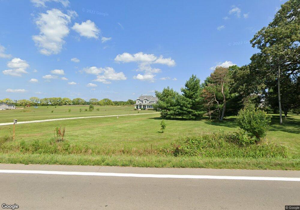
1440 State Route 203 Delaware, OH 43015
Estimated Value: $640,000 - $665,536
4
Beds
4
Baths
2,904
Sq Ft
$225/Sq Ft
Est. Value
About This Home
This home is located at 1440 State Route 203, Delaware, OH 43015 and is currently estimated at $652,884, approximately $224 per square foot. 1440 State Route 203 is a home with nearby schools including Buckeye Valley High School, Grace Community School, and Grace Community Elementary School.
Ownership History
Date
Name
Owned For
Owner Type
Purchase Details
Closed on
Feb 3, 2012
Sold by
Estate Of Pamela W Pace
Bought by
Pace William G
Current Estimated Value
Purchase Details
Closed on
Aug 4, 2011
Sold by
Pace William G and Pace Pamela W
Bought by
Cobb Derrick
Home Financials for this Owner
Home Financials are based on the most recent Mortgage that was taken out on this home.
Original Mortgage
$36,800
Interest Rate
4.5%
Mortgage Type
New Conventional
Create a Home Valuation Report for This Property
The Home Valuation Report is an in-depth analysis detailing your home's value as well as a comparison with similar homes in the area
Home Values in the Area
Average Home Value in this Area
Purchase History
| Date | Buyer | Sale Price | Title Company |
|---|---|---|---|
| Pace William G | -- | Attorney | |
| Cobb Derrick | $46,000 | Lawyers Title Agency |
Source: Public Records
Mortgage History
| Date | Status | Borrower | Loan Amount |
|---|---|---|---|
| Previous Owner | Cobb Derrick | $36,800 |
Source: Public Records
Tax History Compared to Growth
Tax History
| Year | Tax Paid | Tax Assessment Tax Assessment Total Assessment is a certain percentage of the fair market value that is determined by local assessors to be the total taxable value of land and additions on the property. | Land | Improvement |
|---|---|---|---|---|
| 2024 | $6,962 | $185,540 | $36,650 | $148,890 |
| 2023 | $6,774 | $180,570 | $36,650 | $143,920 |
| 2022 | $6,033 | $142,840 | $24,470 | $118,370 |
| 2021 | $5,675 | $134,230 | $24,470 | $109,760 |
| 2020 | $5,701 | $134,230 | $24,470 | $109,760 |
| 2019 | $4,861 | $112,740 | $21,280 | $91,460 |
| 2018 | $4,933 | $112,740 | $21,280 | $91,460 |
| 2017 | $4,246 | $98,350 | $18,830 | $79,520 |
| 2016 | $3,863 | $98,350 | $18,830 | $79,520 |
| 2015 | $4,042 | $97,650 | $18,830 | $78,820 |
| 2014 | $3,803 | $97,650 | $18,830 | $78,820 |
| 2013 | $709 | $17,260 | $17,260 | $0 |
Source: Public Records
Map
Nearby Homes
- 210 Glemsbury Dr
- 2266 Dates St
- 2200 Dates St
- 2238 Farmland Dr
- 2143 Farmland Dr
- 63 Lantern Chase Dr
- 315 Timbersmith Dr
- 2310 Troy Rd
- 518 Lamplight Dr
- 1258 Hills Miller Rd
- Holcombe Plan at Springer Woods
- Aldridge Plan at Springer Woods
- Harmony Plan at Springer Woods
- Fairton Plan at Springer Woods
- Bellamy Plan at Springer Woods
- Newcastle Plan at Springer Woods
- Juniper Plan at Springer Woods
- Henley Plan at Springer Woods
- Pendleton Plan at Springer Woods
- Stamford Plan at Springer Woods
- 1416 State Route 203
- 1524 Ohio 203
- 1391 State Route 203
- 1560 Ohio 203
- 3218 Hills Miller Rd
- 3260 Hills Miller Rd
- 1632 State Route 203
- 1597 State Route 203
- 3082 Hills Miller Rd
- 3161 Hills Miller Rd
- 3121 Hills Miller Rd
- 3042 Hills Miller Rd
- 1700 State Route 203
- 1175 State Route 203
- 3085 Hills Miller Rd
- 1525 State Route 203
- 3141 Hills Miller Rd
- 3051 Hills Miller Rd
- 1707 State Route 203
- 1784 State Route 203