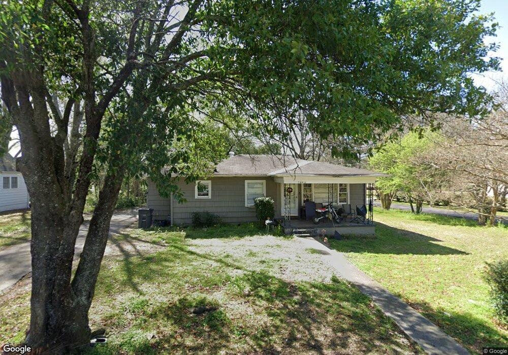
1440 Thompson Cir Gardendale, AL 35071
Estimated Value: $168,987 - $206,000
3
Beds
1
Bath
1,094
Sq Ft
$175/Sq Ft
Est. Value
About This Home
This home is located at 1440 Thompson Cir, Gardendale, AL 35071 and is currently estimated at $190,997, approximately $174 per square foot. 1440 Thompson Cir is a home located in Jefferson County with nearby schools including Snow Rogers Elementary School, Bragg Middle School, and Gardendale High School.
Ownership History
Date
Name
Owned For
Owner Type
Purchase Details
Closed on
Sep 2, 2022
Sold by
Howard James
Bought by
Salters David and Salters Michael
Current Estimated Value
Purchase Details
Closed on
Apr 15, 2011
Sold by
Sellers Investment Properties L L C
Bought by
Howard James and Howard Teresa Lynn
Purchase Details
Closed on
Jul 3, 1998
Sold by
Sellers Ernest C and Sellers Betty M
Bought by
Sellers Investment Properties Llc
Home Financials for this Owner
Home Financials are based on the most recent Mortgage that was taken out on this home.
Original Mortgage
$59,201
Interest Rate
7.02%
Create a Home Valuation Report for This Property
The Home Valuation Report is an in-depth analysis detailing your home's value as well as a comparison with similar homes in the area
Home Values in the Area
Average Home Value in this Area
Purchase History
| Date | Buyer | Sale Price | Title Company |
|---|---|---|---|
| Salters David | $159,000 | -- | |
| Howard James | $43,200 | None Available | |
| Sellers Investment Properties Llc | -- | -- |
Source: Public Records
Mortgage History
| Date | Status | Borrower | Loan Amount |
|---|---|---|---|
| Previous Owner | Sellers Investment Properties Llc | $59,201 |
Source: Public Records
Tax History Compared to Growth
Tax History
| Year | Tax Paid | Tax Assessment Tax Assessment Total Assessment is a certain percentage of the fair market value that is determined by local assessors to be the total taxable value of land and additions on the property. | Land | Improvement |
|---|---|---|---|---|
| 2024 | $1,689 | $28,100 | -- | -- |
| 2022 | $1,545 | $25,700 | $12,940 | $12,760 |
| 2021 | $1,244 | $20,700 | $7,940 | $12,760 |
| 2020 | $1,213 | $20,180 | $7,940 | $12,240 |
| 2019 | $1,113 | $18,520 | $0 | $0 |
| 2018 | $994 | $16,540 | $0 | $0 |
| 2017 | $994 | $16,540 | $0 | $0 |
| 2016 | $994 | $16,540 | $0 | $0 |
| 2015 | $994 | $16,540 | $0 | $0 |
| 2014 | $815 | $16,120 | $0 | $0 |
| 2013 | $815 | $16,120 | $0 | $0 |
Source: Public Records
Map
Nearby Homes
- 216 Howard Dr
- 0 Odum Rd
- 1308 Colonial Ave
- 420 Redmayne Rd
- 220 Payne Rd
- 1641 Jaye Dr
- 304 Mozelle Cir
- 164 Summit Blvd
- 411 Albert Dr
- 1031 Mount Olive Ave Unit 17/18
- 309 Catherine Ct
- 408 Albert Dr
- 304 Fieldstown Rd
- 1704 Magnolia St
- 520 Parks Rd
- 1703 Rushton St
- 1715 Magnolia St
- 5634 Hunter Brook Ct
- 1515 Clover Ave
- 1767 Mount Olive Rd
- 1432 Thompson Cir
- 110 Howard Dr
- 1435 Thompson Cir
- 1433 Moncrief Rd
- 1507 Moncrief Rd
- 1507 Moncrief Rd Unit 1
- 208 Howard Dr
- 213 Howard Dr
- 1513 Moncrief Rd
- 200 Howard Dr
- 1425 Thompson Cir
- 1416 Thompson Cir
- 1417 Thompson Cir
- 217 Howard Dr
- 1517 Moncrief Rd
- 1408 Thompson Cir
- 1508 Moncrief Rd
- 225 Howard Dr
- 1413 Thompson Cir
- 1405 Thompson Cir