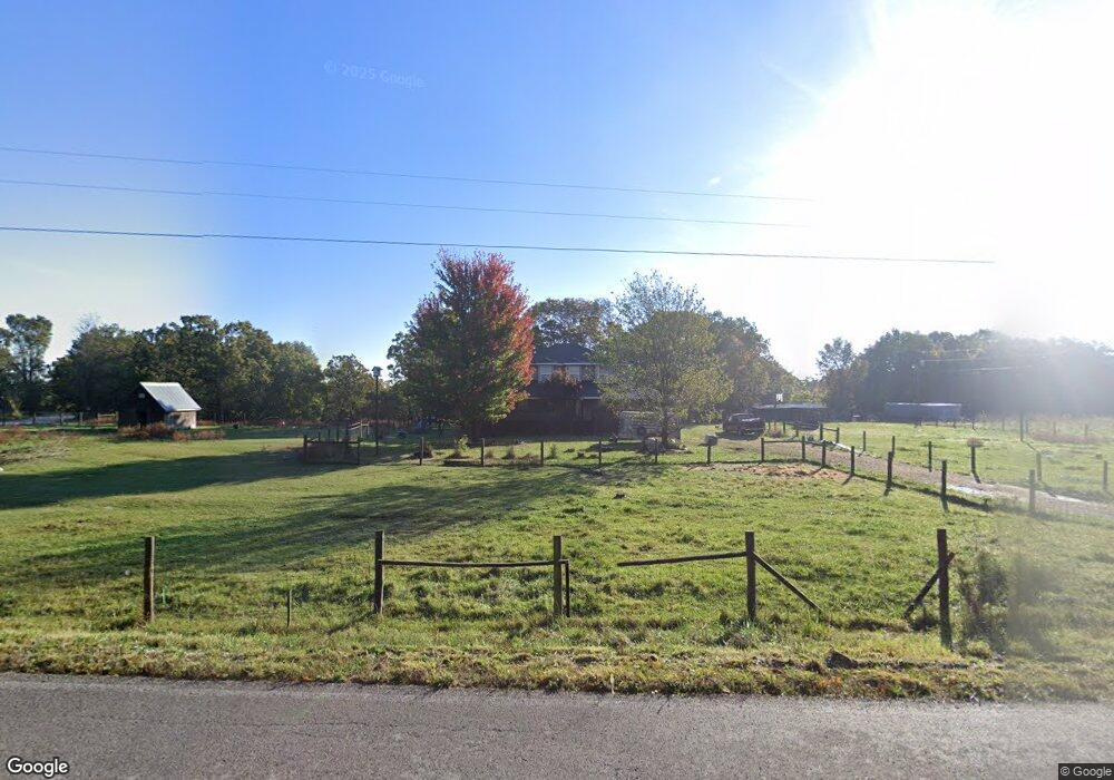
14404 Wallin Mountain Rd West Fork, AR 72774
Estimated Value: $427,000 - $485,000
--
Bed
2
Baths
2,303
Sq Ft
$199/Sq Ft
Est. Value
About This Home
This home is located at 14404 Wallin Mountain Rd, West Fork, AR 72774 and is currently estimated at $457,349, approximately $198 per square foot. 14404 Wallin Mountain Rd is a home located in Washington County with nearby schools including Greenland Middle School, Greenland Elementary School, and Greenland High School.
Ownership History
Date
Name
Owned For
Owner Type
Purchase Details
Closed on
Jul 23, 2004
Sold by
Stolz Bruce A and Stolz Melinda L
Bought by
Wolfe Joe L and Wolfe Carmen L
Current Estimated Value
Home Financials for this Owner
Home Financials are based on the most recent Mortgage that was taken out on this home.
Original Mortgage
$140,000
Outstanding Balance
$69,901
Interest Rate
6.32%
Mortgage Type
Purchase Money Mortgage
Estimated Equity
$387,448
Create a Home Valuation Report for This Property
The Home Valuation Report is an in-depth analysis detailing your home's value as well as a comparison with similar homes in the area
Home Values in the Area
Average Home Value in this Area
Purchase History
| Date | Buyer | Sale Price | Title Company |
|---|---|---|---|
| Wolfe Joe L | $190,000 | -- |
Source: Public Records
Mortgage History
| Date | Status | Borrower | Loan Amount |
|---|---|---|---|
| Open | Wolfe Joe L | $140,000 |
Source: Public Records
Tax History Compared to Growth
Tax History
| Year | Tax Paid | Tax Assessment Tax Assessment Total Assessment is a certain percentage of the fair market value that is determined by local assessors to be the total taxable value of land and additions on the property. | Land | Improvement |
|---|---|---|---|---|
| 2025 | $1,634 | $69,640 | $13,610 | $56,030 |
| 2024 | $1,637 | $69,640 | $13,610 | $56,030 |
| 2023 | $1,642 | $69,640 | $13,610 | $56,030 |
| 2022 | $1,594 | $43,810 | $7,310 | $36,500 |
| 2021 | $1,508 | $43,810 | $7,310 | $36,500 |
| 2020 | $1,473 | $43,810 | $7,310 | $36,500 |
| 2019 | $1,388 | $37,230 | $6,110 | $31,120 |
| 2018 | $1,413 | $37,230 | $6,110 | $31,120 |
| 2017 | $1,344 | $37,230 | $6,110 | $31,120 |
| 2016 | $1,355 | $37,230 | $6,110 | $31,120 |
| 2015 | $1,230 | $37,230 | $6,110 | $31,120 |
| 2014 | $1,155 | $33,060 | $8,100 | $24,960 |
Source: Public Records
Map
Nearby Homes
- 10247 S Smokey Bear Rd
- 10578 S Smokey Bear Rd
- 14790 Slaty Gap Rd
- TBD 7.49 Acres Slaty Gap Rd
- TBD 11 Acres Slaty Gap Rd
- 14630 E Wallin Mountain Rd
- TBD N Smokey Bear Rd
- 14605 Mineral Springs Rd
- 51.39 AC E Black Oak Rd
- 1464 W Hendon St Unit 101
- 1464 W Hendon St
- 11327 Mountain Spring Dr
- 11391 Mountain Spring Dr
- 12284 Flowers Rd
- TBD Stockburger Ave
- 1329 Homestead Ln
- 0 Trace Branch Rd Unit 1293042
- 11724 Brubaker Rd
- 10703 Thunder Rd
- 12730 & 12932 Mineral Springs Wc 30
- 14404 E Wallin Mountain Rd
- 14371 Wallen Mt Rd
- 14371 Wallin Mountain Rd
- 14416 E Wallin Mountain Rd
- 14416 Wallin Mountain Rd
- 14362 Wallin Mountain Rd
- 10386 N Bug Tussel Rd
- 14311 Wallin Mountain Rd
- 14425 Wallin Mountain Rd
- 0 Wallin Mtn Rd Unit 277508
- 0 Wallin Mtn Rd Unit 540057
- 14205 Wallin Mountain Rd
- 10215 S Bug Tussel Rd
- 10433 S Smokey Bear Rd
- 14189 Wallin Mountain Rd
- 10189 S Bug Tussel Rd
- 10189 A-B Bug Tussle Rd
- 10351 S Smokey Bear Rd
- 10351 N Smokey Bear Rd
- 14154 E Wallin Mountain Rd