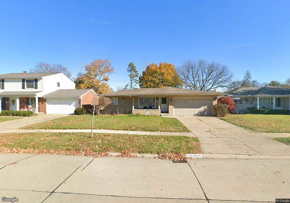
14406 Auburndale St Livonia, MI 48154
Estimated Value: $304,428 - $365,000
--
Bed
1
Bath
1,526
Sq Ft
$223/Sq Ft
Est. Value
About This Home
This home is located at 14406 Auburndale St, Livonia, MI 48154 and is currently estimated at $340,357, approximately $223 per square foot. 14406 Auburndale St is a home located in Wayne County with nearby schools including Kennedy Elementary School, Johnson Upper Elementary School, and Frost Middle School.
Ownership History
Date
Name
Owned For
Owner Type
Purchase Details
Closed on
Dec 23, 2021
Sold by
Lawson Amy F
Bought by
Lawson Amy F and Lawson Brandon Tyler
Current Estimated Value
Home Financials for this Owner
Home Financials are based on the most recent Mortgage that was taken out on this home.
Original Mortgage
$205,000
Outstanding Balance
$188,394
Interest Rate
3.05%
Estimated Equity
$151,963
Purchase Details
Closed on
Apr 30, 2002
Sold by
Dorland Arthur J
Bought by
Lawson Amy F
Purchase Details
Closed on
Dec 20, 1996
Sold by
Has Florine K and Has Thomas
Bought by
Dorlan Arthur J and Dorland Joyce
Create a Home Valuation Report for This Property
The Home Valuation Report is an in-depth analysis detailing your home's value as well as a comparison with similar homes in the area
Home Values in the Area
Average Home Value in this Area
Purchase History
| Date | Buyer | Sale Price | Title Company |
|---|---|---|---|
| Lawson Amy F | -- | None Listed On Document | |
| Lawson Amy F | -- | None Listed On Document | |
| Lawson Amy F | $225,900 | -- | |
| Dorlan Arthur J | $142,010 | -- |
Source: Public Records
Mortgage History
| Date | Status | Borrower | Loan Amount |
|---|---|---|---|
| Open | Lawson Amy F | $205,000 |
Source: Public Records
Tax History Compared to Growth
Tax History
| Year | Tax Paid | Tax Assessment Tax Assessment Total Assessment is a certain percentage of the fair market value that is determined by local assessors to be the total taxable value of land and additions on the property. | Land | Improvement |
|---|---|---|---|---|
| 2025 | $1,971 | $152,200 | $0 | $0 |
| 2024 | $1,971 | $144,100 | $0 | $0 |
| 2023 | $1,881 | $128,400 | $0 | $0 |
| 2022 | $3,302 | $118,400 | $0 | $0 |
| 2021 | $3,207 | $113,900 | $0 | $0 |
| 2019 | $3,077 | $102,100 | $0 | $0 |
| 2018 | $1,590 | $93,900 | $0 | $0 |
| 2017 | $2,814 | $87,900 | $0 | $0 |
| 2016 | $2,958 | $87,900 | $0 | $0 |
| 2015 | $6,867 | $76,100 | $0 | $0 |
| 2012 | -- | $66,260 | $13,500 | $52,760 |
Source: Public Records
Map
Nearby Homes
- 14563 Melrose St
- 14327 Arden St
- 14677 Auburndale St
- 32136 Lyndon St
- 31126 Grennada St
- 31221 Lyndon St
- 14214 Cranston St
- 14164 Bainbridge St
- 14292 Hubbell St
- 15040 Berwick St
- 14154 Hubbell St
- 30831 Lyndon St
- 14879 Fairfield St
- 15075 Hubbard St Unit 5
- 14127 Hillcrest St
- 32950 Perth St
- 33025 Martin St
- 33040 Allen St
- 32651 5 Mile Rd Unit 15
- 15345 Bainbridge St
- 14376 Auburndale St
- 14418 Auburndale St
- 14364 Auburndale St
- 14403 Melrose St
- 14430 Auburndale St
- 14361 Melrose St
- 14415 Melrose St
- 14349 Melrose St
- 14345 Auburndale St
- 14427 Melrose St
- 14442 Auburndale St
- 14417 Auburndale St
- 14337 Melrose St
- 14439 Melrose St
- 14352 Auburndale St
- 14331 Auburndale St
- 14454 Auburndale St
- 14325 Melrose St
- 14451 Melrose St
- 14344 Auburndale St