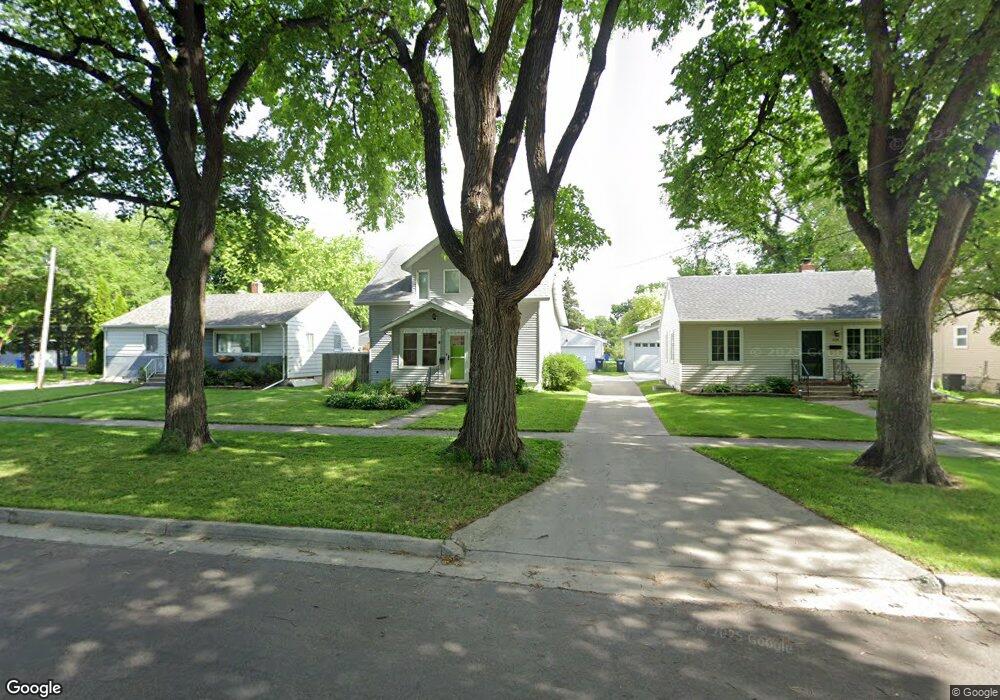
1441 10th Ave S Fargo, ND 58103
Jefferson-Carl NeighborhoodEstimated Value: $232,000 - $251,000
3
Beds
2
Baths
2,400
Sq Ft
$100/Sq Ft
Est. Value
About This Home
This home is located at 1441 10th Ave S, Fargo, ND 58103 and is currently estimated at $241,032, approximately $100 per square foot. 1441 10th Ave S is a home located in Cass County with nearby schools including Clara Barton Elementary School, Carl Ben Eielson Middle School, and South High School.
Ownership History
Date
Name
Owned For
Owner Type
Purchase Details
Closed on
Jun 22, 2017
Sold by
Rogstad John O and Rogstad Jessica A
Bought by
Scilley Matthew A and Berning Antonia Lee
Current Estimated Value
Home Financials for this Owner
Home Financials are based on the most recent Mortgage that was taken out on this home.
Original Mortgage
$180,667
Outstanding Balance
$152,210
Interest Rate
4.5%
Mortgage Type
FHA
Estimated Equity
$88,822
Purchase Details
Closed on
Jun 22, 2012
Sold by
Ronning Dane L and Ronning Rachel V
Bought by
Ragstad John O and Ragstad Jessica A
Purchase Details
Closed on
Jul 11, 2005
Sold by
Hauger Lawrence M and Phillilps Hauger Meredith L
Bought by
Ronning Dane L and Ronning Rachel V
Home Financials for this Owner
Home Financials are based on the most recent Mortgage that was taken out on this home.
Original Mortgage
$121,550
Interest Rate
5.69%
Mortgage Type
VA
Create a Home Valuation Report for This Property
The Home Valuation Report is an in-depth analysis detailing your home's value as well as a comparison with similar homes in the area
Home Values in the Area
Average Home Value in this Area
Purchase History
| Date | Buyer | Sale Price | Title Company |
|---|---|---|---|
| Scilley Matthew A | $184,000 | Fm Title | |
| Ragstad John O | $148,000 | Us Title Fargo | |
| Ronning Dane L | -- | -- |
Source: Public Records
Mortgage History
| Date | Status | Borrower | Loan Amount |
|---|---|---|---|
| Open | Scilley Matthew A | $180,667 | |
| Previous Owner | Ronning Dane L | $121,550 |
Source: Public Records
Tax History Compared to Growth
Tax History
| Year | Tax Paid | Tax Assessment Tax Assessment Total Assessment is a certain percentage of the fair market value that is determined by local assessors to be the total taxable value of land and additions on the property. | Land | Improvement |
|---|---|---|---|---|
| 2024 | $2,424 | $94,800 | $18,350 | $76,450 |
| 2023 | $2,813 | $91,150 | $18,350 | $72,800 |
| 2022 | $2,763 | $87,650 | $18,350 | $69,300 |
| 2021 | $2,720 | $87,650 | $18,350 | $69,300 |
| 2020 | $2,705 | $87,650 | $18,350 | $69,300 |
| 2019 | $2,479 | $78,550 | $10,900 | $67,650 |
| 2018 | $2,425 | $78,550 | $10,900 | $67,650 |
| 2017 | $2,344 | $76,250 | $10,900 | $65,350 |
| 2016 | $2,107 | $74,050 | $10,900 | $63,150 |
| 2015 | $2,285 | $76,500 | $7,450 | $69,050 |
| 2014 | $2,155 | $69,550 | $7,450 | $62,100 |
| 2013 | $2,054 | $66,250 | $7,450 | $58,800 |
Source: Public Records
Map
Nearby Homes
- 1414 10th Ave S
- 1517 9th Ave S
- 1418 11th Ave S
- 1418 12th Ave S
- 910 University Dr S
- 1637 10th Ave S
- 1118 8th Ave S
- 1112 University Dr S
- 1124 University Dr S
- 813 17th St S
- 1314 14th St S
- 1419 5th Ave S
- 1208 University Dr S
- 1020 9th Ave S
- 1301 16 1 2 St S
- 1124 5th Ave S
- 818 19th St S
- 814 19th St S
- 1425 4th Ave S
- 1709 13th Ave S
- 1439 10th Ave S
- 1445 10th Ave S
- 1433 10th Ave S
- 1438 9th Ave S
- 1442 9th Ave S
- 1434 9th Ave S
- 1429 10th Ave S
- 1430 9th Ave S
- 1440 10th Ave S
- 1426 9th Ave S
- 1444 10th Ave S
- 1438 10th Ave S
- 913 15th St S
- 1434 10th Ave S
- 1421 10th Ave S
- 909 15th St S
- 1430 10th Ave S
- 1422 9th Ave S
- 905 15th St S
- 1417 10th Ave S