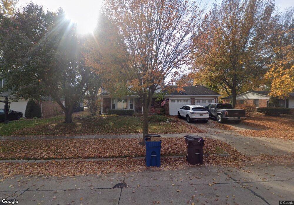
1441 Hartsough St Plymouth, MI 48170
Estimated Value: $492,129 - $597,000
3
Beds
3
Baths
1,738
Sq Ft
$315/Sq Ft
Est. Value
About This Home
This home is located at 1441 Hartsough St, Plymouth, MI 48170 and is currently estimated at $547,282, approximately $314 per square foot. 1441 Hartsough St is a home located in Wayne County with nearby schools including Canton High School, Smith Elementary School, and West Middle School.
Ownership History
Date
Name
Owned For
Owner Type
Purchase Details
Closed on
Mar 18, 2019
Sold by
Whirley Stephen Randall and Whirley Heidi Lyn
Bought by
Stephen Randall Whirley Rlt and Heidi Lyn Whirley Revocable Living Trust
Current Estimated Value
Purchase Details
Closed on
Feb 7, 2011
Sold by
Banjanin Michele
Bought by
Whirley Stephen R and Whirley Heidi L
Purchase Details
Closed on
Jun 3, 2004
Sold by
Walker Scott A and Walker Jill A
Bought by
Banjanin Michele
Purchase Details
Closed on
Dec 20, 2002
Sold by
Arlen Richard T and Arlen Alice
Bought by
Walker Scott A and Walker Jill A
Create a Home Valuation Report for This Property
The Home Valuation Report is an in-depth analysis detailing your home's value as well as a comparison with similar homes in the area
Home Values in the Area
Average Home Value in this Area
Purchase History
| Date | Buyer | Sale Price | Title Company |
|---|---|---|---|
| Stephen Randall Whirley Rlt | -- | None Available | |
| Whirley Stephen R | $270,000 | Fidelity National Title | |
| Banjanin Michele | $279,900 | Commonwealth Land Title | |
| Walker Scott A | $253,000 | First American Title Ins Co |
Source: Public Records
Tax History Compared to Growth
Tax History
| Year | Tax Paid | Tax Assessment Tax Assessment Total Assessment is a certain percentage of the fair market value that is determined by local assessors to be the total taxable value of land and additions on the property. | Land | Improvement |
|---|---|---|---|---|
| 2025 | $6,495 | $251,400 | $0 | $0 |
| 2024 | $6,495 | $240,300 | $0 | $0 |
| 2023 | $6,326 | $209,600 | $0 | $0 |
| 2022 | $6,705 | $196,400 | $0 | $0 |
| 2021 | $6,498 | $192,500 | $0 | $0 |
| 2020 | $6,481 | $195,100 | $0 | $0 |
| 2019 | $5,706 | $193,200 | $0 | $0 |
| 2018 | $5,542 | $178,700 | $0 | $0 |
| 2017 | $1,174 | $174,700 | $0 | $0 |
| 2016 | $6,037 | $168,200 | $0 | $0 |
| 2015 | $13,828 | $146,680 | $0 | $0 |
| 2013 | $13,396 | $145,550 | $0 | $0 |
| 2011 | -- | $124,350 | $0 | $0 |
Source: Public Records
Map
Nearby Homes
- 1199 S Sheldon Rd Unit 77
- 44571 Clare Blvd
- 1125 Sutherland St
- 44736 Lynn Dr
- 1338 S Harvey St
- 44750 Erin Dr Unit 40
- 9453 Brookline Ave
- 44703 Erin Dr
- 44872 Lynn Dr
- 10839 Brookwood Dr
- 44877 Erin Dr Unit 2
- 844 Ross St
- 638 S Harvey St
- 9405 Northern Ave
- 9264 Brookline Ave
- 9230 Brookline Ave
- 553 Jener Place
- 685 Ross St
- 775 Deer Ct Unit 104
- 9060 N Sheldon Rd
- 1421 Hartsough St
- 1451 Hartsough St
- 1430 Ross St
- 1401 Hartsough St
- 1448 Hartsough St
- 1416 Hartsough St
- 1400 Ross St
- 1464 Hartsough St
- 1400 Hartsough St
- 1453 Ross St
- 1493 Ross St
- 1480 Hartsough St
- 1465 Ross St
- 1439 Ross St
- 1479 Ross St
- 1365 Hartsough St
- 1433 Palmer St
- 1449 Palmer St
- 1417 Palmer St
- 1427 Ross St