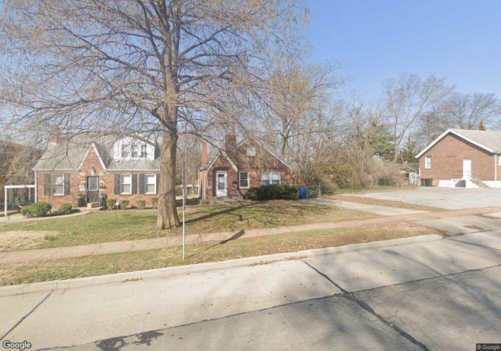
1441 Laclede Station Rd Saint Louis, MO 63117
Estimated Value: $254,000 - $318,000
3
Beds
2
Baths
1,201
Sq Ft
$232/Sq Ft
Est. Value
About This Home
This home is located at 1441 Laclede Station Rd, Saint Louis, MO 63117 and is currently estimated at $279,222, approximately $232 per square foot. 1441 Laclede Station Rd is a home located in St. Louis County with nearby schools including Maplewood Richmond Heights Elementary School, Maplewood Richmond Heights Middle School, and Maplewood-Richmond Heights High School.
Ownership History
Date
Name
Owned For
Owner Type
Purchase Details
Closed on
Aug 30, 2013
Sold by
Wenren Xi
Bought by
Xw Eduhome Llc
Current Estimated Value
Purchase Details
Closed on
Nov 9, 2012
Sold by
Secretary Of Housing & Urban Development
Bought by
Wenren Xi
Purchase Details
Closed on
Jul 27, 2012
Sold by
Citimortgage Inc
Bought by
Secretary Of Housing & Urban Development
Purchase Details
Closed on
Jul 11, 2012
Sold by
Brinkman Robert Kieth
Bought by
Citimortgage Inc
Create a Home Valuation Report for This Property
The Home Valuation Report is an in-depth analysis detailing your home's value as well as a comparison with similar homes in the area
Home Values in the Area
Average Home Value in this Area
Purchase History
| Date | Buyer | Sale Price | Title Company |
|---|---|---|---|
| Xw Eduhome Llc | -- | Old Republic National Title | |
| Wenren Xi | $90,000 | None Available | |
| Secretary Of Housing & Urban Development | $177,005 | None Available | |
| Citimortgage Inc | $177,005 | None Available |
Source: Public Records
Tax History Compared to Growth
Tax History
| Year | Tax Paid | Tax Assessment Tax Assessment Total Assessment is a certain percentage of the fair market value that is determined by local assessors to be the total taxable value of land and additions on the property. | Land | Improvement |
|---|---|---|---|---|
| 2025 | $3,671 | $51,760 | $24,420 | $27,340 |
| 2024 | $3,671 | $47,800 | $17,100 | $30,700 |
| 2023 | $3,638 | $47,800 | $17,100 | $30,700 |
| 2022 | $3,170 | $38,480 | $17,100 | $21,380 |
| 2021 | $3,116 | $38,480 | $17,100 | $21,380 |
| 2020 | $3,030 | $35,480 | $12,200 | $23,280 |
| 2019 | $3,007 | $35,480 | $12,200 | $23,280 |
| 2018 | $2,236 | $23,830 | $10,280 | $13,550 |
| 2017 | $2,220 | $23,830 | $10,280 | $13,550 |
| 2016 | $1,868 | $19,270 | $8,570 | $10,700 |
| 2015 | $1,756 | $19,270 | $8,570 | $10,700 |
| 2014 | $889 | $9,650 | $2,410 | $7,240 |
Source: Public Records
Map
Nearby Homes
- 7735 Saint Albans Ave
- 1501 Stockard Ave
- 1510 Banneker Ave
- 7718 W Ranken Ave
- 7716 Lovella Ave
- 7723 Dale Ave
- 7715 Dale Ave
- 7765 Weston Place
- 1250 Hampton Park Dr
- 1262 Moorlands Dr
- 1241 Strassner Dr Unit 1308
- 7615 W Bruno Ave
- 1270 Strassner Dr Unit 3110
- 2030 Bland Place
- 7590 W Bruno Ave
- 1723 Mccready Ave
- 7742 Wise Ave
- 1174 Claytonia Terrace
- 7555 Alicia Ave
- 1140 Hillside Dr
- 1443 Laclede Station Rd
- 7912 Dale Ave
- 1445 Laclede Station Rd
- 7905 Hicks Ave
- 7909 Hicks Ave
- 7755 Snowden Ave
- 7916 Dale Ave
- 7913 Hicks Ave
- 1451 Laclede Station Rd
- 7751 Snowden Ave
- 7918 Dale Ave
- 7908 Hicks Ave
- 7917 Hicks Ave
- 7922 Dale Ave
- 1455 Laclede Station Rd
- 7747 Snowden Ave
- 1327 Laclede Station Rd
- 1454 Laclede Station Rd
- 7926 Dale Ave
- 7743 Snowden Ave