Estimated Value: $97,000 - $133,000
2
Beds
1
Bath
880
Sq Ft
$135/Sq Ft
Est. Value
About This Home
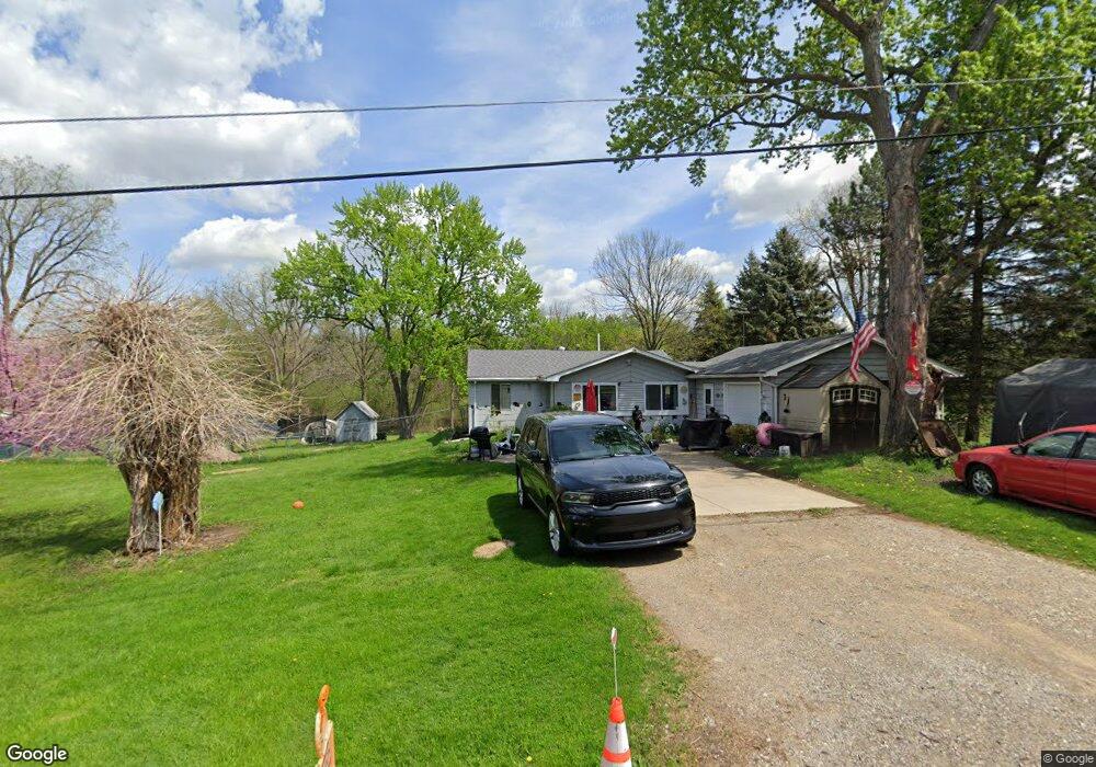
This home is located at 1441 Maxwell St, Flint, MI 48532 and is currently estimated at $118,710, approximately $134 per square foot. 1441 Maxwell St is a home located in Genesee County with nearby schools including Carman-Ainsworth High School, Genesee STEM Academy, and St. Paul Lutheran School.
Ownership History
Date
Name
Owned For
Owner Type
Purchase Details
Closed on
Sep 11, 2017
Sold by
Farver Robert C and Farver Keith
Bought by
Hawley Jackie M
Current Estimated Value
Purchase Details
Closed on
Aug 25, 2017
Sold by
The Maureen A Farver Revocable Living Tr
Bought by
Farver Robert C
Create a Home Valuation Report for This Property
The Home Valuation Report is an in-depth analysis detailing your home's value as well as a comparison with similar homes in the area
Home Values in the Area
Average Home Value in this Area
Purchase History
| Date | Buyer | Sale Price | Title Company |
|---|---|---|---|
| Hawley Jackie M | $32,000 | Liberty Title | |
| Farver Robert C | $32,000 | Liberty Title |
Source: Public Records
Tax History Compared to Growth
Tax History
| Year | Tax Paid | Tax Assessment Tax Assessment Total Assessment is a certain percentage of the fair market value that is determined by local assessors to be the total taxable value of land and additions on the property. | Land | Improvement |
|---|---|---|---|---|
| 2025 | $1,306 | $50,600 | $0 | $0 |
| 2024 | $643 | $52,700 | $0 | $0 |
| 2023 | $613 | $41,300 | $0 | $0 |
| 2022 | $606 | $36,100 | $0 | $0 |
| 2021 | $1,156 | $34,800 | $0 | $0 |
| 2020 | $551 | $31,700 | $0 | $0 |
| 2019 | $543 | $28,100 | $0 | $0 |
| 2018 | $1,057 | $23,900 | $0 | $0 |
| 2017 | $1,388 | $23,900 | $0 | $0 |
| 2016 | $1,402 | $22,100 | $0 | $0 |
| 2015 | $1,258 | $22,200 | $0 | $0 |
| 2014 | $900 | $21,500 | $0 | $0 |
| 2012 | -- | $21,800 | $21,800 | $0 |
Source: Public Records
Map
Nearby Homes
- 10 Acres T A Mansour Blvd
- 0 Charter Dr Unit 50153638
- 4474 Corunna Rd
- 4480 Corunna Rd
- 18.41 Taft Rd
- 3.9 Acres W Court St
- 1540 Pound Dr
- 2 Charter Dr
- 1455 S Linden Rd
- 1193 Normandy Terrace Dr
- 000 Devenish Ln
- 1260 Gilbert St
- 1136 Gilbert St
- 2462 Valley Oaks Cir
- 1068 S Graham Rd
- 3493 Ridgecliffe Dr
- 1460 S Dye Rd
- 0000 Reuben Reuben St
- 5345 Birchtree Ct
- 3320 Timberview St
- 1425 Maxwell St
- 1455 Maxwell St
- 1415 Maxwell St
- 1397 Maxwell St
- 1512 Ward Dr
- 1434 Maxwell St
- 1416 Maxwell St
- 4293 W Court St
- 4261 W Court St
- 4303 W Court St
- 4317 W Court St
- 4050-4233 W Court St
- 4208 Corunna Rd
- 4403 Lenrose Ave
- 4381 W Court St
- 4229 Corunna Rd
- 1374 Benard St
- 4411 Lenrose Ave
- 1423 Conway St
- 1413 Conway St