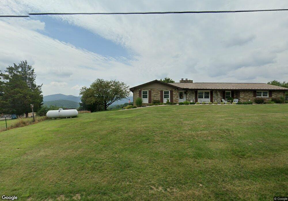
14414 Brant Rd SW Cumberland, MD 21502
Estimated Value: $283,000 - $370,867
5
Beds
3
Baths
3,386
Sq Ft
$98/Sq Ft
Est. Value
About This Home
This home is located at 14414 Brant Rd SW, Cumberland, MD 21502 and is currently estimated at $330,467, approximately $97 per square foot. 14414 Brant Rd SW is a home located in Allegany County with nearby schools including Cresaptown Elementary School, Braddock Middle School, and Allegany High School.
Ownership History
Date
Name
Owned For
Owner Type
Purchase Details
Closed on
May 11, 2015
Sold by
Williams Helen
Bought by
Loar Gary M and Loar Debra K
Current Estimated Value
Purchase Details
Closed on
May 6, 1998
Sold by
Shirley Ronald J and Shirley Denise D
Bought by
Williams Helen
Purchase Details
Closed on
Sep 27, 1996
Sold by
Loar Gary M and Broadwater Debra K
Bought by
Shirley Ronald J and Shirley Denise D
Purchase Details
Closed on
Jun 30, 1992
Sold by
Freno Joseph S-Lori J
Bought by
Loar Gary M-Broadwater Debra K
Home Financials for this Owner
Home Financials are based on the most recent Mortgage that was taken out on this home.
Original Mortgage
$61,000
Interest Rate
8.43%
Create a Home Valuation Report for This Property
The Home Valuation Report is an in-depth analysis detailing your home's value as well as a comparison with similar homes in the area
Home Values in the Area
Average Home Value in this Area
Purchase History
| Date | Buyer | Sale Price | Title Company |
|---|---|---|---|
| Loar Gary M | $200,000 | None Available | |
| Williams Helen | $155,000 | -- | |
| Shirley Ronald J | $145,500 | -- | |
| Loar Gary M-Broadwater Debra K | $118,500 | -- |
Source: Public Records
Mortgage History
| Date | Status | Borrower | Loan Amount |
|---|---|---|---|
| Previous Owner | Loar Gary M-Broadwater Debra K | $61,000 |
Source: Public Records
Tax History Compared to Growth
Tax History
| Year | Tax Paid | Tax Assessment Tax Assessment Total Assessment is a certain percentage of the fair market value that is determined by local assessors to be the total taxable value of land and additions on the property. | Land | Improvement |
|---|---|---|---|---|
| 2025 | $2,526 | $300,400 | $42,400 | $258,000 |
| 2024 | $3,290 | $281,933 | $0 | $0 |
| 2023 | $2,864 | $263,467 | $0 | $0 |
| 2022 | $2,859 | $245,000 | $41,200 | $203,800 |
| 2021 | $2,821 | $243,933 | $0 | $0 |
| 2020 | $2,834 | $242,867 | $0 | $0 |
| 2019 | $2,822 | $241,800 | $41,200 | $200,600 |
| 2018 | $2,822 | $241,800 | $41,200 | $200,600 |
| 2017 | $2,824 | $241,800 | $0 | $0 |
| 2016 | -- | $242,600 | $0 | $0 |
| 2015 | -- | $236,633 | $0 | $0 |
| 2014 | -- | $230,667 | $0 | $0 |
Source: Public Records
Map
Nearby Homes
- 14129 Louise Dr SW
- 11813 Illinois Ave
- 14104 Louise Dr SW
- 14801 Connecticut Ave
- 14308L Greenfield Crescent SW
- 14003 Cedarwood Dr SW
- 15509 Westwood Rd SW
- 15008 Laurel Ridge Rd SW
- 15609 Westwood Rd SW
- 15507 Ivy Ct SW
- 0 Fir Tree Ln Unit MDAL2012106
- 14407 N Bel Air Dr SW
- 15700 Acorn Ct SW
- 14619 Redwood St
- 14200 Stonefield Ln
- 14620 Redwood St
- 15708 Downing St SW
- 14804 Bell St
- 14211 Sparrow Ln SW
- 14219 N Bel Air Dr SW
- 14420 Brant Rd SW
- 14407 Brant Rd SW
- 14313 Brant Rd SW
- 14419 Brant Rd SW
- 14507 Brant Rd SW
- 14501 Brant Rd SW
- 14400 Brant Rd SW
- 14309 Brant Rd SW
- 14508 Brant Rd SW
- 14808 Forest View Dr SW
- 14310 Brant Rd SW
- 14603 Brant Rd SW
- 14308 Brant Rd SW
- 14301 Louise Dr SW
- 14604 Brant Rd SW
- 14216 Cedarwood Dr SW
- 14209 Cedarwood Dr SW
- 14302 Brant Rd SW
- 14709 Forest View Dr SW
- 14211 Cedarwood Dr SW