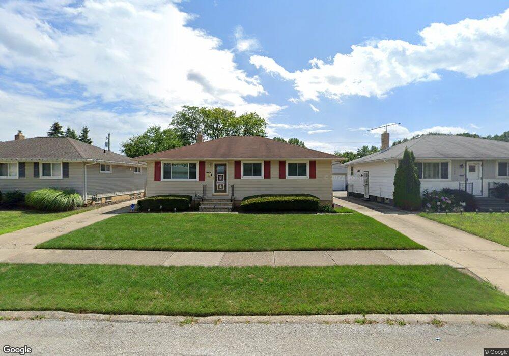
14414 Lisa Dr Maple Heights, OH 44137
Estimated Value: $151,015 - $207,000
3
Beds
1
Bath
1,172
Sq Ft
$146/Sq Ft
Est. Value
About This Home
This home is located at 14414 Lisa Dr, Maple Heights, OH 44137 and is currently estimated at $170,754, approximately $145 per square foot. 14414 Lisa Dr is a home located in Cuyahoga County with nearby schools including Abraham Lincoln Elementary School, Rockside/ J.F. Kennedy School, and Barack Obama School.
Ownership History
Date
Name
Owned For
Owner Type
Purchase Details
Closed on
Apr 13, 2005
Sold by
Niles Ashley
Bought by
Hood Edward N and Hood Rosalind
Current Estimated Value
Home Financials for this Owner
Home Financials are based on the most recent Mortgage that was taken out on this home.
Original Mortgage
$104,000
Outstanding Balance
$60,013
Interest Rate
7.65%
Mortgage Type
Purchase Money Mortgage
Estimated Equity
$110,741
Purchase Details
Closed on
Apr 18, 2002
Sold by
Orlowski Wilma
Bought by
Niles Ashley
Home Financials for this Owner
Home Financials are based on the most recent Mortgage that was taken out on this home.
Original Mortgage
$110,642
Interest Rate
6.93%
Mortgage Type
FHA
Purchase Details
Closed on
Sep 25, 1990
Sold by
Orlowski Ronald and Orlowski Wilma
Bought by
Orlowski Wilma
Purchase Details
Closed on
Jan 1, 1975
Bought by
Orlowski Ronald and Orlowski Wilma
Create a Home Valuation Report for This Property
The Home Valuation Report is an in-depth analysis detailing your home's value as well as a comparison with similar homes in the area
Home Values in the Area
Average Home Value in this Area
Purchase History
| Date | Buyer | Sale Price | Title Company |
|---|---|---|---|
| Hood Edward N | $130,000 | Ata Title | |
| Niles Ashley | $112,000 | -- | |
| Orlowski Wilma | -- | -- | |
| Orlowski Ronald | -- | -- |
Source: Public Records
Mortgage History
| Date | Status | Borrower | Loan Amount |
|---|---|---|---|
| Open | Hood Edward N | $104,000 | |
| Previous Owner | Niles Ashley | $110,642 | |
| Closed | Hood Edward N | $26,000 |
Source: Public Records
Tax History Compared to Growth
Tax History
| Year | Tax Paid | Tax Assessment Tax Assessment Total Assessment is a certain percentage of the fair market value that is determined by local assessors to be the total taxable value of land and additions on the property. | Land | Improvement |
|---|---|---|---|---|
| 2024 | $3,763 | $53,235 | $8,785 | $44,450 |
| 2023 | $2,492 | $33,530 | $7,490 | $26,040 |
| 2022 | $2,520 | $33,530 | $7,490 | $26,040 |
| 2021 | $2,694 | $33,530 | $7,490 | $26,040 |
| 2020 | $2,280 | $27,480 | $6,130 | $21,350 |
| 2019 | $2,266 | $78,500 | $17,500 | $61,000 |
| 2018 | $2,125 | $27,480 | $6,130 | $21,350 |
| 2017 | $2,140 | $26,010 | $4,340 | $21,670 |
| 2016 | $2,064 | $26,010 | $4,340 | $21,670 |
| 2015 | $2,115 | $26,010 | $4,340 | $21,670 |
| 2014 | $2,115 | $27,970 | $4,660 | $23,310 |
Source: Public Records
Map
Nearby Homes
- 14775 Lisa Dr
- 14917 Summit Ave
- 13835 Milo Rd
- 13732 Carpenter Rd
- 14916 Summit Ave
- SL15 Rocky Top Ct
- 13804 Rockside Rd
- 6318 Valley Ranch Dr
- 6030 Dunham Rd
- 13712 Rockside Rd
- 14951 Carol Dr
- 5843 Dunham Rd
- 14708 Brunswick Ave
- 6089 Dunham Rd
- 13578 Foxcroft Dr
- 13577 Robinhood Dr
- 14214 Tabor Ave
- 6378 Valley Ranch Dr
- 6372 Valley Ranch Dr
- 14106 Tabor Ave
- 14440 Lisa Dr
- 14390 Lisa Dr
- 14466 Lisa Dr
- 14362 Lisa Dr
- 14411 Rochelle Dr
- 14451 Rochelle Dr
- 14393 Rochelle Dr
- 14488 Lisa Dr
- 14338 Lisa Dr
- 14469 Rochelle Dr
- 14443 Lisa Dr
- 14415 Lisa Dr
- 14467 Lisa Dr
- 14391 Lisa Dr
- 14341 Rochelle Dr
- 14491 Rochelle Dr
- 14502 Lisa Dr
- 14326 Lisa Dr
- 14503 Lisa Dr
- 14363 Lisa Dr