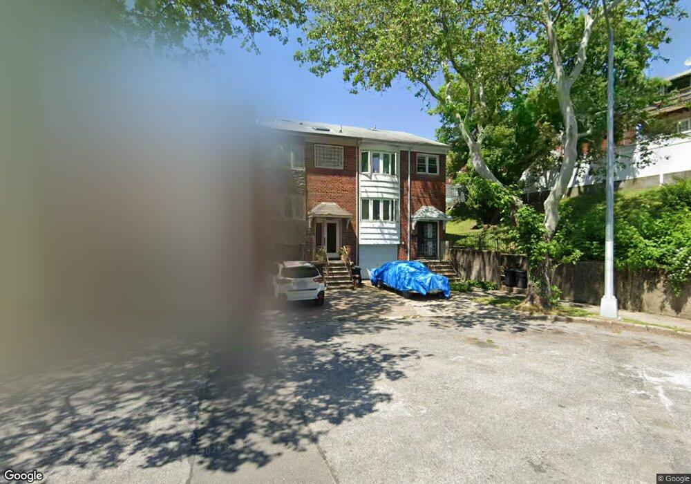
14419 15th Rd Whitestone, NY 11357
Whitestone NeighborhoodEstimated Value: $980,000 - $1,191,000
Studio
--
Bath
1,870
Sq Ft
$562/Sq Ft
Est. Value
About This Home
This home is located at 14419 15th Rd, Whitestone, NY 11357 and is currently estimated at $1,050,329, approximately $561 per square foot. 14419 15th Rd is a home located in Queens County with nearby schools including P.S. 79 - Francis Lewis, Jhs 185 Edward Bleeker, and Flushing High School.
Ownership History
Date
Name
Owned For
Owner Type
Purchase Details
Closed on
Jul 15, 2024
Sold by
Montaquiza Edison and Montaquiza James B
Bought by
Montaquiza James B and Montaquiza Sharon
Current Estimated Value
Purchase Details
Closed on
Jan 2, 2021
Sold by
Estate Of Maria Montaquiza and James B. Montaquiza Executor
Bought by
Montaquiza Edison and Montaquiza James B
Create a Home Valuation Report for This Property
The Home Valuation Report is an in-depth analysis detailing your home's value as well as a comparison with similar homes in the area
Home Values in the Area
Average Home Value in this Area
Purchase History
| Date | Buyer | Sale Price | Title Company |
|---|---|---|---|
| Montaquiza James B | -- | -- | |
| Montaquiza James B | -- | -- | |
| Montaquiza Edison | -- | -- | |
| Montaquiza Edison | -- | -- | |
| Montaquiza Edison | -- | -- |
Source: Public Records
Tax History
| Year | Tax Paid | Tax Assessment Tax Assessment Total Assessment is a certain percentage of the fair market value that is determined by local assessors to be the total taxable value of land and additions on the property. | Land | Improvement |
|---|---|---|---|---|
| 2025 | $9,154 | $48,306 | $6,871 | $41,435 |
| 2024 | $9,154 | $45,574 | $7,071 | $38,503 |
| 2023 | $8,636 | $42,996 | $6,095 | $36,901 |
| 2022 | $8,544 | $64,500 | $9,840 | $54,660 |
| 2021 | $8,979 | $55,620 | $9,840 | $45,780 |
| 2020 | $3,601 | $52,200 | $9,840 | $42,360 |
| 2019 | $3,313 | $54,240 | $9,840 | $44,400 |
| 2018 | $2,993 | $35,830 | $6,962 | $28,868 |
| 2017 | $2,989 | $35,665 | $7,404 | $28,261 |
| 2016 | $2,933 | $35,665 | $7,404 | $28,261 |
| 2015 | $1,590 | $33,546 | $9,250 | $24,296 |
| 2014 | $1,590 | $31,648 | $8,902 | $22,746 |
Source: Public Records
Map
Nearby Homes
- 1537 144th St
- 15-43 144th St
- 145-04 14th Ave
- 1352 145th Place
- 147-20 17th Ave
- 17-34 149th St
- 20-21 Parsons Blvd
- 16-11 149th St
- 1535 149th St
- 1527 149th St
- 2023 Whitestone Expy
- 147-16 20th Ave
- 14915 15th Rd
- 14-33 140th St
- 21-12 144th St
- 14940 15th Dr
- 148-18 12 Rd
- 915 Malba Dr
- 141-16 11th Ave
- 13910 14th Ave
- 14417 15th Rd
- 14415 15th Rd
- 14411 15th Rd
- 15-04 Parsons Blvd
- 14409 15th Rd
- 1504 Parsons Blvd
- 1506 Parsons Blvd
- 1508 Parsons Blvd
- 15-08 Parsons Blvd
- 1514 Parsons Blvd
- 15-14 Parsons Blvd Unit 2
- 1516 Parsons Blvd
- 15-28 Parsons Blvd Unit 2ND FLOOR DUPLEX
- 15-28 Parsons Blvd
- 1501 144th St
- 1503 144th St
- 1505 144th St
- 1507 144th St
- 15-05 144th St
- 1509 144th St
Your Personal Tour Guide
Ask me questions while you tour the home.