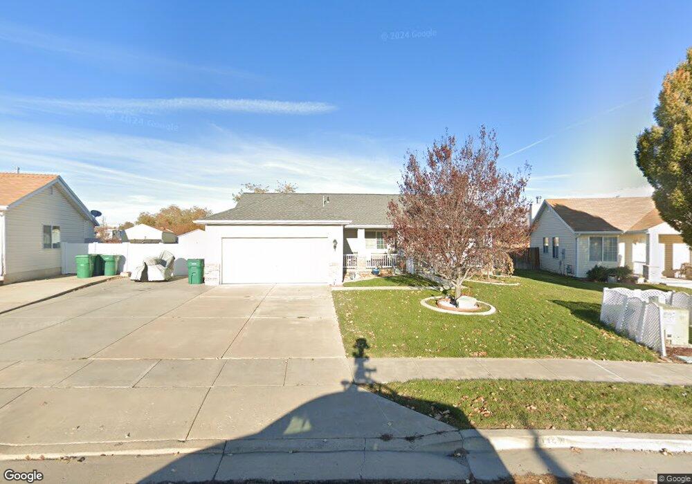
1442 N 2100 W Layton, UT 84041
Estimated Value: $417,000 - $457,000
3
Beds
2
Baths
1,315
Sq Ft
$332/Sq Ft
Est. Value
About This Home
This home is located at 1442 N 2100 W, Layton, UT 84041 and is currently estimated at $437,000, approximately $332 per square foot. 1442 N 2100 W is a home located in Davis County with nearby schools including Ellison Park School, Shoreline Junior High School, and Layton High School.
Ownership History
Date
Name
Owned For
Owner Type
Purchase Details
Closed on
Jul 3, 2019
Sold by
Huntington Donna and Huntington Kenneth
Bought by
Huntington Donna
Current Estimated Value
Home Financials for this Owner
Home Financials are based on the most recent Mortgage that was taken out on this home.
Original Mortgage
$140,100
Outstanding Balance
$122,425
Interest Rate
3.8%
Mortgage Type
New Conventional
Estimated Equity
$314,575
Purchase Details
Closed on
May 3, 2007
Sold by
Fresh Catherine A Barnes and Barnes Catherine A
Bought by
Huntington Kenneth and Huntington Donna
Home Financials for this Owner
Home Financials are based on the most recent Mortgage that was taken out on this home.
Original Mortgage
$149,000
Interest Rate
7.9%
Mortgage Type
Purchase Money Mortgage
Purchase Details
Closed on
Jan 27, 2005
Sold by
Palmer Pamela S
Bought by
Barnes Catherine A
Home Financials for this Owner
Home Financials are based on the most recent Mortgage that was taken out on this home.
Original Mortgage
$131,000
Interest Rate
5.67%
Mortgage Type
Purchase Money Mortgage
Purchase Details
Closed on
Aug 3, 2004
Sold by
Bowers Pamela S and Palmer Pamela S
Bought by
Palmer Pamela S
Home Financials for this Owner
Home Financials are based on the most recent Mortgage that was taken out on this home.
Original Mortgage
$33,500
Interest Rate
6.17%
Mortgage Type
New Conventional
Purchase Details
Closed on
Jul 11, 2002
Sold by
Anderson Julie C
Bought by
Bowers Pamela S
Home Financials for this Owner
Home Financials are based on the most recent Mortgage that was taken out on this home.
Original Mortgage
$127,680
Interest Rate
6.69%
Mortgage Type
Balloon
Purchase Details
Closed on
May 22, 2001
Sold by
Anderson Dorothy M
Bought by
Anderson Dorothy M
Purchase Details
Closed on
Dec 4, 1997
Sold by
Seasons Layton Llc
Bought by
Anderson Merrill B and Anderson Dorothy M
Home Financials for this Owner
Home Financials are based on the most recent Mortgage that was taken out on this home.
Original Mortgage
$125,000
Interest Rate
7.31%
Mortgage Type
VA
Create a Home Valuation Report for This Property
The Home Valuation Report is an in-depth analysis detailing your home's value as well as a comparison with similar homes in the area
Home Values in the Area
Average Home Value in this Area
Purchase History
| Date | Buyer | Sale Price | Title Company |
|---|---|---|---|
| Huntington Donna | -- | First American Title | |
| Huntington Kenneth | -- | Bonneville Superior Title Co | |
| Barnes Catherine A | -- | First American Title | |
| Palmer Pamela S | -- | First American Title Co | |
| Bowers Pamela S | -- | Bonneville Title Company Inc | |
| Anderson Dorothy M | -- | -- | |
| Anderson Merrill B | -- | Merrill Title Company |
Source: Public Records
Mortgage History
| Date | Status | Borrower | Loan Amount |
|---|---|---|---|
| Open | Huntington Donna | $140,100 | |
| Closed | Huntington Kenneth | $149,000 | |
| Previous Owner | Barnes Catherine A | $131,000 | |
| Previous Owner | Palmer Pamela S | $33,500 | |
| Previous Owner | Bowers Pamela S | $127,680 | |
| Previous Owner | Anderson Merrill B | $125,000 |
Source: Public Records
Tax History Compared to Growth
Tax History
| Year | Tax Paid | Tax Assessment Tax Assessment Total Assessment is a certain percentage of the fair market value that is determined by local assessors to be the total taxable value of land and additions on the property. | Land | Improvement |
|---|---|---|---|---|
| 2025 | $2,059 | $216,150 | $131,320 | $84,830 |
| 2024 | $2,003 | $211,750 | $140,732 | $71,018 |
| 2023 | $1,889 | $352,000 | $148,476 | $203,524 |
| 2022 | $2,059 | $208,450 | $86,650 | $121,800 |
| 2021 | $1,875 | $283,000 | $129,957 | $153,043 |
| 2020 | $1,692 | $245,000 | $110,971 | $134,029 |
| 2019 | $1,657 | $235,000 | $109,868 | $125,132 |
| 2018 | $1,489 | $212,000 | $96,800 | $115,200 |
| 2016 | $1,328 | $97,570 | $40,084 | $57,486 |
| 2015 | $1,276 | $88,990 | $39,883 | $49,107 |
| 2014 | $1,316 | $93,835 | $39,883 | $53,952 |
| 2013 | -- | $87,162 | $25,449 | $61,713 |
Source: Public Records
Map
Nearby Homes
- 1430 N 2100 W
- 1491 N 1875 W
- 1491 N 1875 W Unit 158
- 1487 N 1875 W
- 1487 N 1875 W Unit 159
- 1483 N 1875 W
- 1479 N 1875 W
- 1479 N 1875 W Unit 161
- 1476 N 1875 W Unit 164
- 1452 N 1875 W Unit 146
- 1463 N 1875 W Unit 165
- 1463 N 1875 W
- 1459 N 1875 W
- 1459 N 1875 W Unit 166
- 1455 N 1875 W Unit 167
- 1451 N 1875 W Unit 168
- 2115 W 1225 N
- 1477 N 2375 W
- 2114 S 825 E
- 1937 W 1620 N