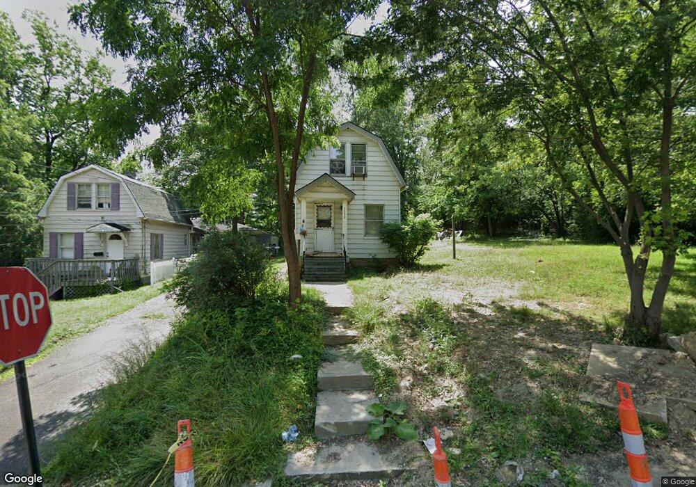
14426 Elm St Maple Heights, OH 44137
Estimated Value: $102,992 - $133,000
2
Beds
1
Bath
--
Sq Ft
9,453
Sq Ft Lot
About This Home
This home is located at 14426 Elm St, Maple Heights, OH 44137 and is currently estimated at $113,664. 14426 Elm St is a home located in Cuyahoga County with nearby schools including Abraham Lincoln Elementary School, Rockside/ J.F. Kennedy School, and Barack Obama School.
Ownership History
Date
Name
Owned For
Owner Type
Purchase Details
Closed on
Aug 5, 2024
Sold by
Wilcsek Randolph M
Bought by
Etlin Group Llc
Current Estimated Value
Purchase Details
Closed on
Dec 30, 2022
Sold by
Wilcsek Randolph M
Bought by
Wilcsek Randolph M
Purchase Details
Closed on
Jan 16, 2008
Sold by
Bartunek Dianne D
Bought by
Wilcsek Randolph M and Wilcsek Gayle
Purchase Details
Closed on
Dec 12, 1997
Sold by
Ballard Norma M
Bought by
Bartunek Dianne D
Purchase Details
Closed on
May 5, 1986
Sold by
Widmar Helen B
Bought by
Ballard Norma M
Purchase Details
Closed on
Jan 1, 1975
Bought by
Widmar Helen B
Create a Home Valuation Report for This Property
The Home Valuation Report is an in-depth analysis detailing your home's value as well as a comparison with similar homes in the area
Home Values in the Area
Average Home Value in this Area
Purchase History
| Date | Buyer | Sale Price | Title Company |
|---|---|---|---|
| Etlin Group Llc | $25,000 | None Listed On Document | |
| Wilcsek Randolph M | -- | None Listed On Document | |
| Wilcsek Randolph M | -- | Attorney | |
| Bartunek Dianne D | $50,000 | -- | |
| Ballard Norma M | $28,000 | -- | |
| Widmar Helen B | -- | -- |
Source: Public Records
Tax History Compared to Growth
Tax History
| Year | Tax Paid | Tax Assessment Tax Assessment Total Assessment is a certain percentage of the fair market value that is determined by local assessors to be the total taxable value of land and additions on the property. | Land | Improvement |
|---|---|---|---|---|
| 2024 | $2,671 | $26,320 | $10,430 | $15,890 |
| 2023 | $2,119 | $17,510 | $5,500 | $12,010 |
| 2022 | $2,113 | $17,500 | $5,495 | $12,005 |
| 2021 | $2,240 | $17,500 | $5,500 | $12,010 |
| 2020 | $1,944 | $13,270 | $4,170 | $9,100 |
| 2019 | $1,923 | $37,900 | $11,900 | $26,000 |
| 2018 | $1,846 | $13,270 | $4,170 | $9,100 |
| 2017 | $1,930 | $13,130 | $5,180 | $7,950 |
| 2016 | $1,859 | $13,130 | $5,180 | $7,950 |
| 2015 | $2,460 | $13,130 | $5,180 | $7,950 |
| 2014 | $2,460 | $13,550 | $5,360 | $8,190 |
Source: Public Records
Map
Nearby Homes
- 5251 Forest Ave
- 5220 Forest Ave
- 5197 Milo Ave
- 14305 Granger Rd
- 14567 Pease Rd
- 5100 Greenhurst Dr
- 15095 Granger Rd
- 13704 Linn Ave
- 5270 E 135th St
- 4955 E 141st St
- 15911 Friend Ave
- 5353 E 129th St
- 16174 Friendly St
- 14417 Corridon Ave
- 16241 Glenburn Ave
- 13008 Willard Ave
- 12913 Darlington Ave
- 13116 Oak Park Blvd
- 13009 Oak Park Blvd
- 13300 Shady Oak Blvd