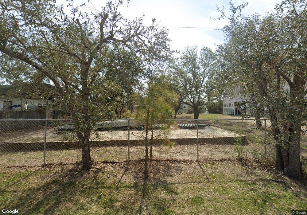
1443 Cedar Landing Rd SW Supply, NC 28462
Estimated Value: $334,000
2
Beds
1
Bath
424
Sq Ft
$788/Sq Ft
Est. Value
About This Home
This home is located at 1443 Cedar Landing Rd SW, Supply, NC 28462 and is currently estimated at $334,000, approximately $787 per square foot. 1443 Cedar Landing Rd SW is a home located in Brunswick County with nearby schools including Virginia Williamson Elementary School, Cedar Grove Middle School, and West Brunswick High School.
Ownership History
Date
Name
Owned For
Owner Type
Purchase Details
Closed on
Jan 19, 2023
Sold by
Anna A Hughes Revocable Trust
Bought by
Williamson Margaret H and Hughes Clay K
Current Estimated Value
Purchase Details
Closed on
Feb 9, 2018
Sold by
S And A Hughes Family Limited Partnershi
Bought by
S And A Hughes Family Limited Partnershi
Create a Home Valuation Report for This Property
The Home Valuation Report is an in-depth analysis detailing your home's value as well as a comparison with similar homes in the area
Home Values in the Area
Average Home Value in this Area
Purchase History
| Date | Buyer | Sale Price | Title Company |
|---|---|---|---|
| Williamson Margaret H | -- | -- | |
| Anna A Hughes Revocable Trust | -- | -- | |
| Williamson Margaret H | -- | None Listed On Document | |
| S And A Hughes Family Limited Partnershi | -- | None Available | |
| S And A Hughes Family Limited Partnershi | -- | None Available | |
| S And A Hughes Family Limited Partnershi | -- | None Available |
Source: Public Records
Tax History Compared to Growth
Tax History
| Year | Tax Paid | Tax Assessment Tax Assessment Total Assessment is a certain percentage of the fair market value that is determined by local assessors to be the total taxable value of land and additions on the property. | Land | Improvement |
|---|---|---|---|---|
| 2025 | -- | $315,930 | $300,000 | $15,930 |
| 2024 | $1,099 | $315,930 | $300,000 | $15,930 |
| 2023 | $1,060 | $344,090 | $300,000 | $44,090 |
| 2022 | $1,049 | $201,430 | $165,000 | $36,430 |
| 2021 | $1,060 | $201,430 | $165,000 | $36,430 |
| 2020 | $1,049 | $201,430 | $165,000 | $36,430 |
| 2019 | $1,049 | $180,290 | $165,000 | $15,290 |
| 2018 | $893 | $152,460 | $141,230 | $11,230 |
| 2017 | $1,460 | $240,830 | $229,600 | $11,230 |
| 2016 | $1,435 | $240,830 | $229,600 | $11,230 |
| 2015 | $1,435 | $275,350 | $229,600 | $45,750 |
| 2014 | $1,820 | $388,714 | $328,000 | $60,714 |
Source: Public Records
Map
Nearby Homes
- 155 Yacht Watch Dr
- 185 Yacht Watch Dr
- 173 Ocean Blvd W Unit A
- 127 Ocean Blvd W
- 0 Brunswick Ave W
- 122 Quinton St
- 3331 Holden Beach Rd SW
- 127 Halstead St
- 149 S Shore Dr
- 124 Halstead St
- 2916 Cherokee Ave SW
- 2928 John T Holden Rd SW
- 281 Brunswick Ave W Unit B
- 123 Brunswick Ave E
- 2923 Burnsville St SW
- 3003 Dave Ray St SW
- 142 Brunswick Ave E Unit A
- 142 Brunswick Ave E Unit B
- 287 Ocean Blvd W
- 297 Sand Piper Ln
- 1447 Cedar Landing Rd SW
- 1431 Cedar Landing Rd SW
- 1425 Cedar Landing Rd SW
- 3217 Brixley Way SW
- 3221 Brixley Way SW
- 3226 Brixley Way SW
- 1395 Cedar Landing Rd SW
- 1385 Cedar Landing Rd SW
- 180 Yacht Watch Dr
- 182 Yacht Watch Dr
- 184 Yacht Watch Dr
- 162 Yacht Watch Dr
- 156 Yacht Watch Dr
- 186 Yacht Watch Dr
- 160 Yacht Watch Dr
- 1386 Cedar Landing Rd SW
- 188 Yacht Watch Dr
- 158 Yacht Watch Dr
- 3123 Canalview St SW
- 192 Yacht Watch Dr
