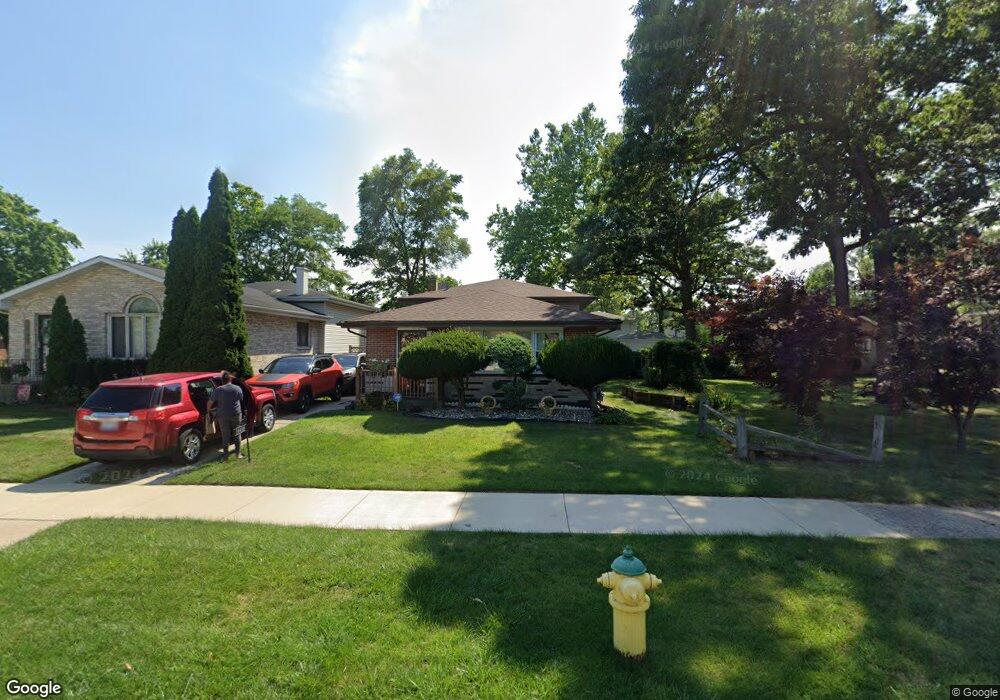
14430 Shepard Dr Dolton, IL 60419
Estimated Value: $156,441 - $200,000
3
Beds
2
Baths
1,141
Sq Ft
$156/Sq Ft
Est. Value
About This Home
This home is located at 14430 Shepard Dr, Dolton, IL 60419 and is currently estimated at $177,610, approximately $155 per square foot. 14430 Shepard Dr is a home located in Cook County with nearby schools including Berger-Vandenberg Elementary School, Creative Communications Academy, and School Of Fine Arts Academy.
Ownership History
Date
Name
Owned For
Owner Type
Purchase Details
Closed on
Apr 18, 2022
Sold by
Robinson Michele and Tinsley Walter
Bought by
Tinsley Walter and Robinson Michele
Current Estimated Value
Purchase Details
Closed on
Apr 6, 2022
Sold by
Robinson Michele and Tinsley Walter
Bought by
Tinsley Walter and Robinson Michele
Purchase Details
Closed on
Feb 4, 2022
Sold by
Robinson Ms Lawanda D
Bought by
Robinson Mrs Michele D
Purchase Details
Closed on
Jan 29, 2022
Sold by
Robinson Ms Lawanda D
Bought by
Robinson Mrs Michele D
Purchase Details
Closed on
Oct 21, 1996
Sold by
Powers Dolores
Bought by
Robinson Maxine
Home Financials for this Owner
Home Financials are based on the most recent Mortgage that was taken out on this home.
Original Mortgage
$43,000
Interest Rate
7.94%
Create a Home Valuation Report for This Property
The Home Valuation Report is an in-depth analysis detailing your home's value as well as a comparison with similar homes in the area
Home Values in the Area
Average Home Value in this Area
Purchase History
| Date | Buyer | Sale Price | Title Company |
|---|---|---|---|
| Tinsley Walter | -- | -- | |
| Tinsley Walter | -- | -- | |
| Robinson Mrs Michele D | $8,000 | -- | |
| Robinson Mrs Michele D | $8,000 | -- | |
| Robinson Maxine | $79,000 | Attorneys Natl Title Network |
Source: Public Records
Mortgage History
| Date | Status | Borrower | Loan Amount |
|---|---|---|---|
| Previous Owner | Robinson Maxine | $43,000 |
Source: Public Records
Tax History Compared to Growth
Tax History
| Year | Tax Paid | Tax Assessment Tax Assessment Total Assessment is a certain percentage of the fair market value that is determined by local assessors to be the total taxable value of land and additions on the property. | Land | Improvement |
|---|---|---|---|---|
| 2024 | $5,464 | $13,000 | $1,989 | $11,011 |
| 2023 | $4,238 | $13,000 | $1,989 | $11,011 |
| 2022 | $4,238 | $9,275 | $1,755 | $7,520 |
| 2021 | $5,429 | $11,213 | $1,755 | $9,458 |
| 2020 | $5,218 | $11,213 | $1,755 | $9,458 |
| 2019 | $3,313 | $7,973 | $1,638 | $6,335 |
| 2018 | $3,295 | $7,973 | $1,638 | $6,335 |
| 2017 | $3,159 | $7,973 | $1,638 | $6,335 |
| 2016 | $4,145 | $8,999 | $1,521 | $7,478 |
| 2015 | $3,926 | $8,999 | $1,521 | $7,478 |
| 2014 | $3,910 | $8,999 | $1,521 | $7,478 |
| 2013 | $4,297 | $10,164 | $1,521 | $8,643 |
Source: Public Records
Map
Nearby Homes
- 14418 Drexel Ave
- 14400 Shepard Dr
- 14333 Drexel Ave
- 14508 Ingleside Ave
- 14408 Lincoln Ave
- 14526 Cottage Grove Ave
- 14421 Murray Ave
- 14325 Ingleside Ave
- 14635 Greenwood Rd Unit B103
- 14640 Ingleside Ave
- 14647 Greenwood Rd Unit A312
- 14320 Dobson Ave
- 14411 Irving Ave
- 14221 Ingleside Ave
- 14502 Irving Ave
- 14429 Minerva Ave
- 933 E 142nd St
- 14326 Irving Ave
- 14644 Ellis Ave
- 14234 Minerva Ave
- 14422 Shepard Dr
- 14434 Shepard Dr
- 14459 Lincoln Ave
- 14457 Lincoln Ave
- 14463 Lincoln Ave
- 14465 Lincoln Ave
- 14453 Lincoln Ave
- 14438 Shepard Dr
- 14419 Cottage Grove Ave
- 14415 Maryland Ave
- 14415 Maryland Ave
- 14437 Shepard Dr
- 14467 Lincoln Ave
- 14414 Shepard Dr
- 14471 Lincoln Ave
- 14444 Shepard Dr
- 14475 Lincoln Ave
- 14400 Maryland Ave
- 14479 Lincoln Ave
- 14424 Drexel Ave