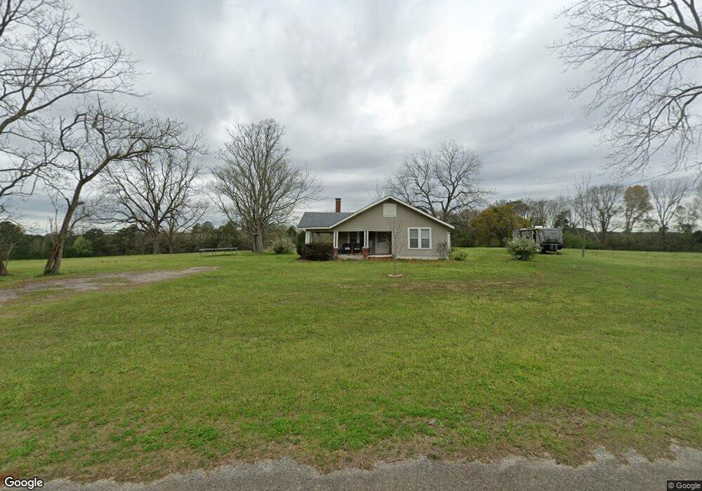
14437 Weant Rd Dozier, AL 36028
Estimated Value: $111,000 - $258,000
--
Bed
--
Bath
1,266
Sq Ft
$156/Sq Ft
Est. Value
About This Home
This home is located at 14437 Weant Rd, Dozier, AL 36028 and is currently estimated at $197,909, approximately $156 per square foot. 14437 Weant Rd is a home with nearby schools including Red Level Elementary School and Red Level High School.
Ownership History
Date
Name
Owned For
Owner Type
Purchase Details
Closed on
Jul 19, 2024
Sold by
Hayse Mark Allen and Hayse Janet Lynn
Bought by
Hayse Mark Allen and Hayse Janet Lynn
Current Estimated Value
Home Financials for this Owner
Home Financials are based on the most recent Mortgage that was taken out on this home.
Original Mortgage
$99,400
Outstanding Balance
$98,124
Interest Rate
6.99%
Mortgage Type
New Conventional
Estimated Equity
$99,785
Purchase Details
Closed on
Aug 2, 2007
Sold by
Hayse Albert J and Hayse Ruth J
Bought by
Hayse Mark Allen and Carlson Patricia Ellen
Create a Home Valuation Report for This Property
The Home Valuation Report is an in-depth analysis detailing your home's value as well as a comparison with similar homes in the area
Home Values in the Area
Average Home Value in this Area
Purchase History
| Date | Buyer | Sale Price | Title Company |
|---|---|---|---|
| Hayse Mark Allen | $90,000 | None Listed On Document | |
| Hayse Mark Allen | -- | None Available |
Source: Public Records
Mortgage History
| Date | Status | Borrower | Loan Amount |
|---|---|---|---|
| Open | Hayse Mark Allen | $99,400 |
Source: Public Records
Tax History Compared to Growth
Tax History
| Year | Tax Paid | Tax Assessment Tax Assessment Total Assessment is a certain percentage of the fair market value that is determined by local assessors to be the total taxable value of land and additions on the property. | Land | Improvement |
|---|---|---|---|---|
| 2024 | $794 | $29,400 | $17,460 | $11,940 |
| 2023 | $794 | $23,392 | $14,760 | $8,632 |
| 2022 | $529 | $19,604 | $12,300 | $7,304 |
| 2021 | $472 | $17,480 | $11,020 | $6,460 |
| 2020 | $473 | $17,500 | $11,040 | $6,460 |
| 2019 | $468 | $17,320 | $11,340 | $5,980 |
| 2018 | $448 | $16,580 | $10,600 | $5,980 |
| 2017 | $435 | $0 | $0 | $0 |
| 2016 | $171 | $0 | $0 | $0 |
| 2015 | $185 | $0 | $0 | $0 |
| 2014 | $148 | $0 | $0 | $0 |
| 2013 | $149 | $7,262 | $4,650 | $2,612 |
Source: Public Records
Map
Nearby Homes
- Boston Rd
- 30937 Rawls Point Rd
- 30959 Rawls Point Rd
- 2.9 Jasper Rd
- 30816 Wateredge Ln
- 15972 Bridge Creek Ln
- 14975 Pier 7 Rd
- 00 Pier 7 Rd
- 30779 Destiny Ln
- 7 Greenbriar Loop
- 15479 Birdhouse Rd
- 15495 Dunns Bridge Rd
- 16730 La Hanina Ln
- 29935 Twin Oaks Rd
- 00 Twin Oaks Rd
- 0 Twin Oaks Rd
- 16881 Canal Rd
- Lot 1 Sunshine Rd
- Lot 2 Sunshine Rd
- 31436 Riverview Rd
- 14558 Weant Rd
- 14213 Weant Rd
- 14740 Weant Rd
- 0 Roundtree Rd
- 15054 Weant Rd
- 14961 Weant Rd
- 32203 Taylor Rd
- 15262 Weant Rd
- 32191 Rawls School Rd
- 32131 Rawls School Rd
- 15242 Weant Rd
- 15294 Weant Rd
- 14857 Glen Ln
- 15261 Weant Rd
- 13542 Rowell Rd
- 15500 Weant Rd
- 32931 Rawls School Rd
- 31766 Wheeler Rd
- 14750 Sawyer Creek Rd
- 15850 Weant Rd