Estimated Value: $315,000 - $370,000
--
Bed
--
Bath
1,672
Sq Ft
$201/Sq Ft
Est. Value
About This Home
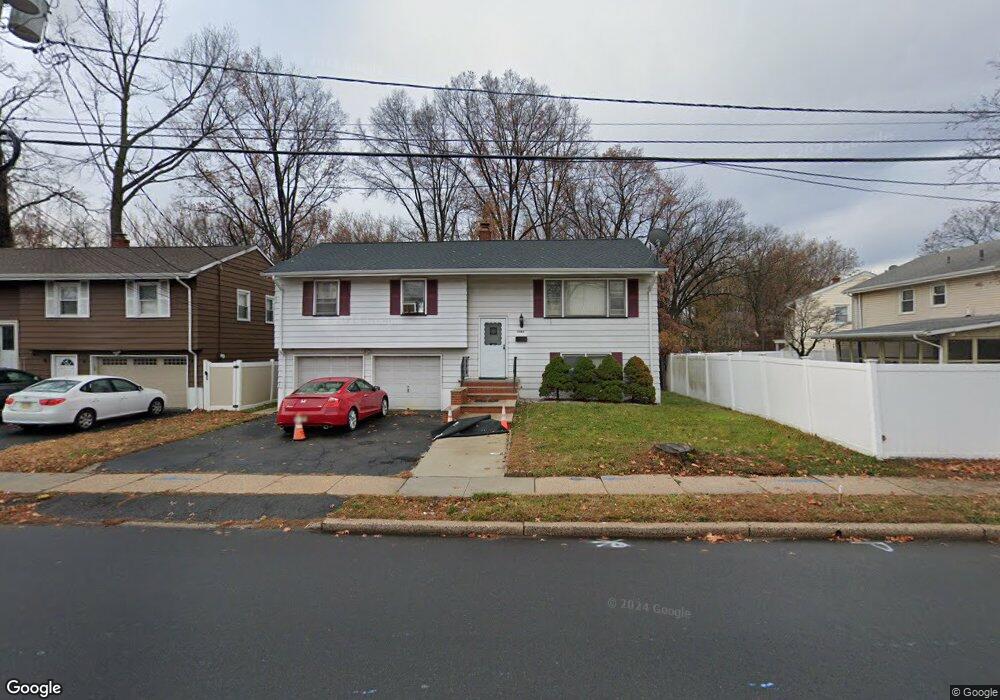
This home is located at 1444 Vauxhall Rd, Union, NJ 07083 and is currently estimated at $335,412, approximately $200 per square foot. 1444 Vauxhall Rd is a home located in Union County with nearby schools including Livingston Elementary School, Union High School, and St Michael Parish School.
Ownership History
Date
Name
Owned For
Owner Type
Purchase Details
Closed on
Jul 17, 2025
Sold by
Booker Paula and Booker Phillip G
Bought by
A & L Property Inc
Current Estimated Value
Home Financials for this Owner
Home Financials are based on the most recent Mortgage that was taken out on this home.
Original Mortgage
$394,500
Outstanding Balance
$330,376
Interest Rate
5.99%
Mortgage Type
Construction
Estimated Equity
$5,036
Purchase Details
Closed on
Jun 28, 2006
Sold by
Kakar Manu
Bought by
Booker Paula
Home Financials for this Owner
Home Financials are based on the most recent Mortgage that was taken out on this home.
Original Mortgage
$308,000
Interest Rate
8.75%
Mortgage Type
Adjustable Rate Mortgage/ARM
Purchase Details
Closed on
Apr 30, 2001
Sold by
Gibilisco Salvatore
Bought by
Kakar Subhash and Kakar Naini
Home Financials for this Owner
Home Financials are based on the most recent Mortgage that was taken out on this home.
Original Mortgage
$155,295
Interest Rate
6.85%
Mortgage Type
Stand Alone First
Create a Home Valuation Report for This Property
The Home Valuation Report is an in-depth analysis detailing your home's value as well as a comparison with similar homes in the area
Home Values in the Area
Average Home Value in this Area
Purchase History
| Date | Buyer | Sale Price | Title Company |
|---|---|---|---|
| A & L Property Inc | $325,000 | Rise Abstract | |
| A & L Property Inc | $325,000 | Rise Abstract | |
| Booker Paula | $385,000 | -- | |
| Kakar Subhash | $173,000 | -- |
Source: Public Records
Mortgage History
| Date | Status | Borrower | Loan Amount |
|---|---|---|---|
| Open | A & L Property Inc | $394,500 | |
| Previous Owner | Booker Paula | $308,000 | |
| Previous Owner | Kakar Subhash | $155,295 |
Source: Public Records
Tax History Compared to Growth
Tax History
| Year | Tax Paid | Tax Assessment Tax Assessment Total Assessment is a certain percentage of the fair market value that is determined by local assessors to be the total taxable value of land and additions on the property. | Land | Improvement |
|---|---|---|---|---|
| 2025 | $10,885 | $48,700 | $21,200 | $27,500 |
| 2024 | $10,553 | $48,700 | $21,200 | $27,500 |
| 2023 | $10,553 | $48,700 | $21,200 | $27,500 |
| 2022 | $10,186 | $48,700 | $21,200 | $27,500 |
| 2021 | $9,939 | $48,700 | $21,200 | $27,500 |
| 2020 | $9,741 | $48,700 | $21,200 | $27,500 |
| 2019 | $9,610 | $48,700 | $21,200 | $27,500 |
| 2018 | $9,446 | $48,700 | $21,200 | $27,500 |
| 2017 | $9,307 | $48,700 | $21,200 | $27,500 |
| 2016 | $9,080 | $48,700 | $21,200 | $27,500 |
| 2015 | $8,929 | $48,700 | $21,200 | $27,500 |
| 2014 | $8,729 | $48,700 | $21,200 | $27,500 |
Source: Public Records
Map
Nearby Homes
- 1393 Cornell Place
- 1322 Marcella Dr
- 1267 Erhardt St
- 1040 Cranbrook Rd
- 553 Harvard Ave
- 557 Yale Ave
- 507 Locust Ave
- 286 Mclean Place
- 314 Fitzpatrick St
- 142 Eastern Pkwy
- 292 Crann St
- 537 Us Highway 22
- 542 Leo St
- 525 Us Highway 22
- 617 Tillman St
- 105 Liberty Ct Unit 105
- 393 Harvard Ave
- 169 Valley View Rd
- 875 Salem Rd
- 365 Broadwell Ave
- 1400 Thelma Dr
- 1436 Vauxhall Rd
- 1436 Vauxhall Rd Unit 1
- 1404 Thelma Dr
- 1408 Thelma Dr
- 1412 Thelma Dr
- 1401 Thelma Dr
- 1455 Vauxhall Rd
- 1416 Thelma Dr
- 1409 Thelma Dr
- 1210 Faitoute Ave
- 1415 Thelma Dr
- 1420 Thelma Dr
- 1215 Roger Ave
- 1085 Robin Ln
- 1220 Faitoute Ave
- 1419 Thelma Dr
- 1210 Roger Ave
- 1426 Thelma Dr
- 1225 Roger Ave