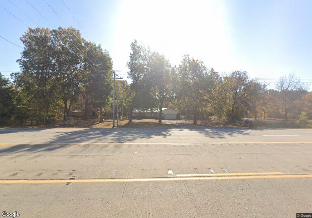
14445 Highway 62 Tahlequah, OK 74464
Estimated Value: $205,345 - $311,000
3
Beds
2
Baths
1,656
Sq Ft
$151/Sq Ft
Est. Value
About This Home
This home is located at 14445 Highway 62, Tahlequah, OK 74464 and is currently estimated at $249,586, approximately $150 per square foot. 14445 Highway 62 is a home located in Cherokee County with nearby schools including Cherokee Immersion Charter School.
Ownership History
Date
Name
Owned For
Owner Type
Purchase Details
Closed on
May 1, 2025
Sold by
Stafford Jim and Stafford Linda
Bought by
Ellis Bobby and Ellis Jamie
Current Estimated Value
Purchase Details
Closed on
Feb 19, 2010
Sold by
Lower Jr Forest Earnest and Lower Mary D
Bought by
Stafford Jim and Stafford Linda
Home Financials for this Owner
Home Financials are based on the most recent Mortgage that was taken out on this home.
Original Mortgage
$51,725
Interest Rate
5.11%
Mortgage Type
Purchase Money Mortgage
Create a Home Valuation Report for This Property
The Home Valuation Report is an in-depth analysis detailing your home's value as well as a comparison with similar homes in the area
Home Values in the Area
Average Home Value in this Area
Purchase History
| Date | Buyer | Sale Price | Title Company |
|---|---|---|---|
| Ellis Bobby | -- | None Listed On Document | |
| Ellis Bobby | -- | None Listed On Document | |
| Stafford Jim | $115,000 | None Available |
Source: Public Records
Mortgage History
| Date | Status | Borrower | Loan Amount |
|---|---|---|---|
| Previous Owner | Stafford Jim | $51,725 |
Source: Public Records
Tax History Compared to Growth
Tax History
| Year | Tax Paid | Tax Assessment Tax Assessment Total Assessment is a certain percentage of the fair market value that is determined by local assessors to be the total taxable value of land and additions on the property. | Land | Improvement |
|---|---|---|---|---|
| 2025 | $899 | $11,829 | $1,485 | $10,344 |
| 2024 | $899 | $12,310 | $1,925 | $10,385 |
| 2023 | $899 | $13,424 | $1,100 | $12,324 |
| 2022 | $1,007 | $13,424 | $1,100 | $12,324 |
| 2021 | $984 | $13,073 | $1,100 | $11,973 |
| 2020 | $973 | $12,692 | $1,100 | $11,592 |
| 2019 | $937 | $12,322 | $1,100 | $11,222 |
| 2018 | $949 | $12,322 | $1,100 | $11,222 |
| 2017 | $945 | $12,157 | $935 | $11,222 |
| 2016 | $994 | $12,762 | $1,540 | $11,222 |
| 2015 | $971 | $12,650 | $880 | $11,770 |
| 2014 | $971 | $12,650 | $880 | $11,770 |
Source: Public Records
Map
Nearby Homes
- 14650 W 835 Rd
- 13670 W 834 Rd
- 2 S 490 Rd
- 0 S 490 Rd
- 0 Hwy 62 Hwy Unit 2532149
- 0 Hwy 62 Hwy Unit 2532139
- 0 Hwy 62 Hwy Unit 2532141
- 0 Hwy 62 Hwy Unit 2532145
- 22781 S 490 Rd
- 16289 W 810 Rd
- 12910 W Southern Oaks St
- 12890 W Southern Oaks St
- 16920 W 828 Rd
- 16981 W 828 Rd
- 12219 U S 62
- 0 S Qualls Rd Unit 2543872
- 15451 W 791 Rd
- 11396 W Joyce Ln
- 27254 S 490 Rd
- 21887 Coffee Hollow Rd
- 14446 Highway 62
- 14355 Highway 62
- 14525 Highway 62
- 14285 W 835 Rd
- 14553 Highway 62
- 14553 Highway 62
- 14353 U S 62
- 14286 W 835 Rd
- 14320 W 835 Rd
- 14374 W 835 Rd
- 14424 W 835
- 14258 W 835 Rd
- 14434 W 835 Rd
- 14236 Cross Timbers Rd
- 14344 Highway 62
- 14470 W 835 Rd
- 14470 W 835 Rd
- 14521 W 835 Rd
- 14232 W 822 Rd
- 14213 Cross Timbers Rd