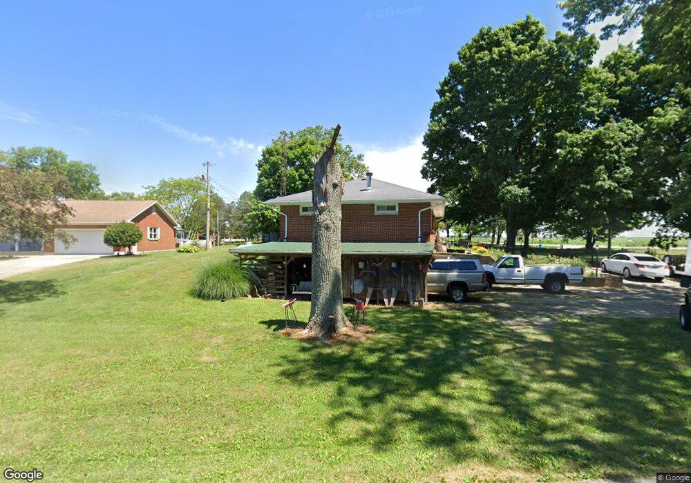
14449 Runor Dr Sidney, OH 45365
Estimated Value: $178,000 - $271,000
3
Beds
3
Baths
1,232
Sq Ft
$173/Sq Ft
Est. Value
About This Home
This home is located at 14449 Runor Dr, Sidney, OH 45365 and is currently estimated at $212,787, approximately $172 per square foot. 14449 Runor Dr is a home located in Shelby County with nearby schools including Sidney High School and Holy Angels Catholic School.
Ownership History
Date
Name
Owned For
Owner Type
Purchase Details
Closed on
Feb 1, 2022
Sold by
Sharrock Daniel M and Sharrock Tammie L
Bought by
Sharrock Family Irrevocable Trust
Current Estimated Value
Purchase Details
Closed on
May 21, 2020
Sold by
Sharrock Daniel M
Bought by
Sharrock Daniel M and Sharrock Tammie L
Home Financials for this Owner
Home Financials are based on the most recent Mortgage that was taken out on this home.
Original Mortgage
$96,000
Interest Rate
3.3%
Mortgage Type
New Conventional
Purchase Details
Closed on
Dec 22, 1998
Sold by
White Donald G
Bought by
Sharrock Daniel M and Sharrock Vonda K
Home Financials for this Owner
Home Financials are based on the most recent Mortgage that was taken out on this home.
Original Mortgage
$74,100
Interest Rate
6.96%
Mortgage Type
New Conventional
Purchase Details
Closed on
Dec 18, 1991
Bought by
White Donald G
Create a Home Valuation Report for This Property
The Home Valuation Report is an in-depth analysis detailing your home's value as well as a comparison with similar homes in the area
Purchase History
| Date | Buyer | Sale Price | Title Company |
|---|---|---|---|
| Sharrock Family Irrevocable Trust | -- | Durnell-Maier Elizabeth A | |
| Sharrock Daniel M | -- | None Available | |
| Sharrock Daniel M | $78,000 | -- | |
| White Donald G | $72,500 | -- |
Source: Public Records
Mortgage History
| Date | Status | Borrower | Loan Amount |
|---|---|---|---|
| Previous Owner | Sharrock Daniel M | $96,000 | |
| Previous Owner | Sharrock Daniel M | $74,100 |
Source: Public Records
Tax History
| Year | Tax Paid | Tax Assessment Tax Assessment Total Assessment is a certain percentage of the fair market value that is determined by local assessors to be the total taxable value of land and additions on the property. | Land | Improvement |
|---|---|---|---|---|
| 2024 | $1,700 | $48,490 | $7,950 | $40,540 |
| 2023 | $1,670 | $48,490 | $7,950 | $40,540 |
| 2022 | $1,462 | $36,780 | $6,460 | $30,320 |
| 2021 | $1,477 | $36,780 | $6,460 | $30,320 |
| 2020 | $1,476 | $36,780 | $6,460 | $30,320 |
| 2019 | $1,209 | $30,350 | $5,370 | $24,980 |
| 2018 | $1,185 | $30,350 | $5,370 | $24,980 |
| 2017 | $1,192 | $30,350 | $5,370 | $24,980 |
| 2016 | $1,160 | $29,570 | $4,470 | $25,100 |
| 2015 | $1,163 | $29,570 | $4,470 | $25,100 |
| 2014 | $1,163 | $29,570 | $4,470 | $25,100 |
| 2013 | $1,160 | $27,680 | $4,470 | $23,210 |
Source: Public Records
Map
Nearby Homes
- 0 County Road 25 Unit A LotWP001
- 4050 River Rd
- --- Childrens Home Rd
- 1843 Westlake Dr
- 1538 Westwood Dr
- 1162 Ontario Ct
- 1680 Wildwood Ct
- 1330 Maple Leaf Ct
- 1252 Spruce Ave
- 1216 Superior Ct
- 1502 Cumberland Ave
- 00 Fair Rd
- 1151 Westwood Dr
- 1780 Creekside Ct
- 1756 Creekside Ct
- 1788 Creekside Ct
- 1768 Creekside Ct
- 1774 Creekside Ct
- 2423 Cole Ct
- 2417 Cole Ct
- 3043 County Road 25a S
- 14441 Runor Dr
- 14441 Runor Dr
- 2999 County Road 25a S
- 3061 County Road 25a S
- 14444 Woodlawn Dr
- 14414 Runor Dr
- 2969 Co Rd 25a
- 2969 County Road 25a S
- 3081 County Road 25a S
- 14413 Runor Dr
- 14411 Woodlawn Dr
- 2941 County Road 25a S
- 14400 Runor Dr
- 14401 Runor Dr
- 14381 Woodlawn Dr
- 14400 Woodlawn Dr
- 2911 County Road 25a S
- 14384 Runor Dr
- 14363 Woodlawn Dr
Your Personal Tour Guide
Ask me questions while you tour the home.