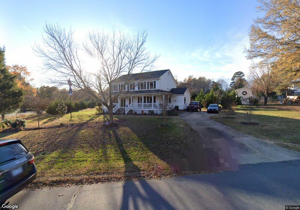
14462 Hackamore Dr Matthews, NC 28105
Estimated Value: $485,000 - $519,000
4
Beds
3
Baths
2,502
Sq Ft
$201/Sq Ft
Est. Value
About This Home
This home is located at 14462 Hackamore Dr, Matthews, NC 28105 and is currently estimated at $503,140, approximately $201 per square foot. 14462 Hackamore Dr is a home located in Mecklenburg County with nearby schools including Mint Hill Middle School, Butler High School, and Matthews Charter Academy.
Ownership History
Date
Name
Owned For
Owner Type
Purchase Details
Closed on
Feb 14, 2011
Sold by
Smith Dale and Posey Robert
Bought by
Hayes Curtis B and Hayes Linda J
Current Estimated Value
Home Financials for this Owner
Home Financials are based on the most recent Mortgage that was taken out on this home.
Original Mortgage
$102,500
Outstanding Balance
$70,271
Interest Rate
4.82%
Mortgage Type
New Conventional
Estimated Equity
$432,869
Create a Home Valuation Report for This Property
The Home Valuation Report is an in-depth analysis detailing your home's value as well as a comparison with similar homes in the area
Home Values in the Area
Average Home Value in this Area
Purchase History
| Date | Buyer | Sale Price | Title Company |
|---|---|---|---|
| Hayes Curtis B | $182,500 | None Available |
Source: Public Records
Mortgage History
| Date | Status | Borrower | Loan Amount |
|---|---|---|---|
| Open | Hayes Curtis B | $102,500 |
Source: Public Records
Tax History
| Year | Tax Paid | Tax Assessment Tax Assessment Total Assessment is a certain percentage of the fair market value that is determined by local assessors to be the total taxable value of land and additions on the property. | Land | Improvement |
|---|---|---|---|---|
| 2025 | $3,368 | $442,700 | $108,000 | $334,700 |
| 2024 | $3,368 | $442,700 | $108,000 | $334,700 |
| 2023 | $3,319 | $442,700 | $108,000 | $334,700 |
| 2022 | $2,741 | $296,300 | $72,000 | $224,300 |
| 2021 | $2,741 | $296,300 | $72,000 | $224,300 |
| 2020 | $2,697 | $296,300 | $72,000 | $224,300 |
| 2019 | $2,691 | $296,300 | $72,000 | $224,300 |
| 2018 | $2,260 | $189,500 | $48,100 | $141,400 |
| 2017 | $2,214 | $189,500 | $48,100 | $141,400 |
| 2016 | $2,211 | $189,500 | $48,100 | $141,400 |
| 2015 | $2,207 | $189,500 | $48,100 | $141,400 |
| 2014 | $2,477 | $217,300 | $52,500 | $164,800 |
Source: Public Records
Map
Nearby Homes
- 2909 Oakcroft Dr
- 14040 Hackamore Dr
- 14010 Mareshead Ln
- 3210 Timber Mill Dr
- 14515 Davis Trace Dr
- 2826 Barnard Castle Ln
- 4212 Lawrence Daniel Dr
- 3011 Winding Trail
- 5153 Blackberry Ln
- 13730 Capriole Ln
- 1419 Vickery Dr
- 14818 Hooks Rd
- 4006 Scarlet Dr Unit 29
- 219 Falcon Ridge
- 2415 Kimway Dr
- 1204 Afternoon Sun Rd
- 5401 Stevens Mill Rd
- 5419 Stevens Mill Rd
- 13657 Idlewild Rd
- 13547 Idlefield Ln
- 2024 Light Brigade Dr
- 14438 Pommel Ln
- 14428 Pommel Ln
- 1930 Light Brigade Dr
- 2032 Light Brigade Dr
- 2032 Light Brigade Dr Unit 13
- 2013 Light Brigade Dr
- 2001 Light Brigade Dr
- 2001 Light Brigade Dr Unit L3 BU
- 2025 Light Brigade Dr
- 14420 Pommel Ln
- 14420 Pommel Ln Unit 19
- 1922 Light Brigade Dr
- 1927 Light Brigade Dr
- 14435 Pommel Ln
- 2101 Light Brigade Dr
- 2310 Triple Crown Ct
- 2110 Light Brigade Dr
- 1914 Light Brigade Dr
- 2320 Triple Crown Ct
Your Personal Tour Guide
Ask me questions while you tour the home.