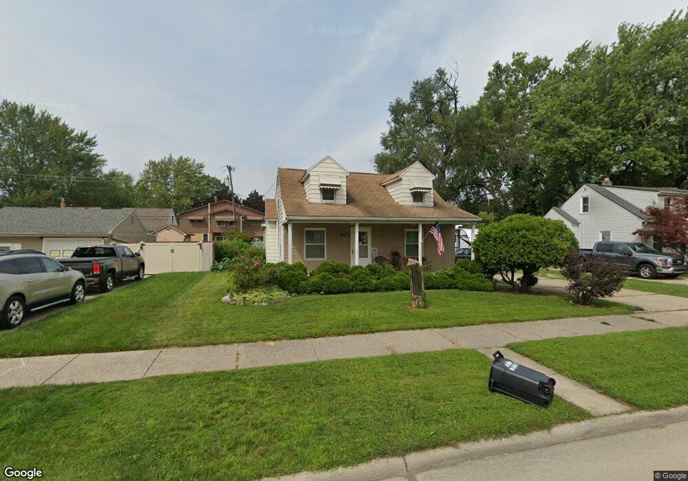
14464 Agnes St Southgate, MI 48195
Estimated Value: $186,000 - $211,534
3
Beds
1
Bath
1,369
Sq Ft
$145/Sq Ft
Est. Value
About This Home
This home is located at 14464 Agnes St, Southgate, MI 48195 and is currently estimated at $198,634, approximately $145 per square foot. 14464 Agnes St is a home located in Wayne County with nearby schools including Fordline Elementary School, Davidson Middle School, and Southgate Anderson High School.
Ownership History
Date
Name
Owned For
Owner Type
Purchase Details
Closed on
Sep 6, 2006
Sold by
Abn Amro Mortgage Group Inc
Bought by
Call Ii William D
Current Estimated Value
Purchase Details
Closed on
Oct 6, 2004
Sold by
Taylor Christopher L
Bought by
Abn Amro Mortgage Group Inc
Purchase Details
Closed on
Oct 8, 2003
Sold by
Taylor Christopher L
Bought by
Abn Amro Mortgage Group Inc
Purchase Details
Closed on
May 31, 2002
Sold by
Moody Jerrill R
Bought by
Taylor Christopher L
Home Financials for this Owner
Home Financials are based on the most recent Mortgage that was taken out on this home.
Original Mortgage
$123,028
Interest Rate
6.8%
Create a Home Valuation Report for This Property
The Home Valuation Report is an in-depth analysis detailing your home's value as well as a comparison with similar homes in the area
Home Values in the Area
Average Home Value in this Area
Purchase History
| Date | Buyer | Sale Price | Title Company |
|---|---|---|---|
| Call Ii William D | $89,000 | Attorneys Title Agency Llc | |
| Abn Amro Mortgage Group Inc | $147,946 | -- | |
| Abn Amro Mortgage Group Inc | $130,218 | -- | |
| Taylor Christopher L | $124,000 | -- |
Source: Public Records
Mortgage History
| Date | Status | Borrower | Loan Amount |
|---|---|---|---|
| Previous Owner | Taylor Christopher L | $123,028 |
Source: Public Records
Tax History Compared to Growth
Tax History
| Year | Tax Paid | Tax Assessment Tax Assessment Total Assessment is a certain percentage of the fair market value that is determined by local assessors to be the total taxable value of land and additions on the property. | Land | Improvement |
|---|---|---|---|---|
| 2025 | $2,475 | $99,600 | $0 | $0 |
| 2024 | $2,475 | $93,000 | $0 | $0 |
| 2023 | $2,357 | $84,200 | $0 | $0 |
| 2022 | $2,724 | $75,900 | $0 | $0 |
| 2021 | $2,652 | $68,700 | $0 | $0 |
| 2020 | $2,608 | $61,300 | $0 | $0 |
| 2019 | $2,576 | $56,100 | $0 | $0 |
| 2018 | $2,608 | $49,200 | $0 | $0 |
| 2017 | $1,147 | $46,000 | $0 | $0 |
| 2016 | $2,385 | $45,100 | $0 | $0 |
| 2015 | $4,067 | $43,700 | $0 | $0 |
| 2013 | $3,940 | $41,200 | $0 | $0 |
| 2012 | $2,394 | $38,800 | $8,100 | $30,700 |
Source: Public Records
Map
Nearby Homes
- 14548 Pearl St
- 14370 Pearl St
- 14567 Longtin St
- 14620 Trenton Rd
- 14268 Trenton Rd
- 14618 Fordline St
- 13847 Helen St
- 14555 Burns St
- 13787 Irene St
- 13728 Agnes St
- 13532 Mercier St
- 0 Poplar St
- 13460 Chestnut St
- 13440 Phelps St
- 13480 Argyle St
- 13632 Pearl St
- 14834 Kennebec St
- 14706 Eureka Rd
- 14791 Windermere St
- 13650 Jobin St
- 14500 Agnes St
- 14440 Agnes St
- 14453 Pearl St
- 14477 Pearl St
- 14429 Pearl St
- 14495 Pearl St
- 14435 Agnes St
- 14465 Agnes St
- 14524 Agnes St
- 14410 Agnes St
- 14507 Pearl St
- 14405 Pearl St
- 14489 Agnes St
- 14407 Agnes St
- 14509 Agnes St
- 14375 Pearl St
- 14548 Agnes St
- 14525 Agnes St
- 14428 Longtin St
- 14428 Longtin St