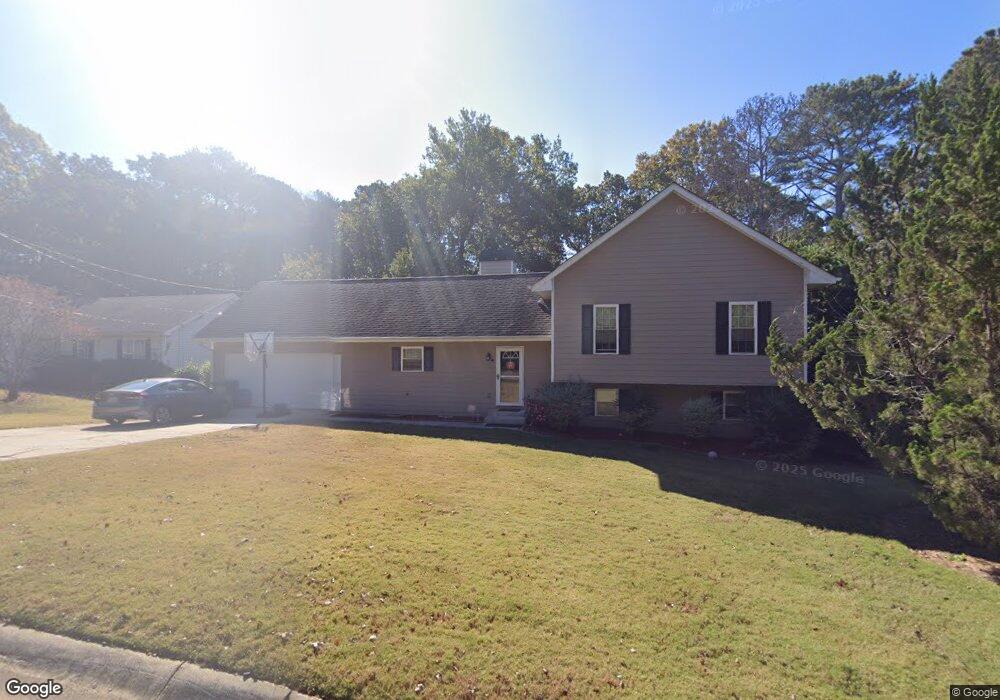
1447 George Dr SE Unit 5 Conyers, GA 30013
Estimated Value: $219,000 - $306,000
3
Beds
3
Baths
1,830
Sq Ft
$146/Sq Ft
Est. Value
About This Home
This home is located at 1447 George Dr SE Unit 5, Conyers, GA 30013 and is currently estimated at $267,563, approximately $146 per square foot. 1447 George Dr SE Unit 5 is a home located in Rockdale County with nearby schools including Flat Shoals Elementary School, Memorial Middle School, and Salem High School.
Ownership History
Date
Name
Owned For
Owner Type
Purchase Details
Closed on
Dec 11, 2015
Sold by
Richardson Taylor Darrell
Bought by
Davis Gia Baker
Current Estimated Value
Home Financials for this Owner
Home Financials are based on the most recent Mortgage that was taken out on this home.
Original Mortgage
$132,554
Outstanding Balance
$108,351
Interest Rate
4.5%
Mortgage Type
FHA
Estimated Equity
$159,212
Purchase Details
Closed on
Sep 27, 2013
Sold by
Hull Catherine B
Bought by
Richardson Taylor Darell
Home Financials for this Owner
Home Financials are based on the most recent Mortgage that was taken out on this home.
Original Mortgage
$54,375
Interest Rate
4.53%
Mortgage Type
New Conventional
Purchase Details
Closed on
Oct 15, 2009
Sold by
Hull Richard N
Bought by
Hull Catherine B
Create a Home Valuation Report for This Property
The Home Valuation Report is an in-depth analysis detailing your home's value as well as a comparison with similar homes in the area
Home Values in the Area
Average Home Value in this Area
Purchase History
| Date | Buyer | Sale Price | Title Company |
|---|---|---|---|
| Davis Gia Baker | $135,000 | -- | |
| Richardson Taylor Darell | $72,500 | -- | |
| Hull Catherine B | -- | -- |
Source: Public Records
Mortgage History
| Date | Status | Borrower | Loan Amount |
|---|---|---|---|
| Open | Davis Gia Baker | $132,554 | |
| Previous Owner | Richardson Taylor Darell | $54,375 |
Source: Public Records
Tax History Compared to Growth
Tax History
| Year | Tax Paid | Tax Assessment Tax Assessment Total Assessment is a certain percentage of the fair market value that is determined by local assessors to be the total taxable value of land and additions on the property. | Land | Improvement |
|---|---|---|---|---|
| 2024 | $5,515 | $139,600 | $23,440 | $116,160 |
| 2023 | $4,804 | $118,160 | $22,680 | $95,480 |
| 2022 | $3,404 | $82,880 | $12,800 | $70,080 |
| 2021 | $2,561 | $62,400 | $8,320 | $54,080 |
| 2020 | $2,659 | $62,400 | $8,320 | $54,080 |
| 2019 | $2,354 | $52,440 | $5,400 | $47,040 |
| 2018 | $2,285 | $50,680 | $5,400 | $45,280 |
| 2017 | $2,048 | $45,000 | $5,400 | $39,600 |
| 2016 | $2,048 | $45,000 | $5,400 | $39,600 |
| 2015 | $529 | $33,200 | $5,400 | $27,800 |
| 2014 | $5 | $13,880 | $4,360 | $9,520 |
| 2013 | -- | $34,316 | $7,200 | $27,116 |
Source: Public Records
Map
Nearby Homes
- 2193 Kings Forest Dr SE
- 2215 Kings Forest Dr SE
- 2225 Kings Forest Dr SE
- 2235 Kings Forest Dr SE
- 2165 Old Salem Rd SE
- 2259 Old Salem Rd SE
- 2239 Mission Ridge Dr SE
- 1896 Poplar St SE
- 0 Flat Shoals Rd SE
- 1975 Flat Shoals Rd SE
- 00 Flat Shoals Rd SE
- 2270 Flat Shoals Rd SE
- 1613 Brentwood Crossing SE Unit 3
- 1819 Dawn Rd Unit 16
- 1823 Dawn Rd Unit 18
- 1260 White Oak St SE
- 2405 Old Salem Rd SE Unit 1
- Ivey Plan at Shoals Crossing
- Evergreen Plan at Shoals Crossing
- Hanover Plan at Shoals Crossing
- 1447 George Dr SE
- 1459 George Dr SE
- 1459 George Dr SE Unit 1459
- 1439 George Dr SE
- 1442 George Dr SE
- 1427 George Dr SE
- 1467 George Dr SE
- 1448 George Dr SE
- 0 George Dr SE Unit 7489206
- 0 George Dr SE Unit 8110559
- 0 George Dr SE Unit 7225799
- 0 George Dr SE Unit 7024217
- 0 George Dr SE Unit 7463365
- 0 George Dr SE Unit 7202125
- 0 George Dr SE Unit 8557785
- 0 George Dr SE Unit 3244307
- 1460 George Dr SE
- 1430 George Dr SE
- 2150 Old Salem Rd SE
- 1479 George Dr SE