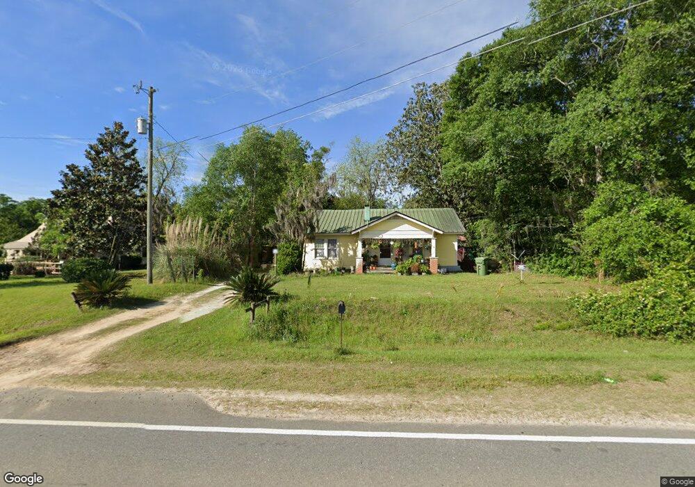
1447 Old Doerun Rd Moultrie, GA 31768
Estimated Value: $97,864 - $136,000
--
Bed
1
Bath
1,614
Sq Ft
$72/Sq Ft
Est. Value
About This Home
This home is located at 1447 Old Doerun Rd, Moultrie, GA 31768 and is currently estimated at $115,716, approximately $71 per square foot. 1447 Old Doerun Rd is a home located in Colquitt County with nearby schools including Doerun Elementary School, C.A. Gray Junior High School, and Willie J. Williams Middle School.
Ownership History
Date
Name
Owned For
Owner Type
Purchase Details
Closed on
Apr 23, 2021
Sold by
Orgaz Domitila Mendoza
Bought by
Mendoza Alexis R Gomez
Current Estimated Value
Purchase Details
Closed on
Apr 26, 2011
Sold by
Rodriguez Gonzalo
Bought by
Orgaz Domitila Mendoza
Purchase Details
Closed on
Mar 21, 2003
Sold by
Edge Steven D
Bought by
Rodriguez Gonzalo
Purchase Details
Closed on
Jul 16, 2002
Sold by
Edge Minnie B Est
Bought by
Edge Steven D
Purchase Details
Closed on
Aug 23, 1968
Bought by
Edge Minnie B
Create a Home Valuation Report for This Property
The Home Valuation Report is an in-depth analysis detailing your home's value as well as a comparison with similar homes in the area
Home Values in the Area
Average Home Value in this Area
Purchase History
| Date | Buyer | Sale Price | Title Company |
|---|---|---|---|
| Mendoza Alexis R Gomez | -- | -- | |
| Orgaz Domitila Mendoza | $24,000 | -- | |
| Rodriguez Gonzalo | $24,000 | -- | |
| Edge Steven D | -- | -- | |
| Edge Minnie B | $7,000 | -- |
Source: Public Records
Tax History Compared to Growth
Tax History
| Year | Tax Paid | Tax Assessment Tax Assessment Total Assessment is a certain percentage of the fair market value that is determined by local assessors to be the total taxable value of land and additions on the property. | Land | Improvement |
|---|---|---|---|---|
| 2024 | $658 | $33,792 | $1,440 | $32,352 |
| 2023 | $713 | $14,208 | $1,440 | $12,768 |
| 2022 | $276 | $11,576 | $1,440 | $10,136 |
| 2021 | $241 | $9,920 | $1,440 | $8,480 |
| 2020 | $245 | $9,920 | $1,440 | $8,480 |
| 2019 | $269 | $9,768 | $1,440 | $8,328 |
| 2018 | $250 | $9,768 | $1,440 | $8,328 |
| 2017 | $266 | $9,768 | $1,440 | $8,328 |
| 2016 | $269 | $9,768 | $1,440 | $8,328 |
| 2015 | $272 | $9,768 | $1,440 | $8,328 |
| 2014 | $267 | $9,768 | $1,440 | $8,328 |
| 2013 | -- | $9,767 | $1,440 | $8,327 |
Source: Public Records
Map
Nearby Homes
- 1208 Maple St
- 722 Martin Luther King jr Dr
- 15,23,27 29th Ave NW
- 0 S U Highway 319 N
- 107 30th Ave NW
- 417 9th St NW
- 316 5th Ave NW
- 615 1st St NW
- 521 5th Ave NW
- 410 W Bypass Pass NW
- 408 9th St NW
- 503 2nd St NW
- 410 West Bypass NW
- 614 2nd Ave NW
- 1321 Hallmark Dr
- 610 1st Ave NW
- 3233 Sylvester Dr
- 00 1st Ave SW
- 310 1st Ave SW
- 618 2nd Ave SW
- 1433 Old Doerun Rd
- 1465 Old Doerun Rd
- 1488 Old Doerun Rd
- 1500 Old Doerun Rd
- 298 W Bypass
- 1512 Old Doerun Rd
- 1538 Old Doerun Rd
- 12 Willow Ln
- 10 Willow Ln
- 16 Willow Ln
- 14 Willow Ln
- 629 Oak Cir
- 1218 Elliott Brown St
- 1558 Old Doerun Rd
- 17 Willow Ln
- 627 Oak Cir
- 1216 Elliott Brown St
- 1315 Old Doerun Rd
- 13 Willow Ln
- 625 Oak Cir