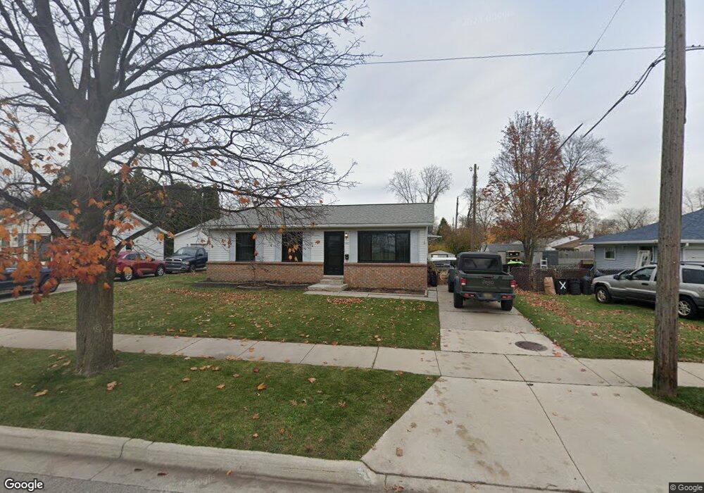
1447 Reid Ave Port Huron, MI 48060
Estimated Value: $129,000 - $145,000
3
Beds
1
Bath
940
Sq Ft
$147/Sq Ft
Est. Value
About This Home
This home is located at 1447 Reid Ave, Port Huron, MI 48060 and is currently estimated at $138,048, approximately $146 per square foot. 1447 Reid Ave is a home located in St. Clair County with nearby schools including Michigamme Elementary School, Central Middle School, and Port Huron High School.
Ownership History
Date
Name
Owned For
Owner Type
Purchase Details
Closed on
Oct 30, 2020
Sold by
Weber Michael W and Lowe Susan K
Bought by
Sisk Christopher
Current Estimated Value
Home Financials for this Owner
Home Financials are based on the most recent Mortgage that was taken out on this home.
Original Mortgage
$72,000
Interest Rate
2.7%
Mortgage Type
New Conventional
Create a Home Valuation Report for This Property
The Home Valuation Report is an in-depth analysis detailing your home's value as well as a comparison with similar homes in the area
Home Values in the Area
Average Home Value in this Area
Purchase History
| Date | Buyer | Sale Price | Title Company |
|---|---|---|---|
| Sisk Christopher | $90,000 | Amrock |
Source: Public Records
Mortgage History
| Date | Status | Borrower | Loan Amount |
|---|---|---|---|
| Previous Owner | Sisk Christopher | $72,000 |
Source: Public Records
Tax History Compared to Growth
Tax History
| Year | Tax Paid | Tax Assessment Tax Assessment Total Assessment is a certain percentage of the fair market value that is determined by local assessors to be the total taxable value of land and additions on the property. | Land | Improvement |
|---|---|---|---|---|
| 2025 | $1,942 | $58,600 | $0 | $0 |
| 2024 | $1,893 | $56,600 | $0 | $0 |
| 2023 | $1,789 | $50,600 | $0 | $0 |
| 2022 | $1,878 | $44,100 | $0 | $0 |
| 2021 | $1,744 | $40,200 | $0 | $0 |
| 2020 | $1,687 | $38,300 | $38,300 | $0 |
| 2019 | $1,187 | $27,800 | $0 | $0 |
| 2018 | $1,160 | $27,800 | $0 | $0 |
| 2016 | $880 | $25,400 | $0 | $0 |
| 2015 | $863 | $25,400 | $25,400 | $0 |
| 2014 | $863 | $24,300 | $24,300 | $0 |
| 2013 | -- | $23,700 | $0 | $0 |
Source: Public Records
Map
Nearby Homes
- 1403 Catherine McAuley Dr
- 2752 Military St
- 2718 Electric Ave
- 3136 Military St
- 2704 Military St
- 9999 Cleveland Ave
- 2627 24th St
- 2444 Military St
- 2506 Vanness St
- 2513 Vanness St
- Lot 3 24th St
- 2411 26th St
- 2600 Vanness St
- 2203 VL Railroad St
- 2200 VL Railroad St
- 2702 Vanness St
- 1127 Minnie St
- 2023 23rd St
- 1831 11th St
- 1325 Division St
- 1451 Reid Ave
- 2899 Mason Ave
- 1505 Reid Ave
- 2895 Mason Ave
- 1509 Reid Ave
- 2894 W Rick Dr
- 2893 Mason Ave Unit Bldg-Unit
- 2893 Mason Ave
- 2891 Mason Ave
- 1515 Reid Ave
- 1510 W Rick Ct
- 2896 Mason Ave
- 2889 Mason Ave
- 2889 Mason Ave
- 2898 Mason Ave
- 2894 Mason Ave
- 1521 Reid Ave
- 2886 W Rick Dr
- 1505 W Rick Ct
- 2892 Mason Ave