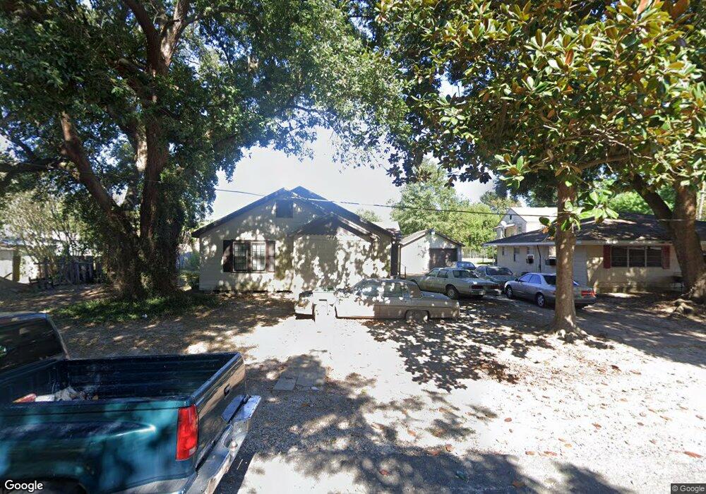
1448 Carroll Ave Port Arthur, TX 77642
Estimated Value: $63,000 - $111,000
3
Beds
3
Baths
1,822
Sq Ft
$52/Sq Ft
Est. Value
About This Home
This home is located at 1448 Carroll Ave, Port Arthur, TX 77642 and is currently estimated at $94,664, approximately $51 per square foot. 1448 Carroll Ave is a home located in Jefferson County with nearby schools including Travis Elementary School, Jefferson Middle School, and Memorial High School.
Ownership History
Date
Name
Owned For
Owner Type
Purchase Details
Closed on
Nov 25, 2008
Sold by
Bescher Mary Ann
Bought by
Bobino Romonia M
Current Estimated Value
Home Financials for this Owner
Home Financials are based on the most recent Mortgage that was taken out on this home.
Original Mortgage
$49,730
Outstanding Balance
$33,447
Interest Rate
6.5%
Mortgage Type
FHA
Estimated Equity
$61,217
Create a Home Valuation Report for This Property
The Home Valuation Report is an in-depth analysis detailing your home's value as well as a comparison with similar homes in the area
Home Values in the Area
Average Home Value in this Area
Purchase History
| Date | Buyer | Sale Price | Title Company |
|---|---|---|---|
| Bobino Romonia M | -- | None Available |
Source: Public Records
Mortgage History
| Date | Status | Borrower | Loan Amount |
|---|---|---|---|
| Open | Bobino Romonia M | $49,730 |
Source: Public Records
Tax History Compared to Growth
Tax History
| Year | Tax Paid | Tax Assessment Tax Assessment Total Assessment is a certain percentage of the fair market value that is determined by local assessors to be the total taxable value of land and additions on the property. | Land | Improvement |
|---|---|---|---|---|
| 2025 | $238 | $81,842 | -- | -- |
| 2024 | $238 | $74,402 | -- | -- |
| 2023 | $238 | $67,638 | $0 | $0 |
| 2022 | $1,953 | $61,489 | $0 | $0 |
| 2021 | $1,853 | $55,899 | $3,500 | $52,399 |
| 2020 | $164 | $54,411 | $3,500 | $50,911 |
| 2019 | $1,626 | $51,020 | $3,500 | $47,520 |
| 2018 | $148 | $51,020 | $3,500 | $47,520 |
| 2017 | $1,581 | $51,020 | $3,500 | $47,520 |
| 2016 | $1,495 | $51,020 | $3,500 | $47,520 |
| 2015 | $1,523 | $51,020 | $3,500 | $47,520 |
| 2014 | $1,523 | $51,020 | $3,500 | $47,520 |
Source: Public Records
Map
Nearby Homes
- 3945 12th St
- 4100 Dryden Rd
- 2129 Neches Ave
- 2301 Glenwood Dr
- 0 5th St
- 1349 Jefferson Dr
- 2325 Oaklawn Ave
- 3326 Thomas Blvd
- 2515 Glenwood Dr
- 3512 7th St
- 2515 Date St
- 3300 9th St
- 3401 6th St
- 3439 5th St
- LOT 55 Royal Meadows Estate
- 3123 13th St
- 3118 14th St
- 2323 7th Ave
- 3737 Lakeshore Dr
- 2621 Evergreen Dr
- 3960 Brinkman Dr
- 3966 Brinkman Dr
- 3966 Brinkman Dr Unit Almost All Bills Pai
- 3952 Brinkman Dr
- 3972 Brinkman Dr
- 3959 13th St
- 3932 Brinkman Dr
- 3965 13th St
- 3951 13th St
- 1425 12th Ave
- 3975 13th St
- 3980 Brinkman Dr
- 3926 Brinkman Dr
- 3985 13th St
- 3949 13th St
- 3963 Brinkman Dr
- 3969 Brinkman Dr
- 3920 Brinkman Dr
- 3951 Brinkman Dr
- 3991 13th St