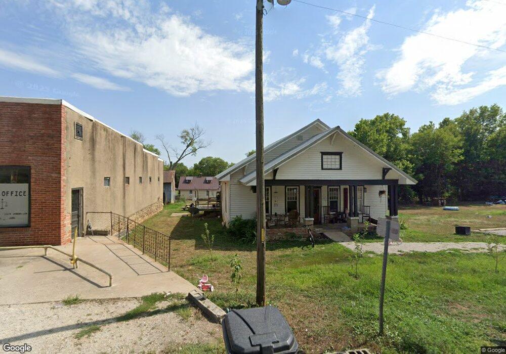
14480 E Spur N Stockton, MO 65785
Estimated Value: $186,919 - $195,000
3
Beds
1
Bath
1,998
Sq Ft
$96/Sq Ft
Est. Value
About This Home
This home is located at 14480 E Spur N, Stockton, MO 65785 and is currently estimated at $191,230, approximately $95 per square foot. 14480 E Spur N is a home located in Cedar County with nearby schools including Stockton Elementary School, Stockton Middle School, and Stockton High School.
Ownership History
Date
Name
Owned For
Owner Type
Purchase Details
Closed on
Jan 2, 2024
Sold by
Tighe Michael A and Tighe Alexis H
Bought by
Dehart Johnathon Dean
Current Estimated Value
Home Financials for this Owner
Home Financials are based on the most recent Mortgage that was taken out on this home.
Original Mortgage
$112,000
Outstanding Balance
$109,966
Interest Rate
7.29%
Mortgage Type
New Conventional
Estimated Equity
$81,264
Purchase Details
Closed on
May 18, 2017
Sold by
Dambrosio David J and Dambrosio Rhonda J
Bought by
Rustic River Restaurant Llc
Create a Home Valuation Report for This Property
The Home Valuation Report is an in-depth analysis detailing your home's value as well as a comparison with similar homes in the area
Purchase History
| Date | Buyer | Sale Price | Title Company |
|---|---|---|---|
| Dehart Johnathon Dean | -- | None Listed On Document | |
| Rustic River Restaurant Llc | -- | None Available |
Source: Public Records
Mortgage History
| Date | Status | Borrower | Loan Amount |
|---|---|---|---|
| Open | Dehart Johnathon Dean | $112,000 | |
| Closed | Rustic River Restaurant Llc | $0 |
Source: Public Records
Tax History
| Year | Tax Paid | Tax Assessment Tax Assessment Total Assessment is a certain percentage of the fair market value that is determined by local assessors to be the total taxable value of land and additions on the property. | Land | Improvement |
|---|---|---|---|---|
| 2025 | $449 | $9,320 | $760 | $8,560 |
| 2024 | $449 | $9,060 | $760 | $8,300 |
| 2023 | $448 | $9,060 | $0 | $0 |
| 2022 | $448 | $9,060 | $0 | $0 |
| 2021 | $436 | $9,060 | $0 | $0 |
| 2020 | $436 | $8,760 | $0 | $0 |
| 2019 | $407 | $8,760 | $0 | $0 |
| 2018 | $406 | $8,760 | $0 | $0 |
| 2017 | -- | $8,760 | $0 | $0 |
| 2016 | -- | $8,760 | $0 | $0 |
| 2015 | -- | $8,760 | $0 | $0 |
| 2014 | -- | $8,760 | $0 | $0 |
| 2013 | -- | $11,500 | $0 | $0 |
Source: Public Records
Map
Nearby Homes
- 14480 E Spur N
- 14480 East Spur N
- 6820 S 1451 Rd
- 14726 E 676 Rd
- 000 12552 E 550 Rd
- 000 State Highway 39
- 12552 E 550 Rd
- 001 E 570th Rd
- 002 E 570th Rd
- 16996 E 524 Rd
- Tbd East Hwy N
- 01a K Hwy
- Tbd B S Hwy J
- 5043 State Highway J
- 0000 S 2125 Rd
- E 500 Rd
- 11975 E 1100 Rd
- 11620 S 1215 Rd
- 000 East Hwy N
- 000 E 1000 Rd
- 14475 E Spur Spur N
- 14482 East Spur N
- 6686 S 1445 Rd
- 14535 E 676 Rd
- 14585 E 676 Rd
- 14510 E 676 Rd
- 14505 E 676 Rd
- 14570 E 676 Rd
- 6690 S 1451 Rd
- 6647 S 1451 Rd
- 14400 E Spur N A N
- 6685 S 1445 Rd
- 6714 S 1445 Rd
- 6655 S 1445 Rd
- 6920 S 1451 Rd
- 14343 E Spur N
- 14352 E Spur N
- 14315 E Spur Spur N
- 6615 S 1445 Rd
- 14310 E Spur N
Your Personal Tour Guide
Ask me questions while you tour the home.