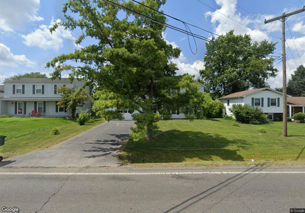
1449 Demorest Rd Columbus, OH 43228
Riverbend NeighborhoodEstimated Value: $233,000 - $256,000
3
Beds
2
Baths
1,250
Sq Ft
$195/Sq Ft
Est. Value
About This Home
This home is located at 1449 Demorest Rd, Columbus, OH 43228 and is currently estimated at $243,909, approximately $195 per square foot. 1449 Demorest Rd is a home located in Franklin County with nearby schools including West Franklin Elementary School, Franklin Woods Intermediate School, and Finland Middle School.
Ownership History
Date
Name
Owned For
Owner Type
Purchase Details
Closed on
Aug 27, 2007
Sold by
Estate Of Kathleen A Ward
Bought by
Ward David K
Current Estimated Value
Purchase Details
Closed on
Dec 29, 1969
Bought by
Ward Kathleen A
Create a Home Valuation Report for This Property
The Home Valuation Report is an in-depth analysis detailing your home's value as well as a comparison with similar homes in the area
Home Values in the Area
Average Home Value in this Area
Purchase History
| Date | Buyer | Sale Price | Title Company |
|---|---|---|---|
| Ward David K | -- | None Available | |
| Ward Kathleen A | -- | -- |
Source: Public Records
Tax History Compared to Growth
Tax History
| Year | Tax Paid | Tax Assessment Tax Assessment Total Assessment is a certain percentage of the fair market value that is determined by local assessors to be the total taxable value of land and additions on the property. | Land | Improvement |
|---|---|---|---|---|
| 2024 | $2,701 | $74,070 | $23,630 | $50,440 |
| 2023 | $2,653 | $74,060 | $23,625 | $50,435 |
| 2022 | $2,103 | $43,090 | $14,280 | $28,810 |
| 2021 | $2,145 | $43,090 | $14,280 | $28,810 |
| 2020 | $2,133 | $43,090 | $14,280 | $28,810 |
| 2019 | $1,991 | $35,490 | $11,900 | $23,590 |
| 2018 | $1,783 | $35,490 | $11,900 | $23,590 |
| 2017 | $1,779 | $35,490 | $11,900 | $23,590 |
| 2016 | $1,585 | $26,190 | $5,850 | $20,340 |
| 2015 | $1,585 | $26,190 | $5,850 | $20,340 |
| 2014 | $1,586 | $26,190 | $5,850 | $20,340 |
| 2013 | $873 | $29,050 | $6,475 | $22,575 |
Source: Public Records
Map
Nearby Homes
- 1485 Demorest Rd
- 3623 High Creek Dr
- 3728 Greenock Ct
- 3488 Rocky Rd
- 1657 Ripplebrook Rd
- 1830 Winding Hollow Dr
- 3766 Dunlane Ct
- 1465 Tall Meadows Dr
- 3206 Andy Terrace
- 3814 Clime Rd
- 1226 Pinnacle Dr
- 3326 Bluhm Ct
- 1181 Onslow Dr
- 2930 Alkire Rd
- 2062 Summer Banks Dr
- 3360 Briggs Rd
- 1027 S Brinker Ave
- 3551 Glorious Rd
- 3727-3729 Briggs Rd
- 3318 Miriam Dr S
- 1449 Demorest Rd
- 1453 Demorest Rd
- 1477 Greenock Rd
- 1457 Demorest Rd
- 3679 Klibreck Dr
- 3681 Klibreck Dr
- 3675 Klibreck Dr
- 1461 Demorest Rd
- 1500 Klibreck Ct
- 1456 Demorest Rd
- 1510 Klibreck Ct
- 1444 Demorest Rd
- 1465 Demorest Rd
- 3647 Rocky Rd
- 1415 Demorest Rd Unit 1419
- 3558 Maple Shade Ct
- 1473 Demorest Rd
- 3639 Rocky Rd
- 3672 Klibreck Dr
- 3684 Klibreck Dr