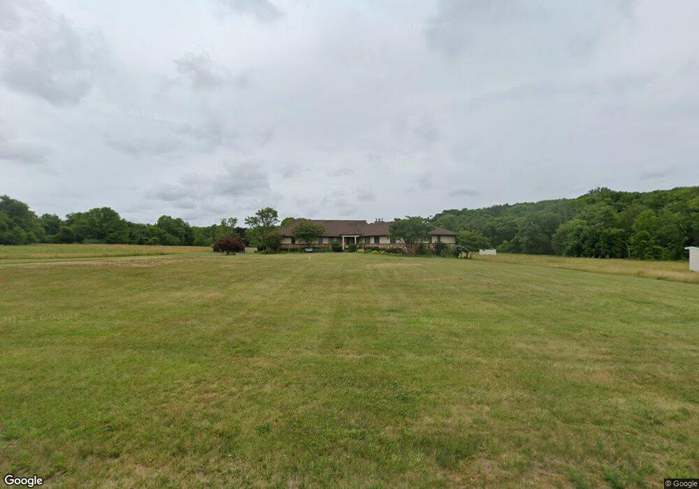
145 Baird Rd Millstone Township, NJ 08535
Estimated Value: $980,797 - $2,010,000
3
Beds
3
Baths
3,233
Sq Ft
$423/Sq Ft
Est. Value
About This Home
This home is located at 145 Baird Rd, Millstone Township, NJ 08535 and is currently estimated at $1,368,266, approximately $423 per square foot. 145 Baird Rd is a home with nearby schools including Millstone Township Primary School, Millstone Township Elementary School, and Millstone Township Middle School.
Ownership History
Date
Name
Owned For
Owner Type
Purchase Details
Closed on
May 8, 2014
Sold by
Ginolfi Frank and Ginolfi Audrey
Bought by
Board Of Chosen Freeholders
Current Estimated Value
Purchase Details
Closed on
Nov 26, 1996
Sold by
Cihidnikov Irene
Bought by
Ginolfi Frank and Ginolfi Audrey
Create a Home Valuation Report for This Property
The Home Valuation Report is an in-depth analysis detailing your home's value as well as a comparison with similar homes in the area
Home Values in the Area
Average Home Value in this Area
Purchase History
| Date | Buyer | Sale Price | Title Company |
|---|---|---|---|
| Board Of Chosen Freeholders | $785,000 | None Available | |
| Ginolfi Frank | $485,000 | -- |
Source: Public Records
Tax History Compared to Growth
Tax History
| Year | Tax Paid | Tax Assessment Tax Assessment Total Assessment is a certain percentage of the fair market value that is determined by local assessors to be the total taxable value of land and additions on the property. | Land | Improvement |
|---|---|---|---|---|
| 2025 | -- | $735,100 | $193,000 | $542,100 |
| 2024 | -- | $569,000 | $210,500 | $358,500 |
| 2023 | -- | $569,000 | $210,500 | $358,500 |
| 2022 | $0 | $569,000 | $210,500 | $358,500 |
| 2021 | $6,470 | $569,000 | $210,500 | $358,500 |
| 2020 | $6,470 | $569,000 | $210,500 | $358,500 |
| 2019 | $6,470 | $569,000 | $210,500 | $358,500 |
| 2018 | $6,470 | $569,000 | $210,500 | $358,500 |
| 2017 | $12,939 | $569,000 | $210,500 | $358,500 |
| 2016 | $15,284 | $677,200 | $210,500 | $466,700 |
| 2015 | $12,017 | $631,800 | $210,500 | $421,300 |
| 2014 | $12,017 | $462,000 | $92,000 | $370,000 |
Source: Public Records
Map
Nearby Homes
- 34 Rochdale Ave
- 32 Rochdale Ave
- 36 Rochdale Ave
- 38 Rochdale Ave
- 141 Baird Rd
- 20 Running Brook Dr
- 1 Scotto Farm Ln
- 3 Scotto Farm Ln
- 18 Running Brook Dr
- 3 Old Oak Ct
- 1 Old Oak Ct
- 2 Scotto Farm Ln
- 23 Running Brook Dr
- 5 Old Oak Ct
- 7 Scotto Farm Ln
- 21 Running Brook Dr
- 14 Running Brook Dr
- 1 Cuomo Ct
- 132 Baird Rd
- 4 Old Oak Ct